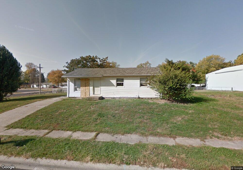
1909 S Perkins Ct Springfield, IL 62703
Estimated Value: $64,113 - $70,000
3
Beds
1
Bath
1,050
Sq Ft
$64/Sq Ft
Est. Value
About This Home
This home is located at 1909 S Perkins Ct, Springfield, IL 62703 and is currently estimated at $67,028, approximately $63 per square foot. 1909 S Perkins Ct is a home located in Sangamon County with nearby schools including Laketown Elementary School, Jefferson Middle School, and Springfield Southeast High School.
Ownership History
Date
Name
Owned For
Owner Type
Purchase Details
Closed on
Aug 19, 2020
Sold by
Aaron Dean Properties Llc
Bought by
R & L Holdings 1 Inc
Current Estimated Value
Purchase Details
Closed on
Aug 31, 2006
Purchase Details
Closed on
Nov 18, 2004
Purchase Details
Closed on
Sep 30, 1999
Create a Home Valuation Report for This Property
The Home Valuation Report is an in-depth analysis detailing your home's value as well as a comparison with similar homes in the area
Purchase History
| Date | Buyer | Sale Price | Title Company |
|---|---|---|---|
| R & L Holdings 1 Inc | $190,000 | Illinois Real Estate Title | |
| -- | -- | -- | |
| -- | $41,500 | -- | |
| -- | $44,000 | -- |
Source: Public Records
Tax History
| Year | Tax Paid | Tax Assessment Tax Assessment Total Assessment is a certain percentage of the fair market value that is determined by local assessors to be the total taxable value of land and additions on the property. | Land | Improvement |
|---|---|---|---|---|
| 2024 | $1,630 | $19,401 | $6,338 | $13,063 |
| 2023 | $1,567 | $17,721 | $5,789 | $11,932 |
| 2022 | $1,506 | $16,810 | $5,491 | $11,319 |
| 2021 | $1,456 | $16,180 | $5,285 | $10,895 |
| 2020 | $1,427 | $16,204 | $5,293 | $10,911 |
| 2019 | $1,401 | $16,148 | $5,275 | $10,873 |
| 2018 | $1,401 | $16,587 | $5,248 | $11,339 |
| 2017 | $1,372 | $16,372 | $5,180 | $11,192 |
| 2016 | $1,345 | $16,133 | $5,104 | $11,029 |
| 2015 | $1,332 | $15,940 | $5,043 | $10,897 |
| 2014 | $1,312 | $15,837 | $5,010 | $10,827 |
| 2013 | $1,283 | $15,837 | $5,010 | $10,827 |
Source: Public Records
Map
Nearby Homes
- 1848 Honeysuckle Ct
- 2325 E Spruce St
- 2051 Randall Ct
- 1838 S 19th St
- 1909 E Cedar St
- 2238 E Stuart St
- 1105 Knoll Pointe Place
- 1622 E Cornell Ave
- Lot 1 & 2 Bunn Dr
- 2160 S 14th St
- 2212 S 14th St
- 2709 Carl Prairie Dr
- 2154 S 13th St
- 2216 S 13th St
- 2875 Taylor Ave
- 2313 S 13th St
- 2800 Via Rosso St Unit 147
- 2800 Via Rosso St Unit 605
- 1318 E Lenox Ave
- 1942 S 11th St
- 1908 Taylor Ave
- 1904 S Perkins Ct
- 1904 Taylor Ave
- 1900 Taylor Ave
- 1917 Taylor Ave
- 1921 Taylor Ave
- 1925 Taylor Ave
- 1913 Taylor Ave
- 1909 Taylor Ave
- 1929 Taylor Ave
- 1905 Taylor Ave
- 1933 Taylor Ave
- 1920 Greentree Rd
- 1916 Greentree Rd
- 1912 Greentree Rd
- 1924 Greentree Rd
- 1908 Greentree Rd
- 1901 Taylor Ave
- 1928 Greentree Rd
- 2327 E Ash St
Your Personal Tour Guide
Ask me questions while you tour the home.