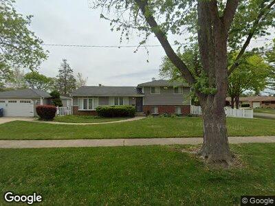
191 Westmere Rd Des Plaines, IL 60016
Estimated Value: $387,000 - $458,000
3
Beds
2
Baths
1,322
Sq Ft
$318/Sq Ft
Est. Value
About This Home
This home is located at 191 Westmere Rd, Des Plaines, IL 60016 and is currently estimated at $419,892, approximately $317 per square foot. 191 Westmere Rd is a home located in Cook County with nearby schools including Brentwood Elementary School, Friendship Jr High School, and Elk Grove High School.
Ownership History
Date
Name
Owned For
Owner Type
Purchase Details
Closed on
Jun 26, 2008
Sold by
Nikodem Larry F and Nikodem Gail A
Bought by
Olivares Jorge L and Olivares Beverly J
Current Estimated Value
Home Financials for this Owner
Home Financials are based on the most recent Mortgage that was taken out on this home.
Original Mortgage
$293,356
Outstanding Balance
$193,798
Interest Rate
5.96%
Mortgage Type
FHA
Estimated Equity
$214,472
Create a Home Valuation Report for This Property
The Home Valuation Report is an in-depth analysis detailing your home's value as well as a comparison with similar homes in the area
Home Values in the Area
Average Home Value in this Area
Purchase History
| Date | Buyer | Sale Price | Title Company |
|---|---|---|---|
| Olivares Jorge L | $297,500 | None Available |
Source: Public Records
Mortgage History
| Date | Status | Borrower | Loan Amount |
|---|---|---|---|
| Open | Olivares Jorge L | $293,356 | |
| Previous Owner | Nikodem Larry F | $50,000 | |
| Previous Owner | Nikodem Larry F | $125,150 | |
| Previous Owner | Nikodem Larry F | $30,000 | |
| Previous Owner | Nikodem Larry F | $85,000 |
Source: Public Records
Tax History Compared to Growth
Tax History
| Year | Tax Paid | Tax Assessment Tax Assessment Total Assessment is a certain percentage of the fair market value that is determined by local assessors to be the total taxable value of land and additions on the property. | Land | Improvement |
|---|---|---|---|---|
| 2024 | $7,752 | $32,000 | $7,320 | $24,680 |
| 2023 | $7,752 | $32,000 | $7,320 | $24,680 |
| 2022 | $7,752 | $32,000 | $7,320 | $24,680 |
| 2021 | $7,127 | $25,650 | $4,879 | $20,771 |
| 2020 | $6,971 | $25,650 | $4,879 | $20,771 |
| 2019 | $7,046 | $28,501 | $4,879 | $23,622 |
| 2018 | $7,441 | $26,624 | $4,066 | $22,558 |
| 2017 | $7,305 | $26,624 | $4,066 | $22,558 |
| 2016 | $6,872 | $26,624 | $4,066 | $22,558 |
| 2015 | $6,887 | $24,992 | $3,659 | $21,333 |
| 2014 | $6,810 | $24,992 | $3,659 | $21,333 |
| 2013 | $6,665 | $24,992 | $3,659 | $21,333 |
Source: Public Records
Map
Nearby Homes
- 220 E Washington St
- 200 Marshall Dr
- 355 S Westgate Rd
- 237 S Radcliffe Ave
- 277 Harvey Ave
- 161 E Thacker St
- 901 S Westgate Rd
- 26 Marina Dr
- 567 W Dempster St
- 91 Fletcher Dr
- 504 E Berkshire Ln
- 43 N Mount Prospect Rd
- 745 Dulles Rd Unit C
- 336 S Wolf Rd
- 884 Arnold Ct
- 617 S Albert St
- 857 Beau Dr Unit 9
- 1048 Marshall Dr
- 601 S William St
- 940 Beau Dr Unit 111
- 191 Westmere Rd
- 529 Farthing Ln
- 537 Farthing Ln
- 171 Westmere Rd
- 190 Westmere Rd
- 532 Leahy Cir
- 170 Westmere Rd
- 539 Farthing Ln
- 201 Westmere Rd
- 528 Farthing Ln
- 471 Farthing Ln
- 170 W Millers Rd
- 536 Farthing Ln
- 470 Leahy Cir
- 200 Westmere Rd
- 461 Farthing Ln
- 470 Farthing Ln
- 211 Westmere Rd
- 460 Leahy Cir
- 175 W Millers Rd