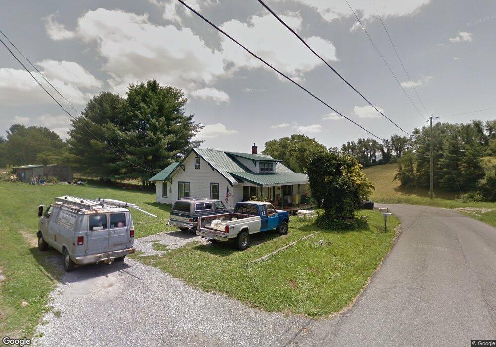
1910 Snider Ln Pulaski, VA 24301
Estimated Value: $64,000 - $148,522
2
Beds
1
Bath
1,496
Sq Ft
$59/Sq Ft
Est. Value
About This Home
This home is located at 1910 Snider Ln, Pulaski, VA 24301 and is currently estimated at $87,881, approximately $58 per square foot. 1910 Snider Ln is a home located in Pulaski County with nearby schools including Pulaski Elementary School, Pulaski County Middle School, and Pulaski County High School.
Ownership History
Date
Name
Owned For
Owner Type
Purchase Details
Closed on
Aug 22, 2024
Sold by
Home Equity Mortgage Loan Asset-Backed T and Phh Mortgage Corporation
Bought by
Mcdonald Brookyn and Mcdonald Michael
Current Estimated Value
Purchase Details
Closed on
Jun 4, 2024
Sold by
Johnson Thomas Lee and Johnson Candace
Bought by
Hm Eqity Mtg Ln Asset-Backed T and Deutsche Bank Nat'L Trust
Purchase Details
Closed on
Aug 3, 2005
Sold by
Johnson Rose H and Johnson Thoams Lee
Bought by
Johnson Thomas Lee and Johnson Candace
Home Financials for this Owner
Home Financials are based on the most recent Mortgage that was taken out on this home.
Original Mortgage
$50,000
Interest Rate
8.25%
Mortgage Type
Adjustable Rate Mortgage/ARM
Create a Home Valuation Report for This Property
The Home Valuation Report is an in-depth analysis detailing your home's value as well as a comparison with similar homes in the area
Home Values in the Area
Average Home Value in this Area
Purchase History
| Date | Buyer | Sale Price | Title Company |
|---|---|---|---|
| Mcdonald Brookyn | $65,000 | None Listed On Document | |
| Hm Eqity Mtg Ln Asset-Backed T | $69,500 | None Listed On Document | |
| Johnson Thomas Lee | -- | None Available |
Source: Public Records
Mortgage History
| Date | Status | Borrower | Loan Amount |
|---|---|---|---|
| Previous Owner | Johnson Thomas Lee | $50,000 |
Source: Public Records
Tax History Compared to Growth
Tax History
| Year | Tax Paid | Tax Assessment Tax Assessment Total Assessment is a certain percentage of the fair market value that is determined by local assessors to be the total taxable value of land and additions on the property. | Land | Improvement |
|---|---|---|---|---|
| 2025 | $465 | $62,800 | $17,000 | $45,800 |
| 2024 | $465 | $62,800 | $17,000 | $45,800 |
| 2023 | $465 | $62,800 | $17,000 | $45,800 |
| 2022 | $465 | $62,800 | $17,000 | $45,800 |
| 2021 | $465 | $62,800 | $17,000 | $45,800 |
| 2020 | $407 | $52,800 | $15,000 | $37,800 |
| 2019 | $407 | $52,800 | $15,000 | $37,800 |
| 2018 | $407 | $52,800 | $15,000 | $37,800 |
| 2017 | $338 | $52,800 | $15,000 | $37,800 |
| 2016 | $338 | $52,800 | $15,000 | $37,800 |
| 2015 | $338 | $52,800 | $15,000 | $37,800 |
| 2014 | $435 | $73,700 | $20,000 | $53,700 |
| 2013 | $435 | $73,700 | $20,000 | $53,700 |
Source: Public Records
Map
Nearby Homes
- 1890 Alum Spring Rd
- 1961 Snider Ln
- 1922 Alum Spring Rd
- 1970 Snider Ln
- 00 Robinson Tract Rd
- 115 14th St NW
- 601 Orchard Rd
- 1407 Randolph Ave
- 2211 Pleasant Hill Dr
- 804 Oakhurst Ave
- 3727 Largen Hill Ct
- 1128 Camper St
- 712 Orchard Rd
- 721 Gateway Dr
- 1317 Peppers Ferry Rd
- 806 Monroe Ave
- 745 Peppers Ferry Rd
- TBD Randolph Ave
- 20 7th St NW
- 550 Monroe Ave
- 1920 Snider Ln
- 1900 Snider Ln
- 1933 Snider Ln
- 1890 Snider Ln
- 1930 Snider Ln
- 1936 Snider Ln
- 1917 Alum Spring Rd
- 1942 Snider Ln
- 1929 Alum Spring Rd
- 1933 Alum Spring Rd
- 1946 Snider Ln
- 1950 Snider Ln
- 1817 Alum Spring Rd
- 1937 Alum Spring Rd
- 1914 Alum Spring Rd
- 1954 Snider Ln
- 1941 Alum Spring Rd
- 1956 Snider Ln
- 309 Byrd Dr
- 1918 Alum Spring Rd