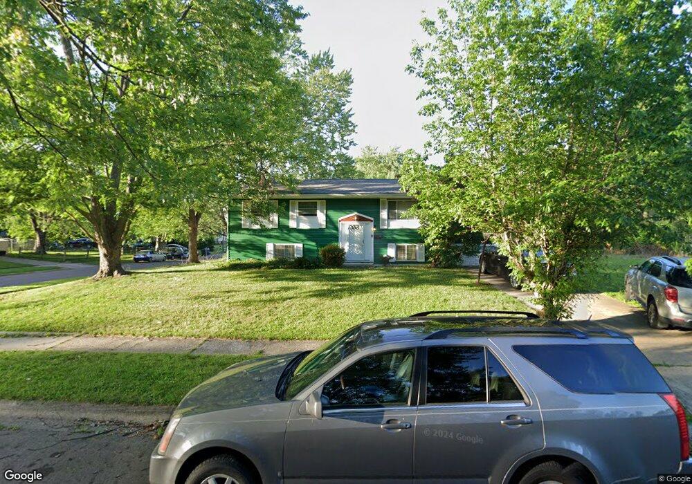
1910 Stetson Rd Columbus, OH 43232
Pine Hills NeighborhoodEstimated Value: $204,000 - $230,000
3
Beds
2
Baths
988
Sq Ft
$219/Sq Ft
Est. Value
About This Home
This home is located at 1910 Stetson Rd, Columbus, OH 43232 and is currently estimated at $216,825, approximately $219 per square foot. 1910 Stetson Rd is a home located in Franklin County with nearby schools including Woodcrest Elementary School, Sherwood Middle School, and Walnut Ridge High School.
Ownership History
Date
Name
Owned For
Owner Type
Purchase Details
Closed on
Apr 23, 1999
Sold by
Borries Jeffrey G
Bought by
Williams Ruth W
Current Estimated Value
Home Financials for this Owner
Home Financials are based on the most recent Mortgage that was taken out on this home.
Original Mortgage
$78,937
Interest Rate
7.17%
Mortgage Type
FHA
Purchase Details
Closed on
May 19, 1992
Bought by
Borries Jeffrey G
Purchase Details
Closed on
May 18, 1988
Create a Home Valuation Report for This Property
The Home Valuation Report is an in-depth analysis detailing your home's value as well as a comparison with similar homes in the area
Home Values in the Area
Average Home Value in this Area
Purchase History
| Date | Buyer | Sale Price | Title Company |
|---|---|---|---|
| Williams Ruth W | $79,000 | Titlequest Agency Inc | |
| Borries Jeffrey G | -- | -- | |
| -- | $52,000 | -- |
Source: Public Records
Mortgage History
| Date | Status | Borrower | Loan Amount |
|---|---|---|---|
| Previous Owner | Williams Ruth W | $78,937 |
Source: Public Records
Tax History Compared to Growth
Tax History
| Year | Tax Paid | Tax Assessment Tax Assessment Total Assessment is a certain percentage of the fair market value that is determined by local assessors to be the total taxable value of land and additions on the property. | Land | Improvement |
|---|---|---|---|---|
| 2024 | $2,737 | $70,780 | $14,390 | $56,390 |
| 2023 | $2,730 | $70,770 | $14,385 | $56,385 |
| 2022 | $1,737 | $42,250 | $6,720 | $35,530 |
| 2021 | $1,741 | $42,250 | $6,720 | $35,530 |
| 2020 | $1,743 | $42,250 | $6,720 | $35,530 |
| 2019 | $1,501 | $33,500 | $5,360 | $28,140 |
| 2018 | $1,325 | $33,500 | $5,360 | $28,140 |
| 2017 | $1,501 | $33,500 | $5,360 | $28,140 |
| 2016 | $1,269 | $27,900 | $5,220 | $22,680 |
| 2015 | $1,152 | $27,900 | $5,220 | $22,680 |
| 2014 | $1,154 | $27,900 | $5,220 | $22,680 |
| 2013 | $661 | $30,975 | $5,775 | $25,200 |
Source: Public Records
Map
Nearby Homes
- 1835 Woodette Rd
- 5337 Ivyhurst Dr
- 1759 Lonsdale Rd
- 1942 Bairsford Dr Unit 944
- 1945 Riverdale Rd
- 5596 Autumn Chase Dr
- 5366 Yorkshire Village Ln Unit B-22
- 5036 Brinwood Place
- 1616 Coppertree Rd Unit 1615
- 1930 Walnut Hill Park Dr
- 1718 Sunapple Way
- 2173 Noe Bixby Rd
- 5123 Jameson Dr
- 1591 Stephanie Ct Unit 15912
- 1486 Efner Dr
- 5114 Carbondale Dr
- 5061 Labelle Dr
- 5268 Carbondale Dr
- 5846 Riverton Rd
- 2651 Brownfield Rd
- 1902 Stetson Rd
- 1935 Woodette Rd
- 1894 Stetson Rd
- 1927 Woodette Rd
- 1899 Stetson Rd
- 5352 Mapleridge Dr
- 5327 Kornwal Dr
- 1919 Woodette Rd
- 1886 Stetson Rd
- 5344 Mapleridge Dr
- 1891 Stetson Rd
- 1902 Lonsdale Rd
- 1911 Lonsdale Rd
- 1911 Woodette Rd
- 1878 Stetson Rd
- 5336 Mapleridge Dr
- 5319 Kornwal Dr
- 1883 Stetson Rd
- 5314 Kornwal Dr
- 1905 Woodette Rd