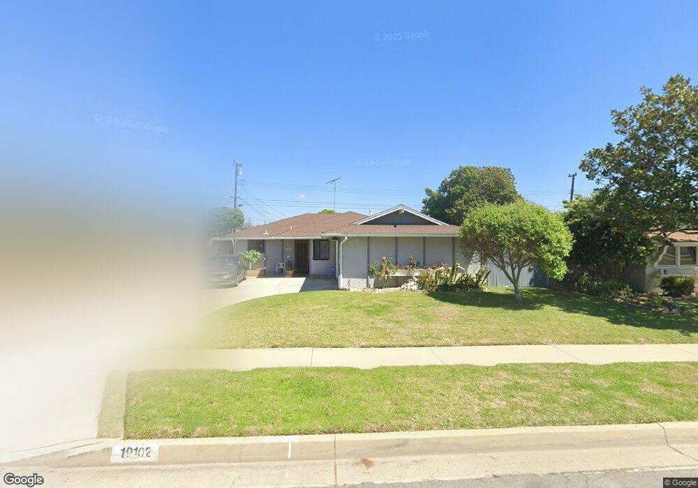
19102 Campaign Dr Carson, CA 90746
Estimated Value: $785,847 - $871,000
3
Beds
2
Baths
1,465
Sq Ft
$578/Sq Ft
Est. Value
About This Home
This home is located at 19102 Campaign Dr, Carson, CA 90746 and is currently estimated at $847,212, approximately $578 per square foot. 19102 Campaign Dr is a home located in Los Angeles County with nearby schools including Leapwood Avenue Elementary School, Glenn Hammond Curtiss Middle School, and Rancho Dominguez Preparatory School.
Ownership History
Date
Name
Owned For
Owner Type
Purchase Details
Closed on
Sep 11, 2024
Sold by
Jones Keith M
Bought by
Keith Maurice Jones Revocable Living Trust and Jones
Current Estimated Value
Purchase Details
Closed on
Aug 9, 2006
Sold by
Herring Sherman and Winborne Avater
Bought by
Herring Sherman and Winborne Avater
Home Financials for this Owner
Home Financials are based on the most recent Mortgage that was taken out on this home.
Original Mortgage
$472,000
Interest Rate
7.75%
Mortgage Type
Purchase Money Mortgage
Create a Home Valuation Report for This Property
The Home Valuation Report is an in-depth analysis detailing your home's value as well as a comparison with similar homes in the area
Home Values in the Area
Average Home Value in this Area
Purchase History
| Date | Buyer | Sale Price | Title Company |
|---|---|---|---|
| Keith Maurice Jones Revocable Living Trust | -- | None Listed On Document | |
| Herring Sherman | -- | None Available |
Source: Public Records
Mortgage History
| Date | Status | Borrower | Loan Amount |
|---|---|---|---|
| Previous Owner | Herring Sherman | $472,000 |
Source: Public Records
Tax History
| Year | Tax Paid | Tax Assessment Tax Assessment Total Assessment is a certain percentage of the fair market value that is determined by local assessors to be the total taxable value of land and additions on the property. | Land | Improvement |
|---|---|---|---|---|
| 2025 | $2,825 | $167,500 | $66,991 | $100,509 |
| 2024 | $2,825 | $164,217 | $65,678 | $98,539 |
| 2023 | $2,764 | $160,998 | $64,391 | $96,607 |
| 2022 | $2,636 | $157,842 | $63,129 | $94,713 |
| 2021 | $2,596 | $154,748 | $61,892 | $92,856 |
| 2019 | $2,493 | $150,159 | $60,057 | $90,102 |
| 2018 | $2,393 | $147,216 | $58,880 | $88,336 |
| 2016 | $2,286 | $141,501 | $56,595 | $84,906 |
| 2015 | $2,231 | $139,376 | $55,745 | $83,631 |
| 2014 | $2,225 | $136,647 | $54,654 | $81,993 |
Source: Public Records
Map
Nearby Homes
- 19202 Campaign Dr
- 19603 Enslow Dr
- 19426 Belshaw Ave
- 19012 Tillman Ave
- 19327 Galway Ave
- 664 E Elsmere Dr
- 879 E Turmont St
- 956 E Gladwick St
- 20203 Tillman Ave
- 1351 E Bankers Dr
- 19103 Hillford Ave
- 19008 Hillford Ave
- 17700 Avalon Blvd Unit 267
- 17700 Avalon Blvd Unit 387
- 17700 Avalon Blvd Unit 40
- 910 E Meadbrook St
- 17809 Ash Ct
- 19306 Harlan Ave
- 17914 Goodyear
- 17700 S Avalon Blvd Unit 156
- 19110 Campaign Dr
- 19018 Campaign Dr
- 19103 Enslow Dr
- 19017 Enslow Dr
- 19109 Enslow Dr
- 19116 Campaign Dr
- 19010 Campaign Dr
- 19011 Enslow Dr
- 19115 Enslow Dr
- 19103 Campaign Dr
- 19111 Campaign Dr
- 19017 Campaign Dr
- 19004 Campaign Dr
- 19117 Campaign Dr
- 19003 Enslow Dr
- 19009 Campaign Dr
- 19102 Enslow Dr
- 19016 Enslow Dr
- 19108 Enslow Dr
- 19003 Campaign Dr