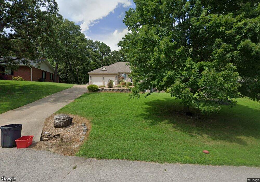
1911 Cambridge Cir West Plains, MO 65775
Estimated Value: $295,601 - $353,000
4
Beds
3
Baths
3,431
Sq Ft
$96/Sq Ft
Est. Value
About This Home
This home is located at 1911 Cambridge Cir, West Plains, MO 65775 and is currently estimated at $328,400, approximately $95 per square foot. 1911 Cambridge Cir is a home located in Howell County with nearby schools including West Plains Senior High School and Faith Assembly Christian School.
Ownership History
Date
Name
Owned For
Owner Type
Purchase Details
Closed on
Dec 29, 2014
Sold by
Hoover Christy L
Bought by
Hoover Carolyn Ruth and Carolyn Ruth Hoover Trust
Current Estimated Value
Purchase Details
Closed on
Jul 16, 2012
Sold by
Myers Seth R and Myers Denver Lee
Bought by
Hoover Christy L
Home Financials for this Owner
Home Financials are based on the most recent Mortgage that was taken out on this home.
Original Mortgage
$211,894
Interest Rate
3.61%
Mortgage Type
Future Advance Clause Open End Mortgage
Create a Home Valuation Report for This Property
The Home Valuation Report is an in-depth analysis detailing your home's value as well as a comparison with similar homes in the area
Home Values in the Area
Average Home Value in this Area
Purchase History
| Date | Buyer | Sale Price | Title Company |
|---|---|---|---|
| Hoover Carolyn Ruth | -- | None Available | |
| Hoover Christy L | -- | Security Title |
Source: Public Records
Mortgage History
| Date | Status | Borrower | Loan Amount |
|---|---|---|---|
| Previous Owner | Hoover Christy L | $211,894 |
Source: Public Records
Tax History Compared to Growth
Tax History
| Year | Tax Paid | Tax Assessment Tax Assessment Total Assessment is a certain percentage of the fair market value that is determined by local assessors to be the total taxable value of land and additions on the property. | Land | Improvement |
|---|---|---|---|---|
| 2025 | $1,630 | $39,360 | $2,390 | $36,970 |
| 2024 | $1,620 | $35,140 | -- | -- |
| 2023 | $1,620 | $35,140 | $0 | $0 |
| 2022 | $1,527 | $33,160 | $0 | $0 |
| 2021 | $1,513 | $33,160 | $0 | $0 |
| 2020 | $1,513 | $32,100 | $0 | $0 |
| 2019 | $1,571 | $32,100 | $0 | $0 |
| 2018 | $1,571 | $32,100 | $0 | $0 |
| 2017 | $1,565 | $32,100 | $0 | $0 |
| 2015 | -- | $31,670 | $0 | $0 |
| 2014 | -- | $31,670 | $0 | $0 |
| 2013 | -- | $31,670 | $0 | $0 |
Source: Public Records
Map
Nearby Homes
- 1157 Chateau Dr
- 1158 Chateau Dr
- 2006 W Broadway St
- 2035 Roberta Ave
- 000 Woodridge Subdivision
- 2010 Catalina Dr
- 1903 Catalina Dr
- 1989 Crawford St
- 224 Crawford St
- 1908 Timber Ln
- 1165 Susan Dr
- 1402 Stoney Dr
- Tbd N Kentucky Ave
- 000 Kentucky Ave
- 1611 9th St
- 1443 W 6th St
- 1451 W 5th St
- 1449 4th St
- 1434 W 6th St
- 000 Lot 1 Block 13 Morrison Sub
- 1911 Cambridge Cir
- 1909 Cambridge Cir
- 1913 Cambridge Cir
- 1910 Cambridge Cir
- 904 Oakwood Dr
- 1908 Cambridge Cir
- 902 S Oakwood Dr
- 1043 Country Club Dr
- 1909 Greenway Dr
- 1905 Greenway Dr
- 929 Country Club Dr
- 1146 Stoney Dr
- 1146 Stoney Dr
- 2004 Cambridge Dr
- 2005 Cambridge Dr
- 806 S Oakwood Dr
- 927 Country Club Dr
- 832 S Oakwood Dr
- 1038 County Rd
- 1047 Country Club Dr