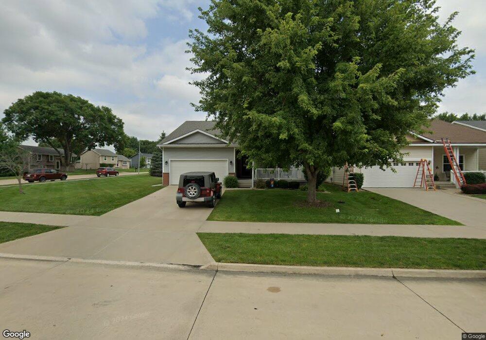
1912 Bristol St Norwalk, IA 50211
Estimated Value: $346,006 - $371,000
3
Beds
2
Baths
1,436
Sq Ft
$254/Sq Ft
Est. Value
About This Home
This home is located at 1912 Bristol St, Norwalk, IA 50211 and is currently estimated at $364,252, approximately $253 per square foot. 1912 Bristol St is a home located in Warren County with nearby schools including Oviatt Elementary School, Lakewood Elementary School, and Orchard Hills Elementary School.
Ownership History
Date
Name
Owned For
Owner Type
Purchase Details
Closed on
Jun 28, 2010
Sold by
Villas At The Legacy Llc
Bought by
Morgan Larry L and Morgan Jean R
Current Estimated Value
Home Financials for this Owner
Home Financials are based on the most recent Mortgage that was taken out on this home.
Original Mortgage
$214,100
Outstanding Balance
$143,490
Interest Rate
4.97%
Mortgage Type
VA
Estimated Equity
$220,762
Purchase Details
Closed on
Apr 19, 2010
Sold by
H Cm L L C
Bought by
Villas At The Legacy Llc
Create a Home Valuation Report for This Property
The Home Valuation Report is an in-depth analysis detailing your home's value as well as a comparison with similar homes in the area
Home Values in the Area
Average Home Value in this Area
Purchase History
| Date | Buyer | Sale Price | Title Company |
|---|---|---|---|
| Morgan Larry L | -- | None Available | |
| Villas At The Legacy Llc | $25,000 | -- |
Source: Public Records
Mortgage History
| Date | Status | Borrower | Loan Amount |
|---|---|---|---|
| Open | Morgan Larry L | $214,100 |
Source: Public Records
Tax History Compared to Growth
Tax History
| Year | Tax Paid | Tax Assessment Tax Assessment Total Assessment is a certain percentage of the fair market value that is determined by local assessors to be the total taxable value of land and additions on the property. | Land | Improvement |
|---|---|---|---|---|
| 2025 | $4,974 | $306,300 | $62,900 | $243,400 |
| 2024 | $5,086 | $296,300 | $43,100 | $253,200 |
| 2023 | $5,496 | $296,300 | $43,100 | $253,200 |
| 2022 | $5,476 | $258,000 | $43,100 | $214,900 |
| 2021 | $5,124 | $258,000 | $43,100 | $214,900 |
| 2020 | $5,124 | $228,500 | $30,000 | $198,500 |
| 2019 | $4,926 | $228,500 | $30,000 | $198,500 |
| 2018 | $4,768 | $216,000 | $0 | $0 |
| 2017 | $4,768 | $216,000 | $0 | $0 |
| 2016 | $3,696 | $165,900 | $0 | $0 |
| 2015 | $3,696 | $165,900 | $0 | $0 |
| 2014 | $3,422 | $154,100 | $0 | $0 |
Source: Public Records
Map
Nearby Homes
- 1725 Holly Dr
- 1000 Gordon Ave
- 1808 Dorchester St
- 2204 Legacy Dr
- 2208 Legacy Dr
- 2212 Legacy Dr
- 932 Sawgrass Dr
- 936 Sawgrass Dr
- 2216 Legacy Dr
- 2224 Legacy Dr
- 952 Sawgrass Dr
- 1321 Meadow Dr
- 2228 Legacy Dr
- 2232 Legacy Dr
- 801 Oakmont Place
- 620 Nantucket Place
- 2310 Legacy Dr
- 2314 Legacy Dr
- 510 Turnberry Dr
- 1118 Holly Dr
- 1908 Bristol St
- 604 Gordon Ave
- 1904 Bristol St
- 1832 Bristol St
- 612 Gordon Ave
- 1905 Bristol St
- 603 Gordon Ave
- 1913 Bristol St
- 1917 Bristol St
- 1909 Bristol St
- 1921 Bristol St
- 1828 Bristol St
- 1925 Bristol St
- 609 Gordon Ave
- 1829 Bristol St
- 1719 Holly Dr
- 1713 Holly Dr
- 1931 Bristol St
- 618 Gordon Ave
- 1824 Bristol St