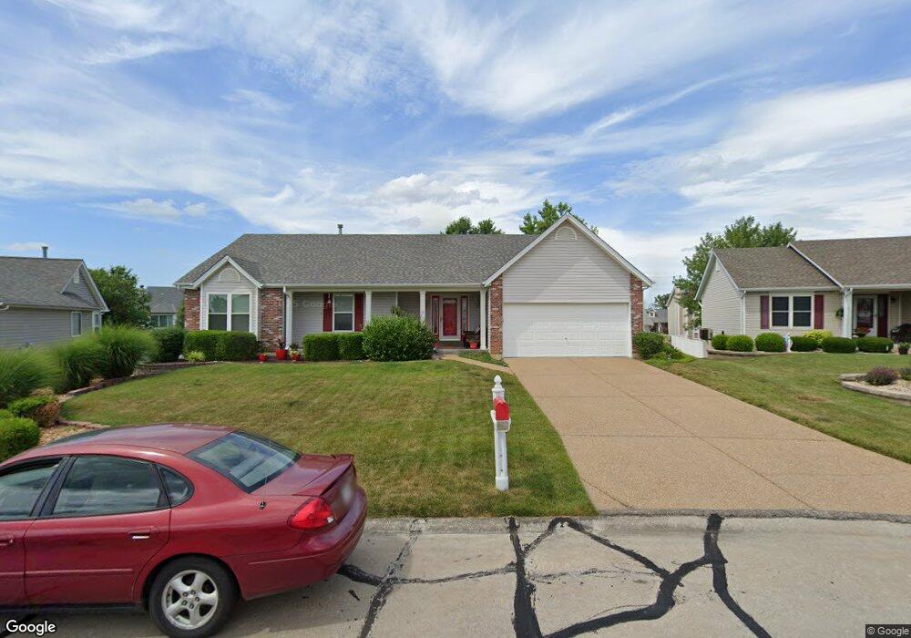
1912 Sapling Dr O Fallon, MO 63366
Estimated Value: $358,279 - $392,000
3
Beds
2
Baths
1,782
Sq Ft
$212/Sq Ft
Est. Value
About This Home
This home is located at 1912 Sapling Dr, O Fallon, MO 63366 and is currently estimated at $378,320, approximately $212 per square foot. 1912 Sapling Dr is a home located in St. Charles County with nearby schools including Westhoff Elementary School, Fort Zumwalt North Middle School, and Fort Zumwalt North High School.
Ownership History
Date
Name
Owned For
Owner Type
Purchase Details
Closed on
Mar 10, 2022
Sold by
Seep Ralph A and Seep Cherin M
Bought by
Seep Ralph A and Seep Cheri M
Current Estimated Value
Home Financials for this Owner
Home Financials are based on the most recent Mortgage that was taken out on this home.
Original Mortgage
$56,000
Outstanding Balance
$52,281
Interest Rate
3.85%
Mortgage Type
New Conventional
Estimated Equity
$326,039
Purchase Details
Closed on
May 12, 1999
Sold by
Whittaker Construction Inc
Bought by
Seep Ralph A and Seep Cherri M
Home Financials for this Owner
Home Financials are based on the most recent Mortgage that was taken out on this home.
Original Mortgage
$100,000
Interest Rate
7.04%
Create a Home Valuation Report for This Property
The Home Valuation Report is an in-depth analysis detailing your home's value as well as a comparison with similar homes in the area
Home Values in the Area
Average Home Value in this Area
Purchase History
| Date | Buyer | Sale Price | Title Company |
|---|---|---|---|
| Seep Ralph A | -- | None Listed On Document | |
| Seep Ralph A | $164,023 | -- |
Source: Public Records
Mortgage History
| Date | Status | Borrower | Loan Amount |
|---|---|---|---|
| Open | Seep Ralph A | $56,000 | |
| Previous Owner | Seep Ralph A | $100,000 |
Source: Public Records
Tax History
| Year | Tax Paid | Tax Assessment Tax Assessment Total Assessment is a certain percentage of the fair market value that is determined by local assessors to be the total taxable value of land and additions on the property. | Land | Improvement |
|---|---|---|---|---|
| 2025 | $3,978 | $64,887 | -- | -- |
| 2023 | $3,980 | $60,152 | $0 | $0 |
| 2022 | $3,402 | $47,778 | $0 | $0 |
| 2021 | $3,404 | $47,778 | $0 | $0 |
| 2020 | $3,536 | $48,114 | $0 | $0 |
| 2019 | $3,544 | $48,114 | $0 | $0 |
| 2018 | $3,350 | $43,407 | $0 | $0 |
| 2017 | $3,309 | $43,407 | $0 | $0 |
| 2016 | $2,843 | $37,144 | $0 | $0 |
| 2015 | $2,643 | $37,144 | $0 | $0 |
| 2014 | $2,451 | $33,866 | $0 | $0 |
Source: Public Records
Map
Nearby Homes
- 1818 Sapling Dr
- 1805 Sapling Dr
- 2837 Grand Slam Dr
- 811 Homefield Grove Ct
- 730 Homerun Dr Unit 76N
- 487 Chatham Dr
- 634 Homerun Dr Unit 34N
- 632 Homerun Dr Unit 33N
- 17 Homefield Gardens Dr
- 1612 Homefield Meadows Dr
- 1358 Deerfield Estates Dr
- 231 England Dr
- 214 Maryland Dr Unit 26B
- 31 Piepers Glen Ct
- 1102 Danielle Elizabeth Ct
- 0 Tom Ginnever Ave
- 6 S Boxwood Ln
- 34 Logan Crossing Cir
- 201 Allen Dr
- 765 Koch Rd
- 1908 Sapling Dr
- 1916 Sapling Dr
- 346 Highgrove Place Dr
- 350 Highgrove Place Dr
- 340 Highgrove Place Dr
- 1904 Sapling Dr
- 354 Highgrove Place Dr
- 1920 Sapling Dr
- 1917 Sapling Dr
- 336 Highgrove Place Dr
- 1905 Sapling Dr
- 332 Highgrove Place Dr
- 360 Highgrove Place Dr
- 1924 Sapling Dr
- 1900 Sapling Dr
- 372 Highgrove Place Dr
- 1925 Sapling Dr
- 317 Estate Dr
- 328 Highgrove Place Dr
- 345 Highgrove Place Dr
Your Personal Tour Guide
Ask me questions while you tour the home.