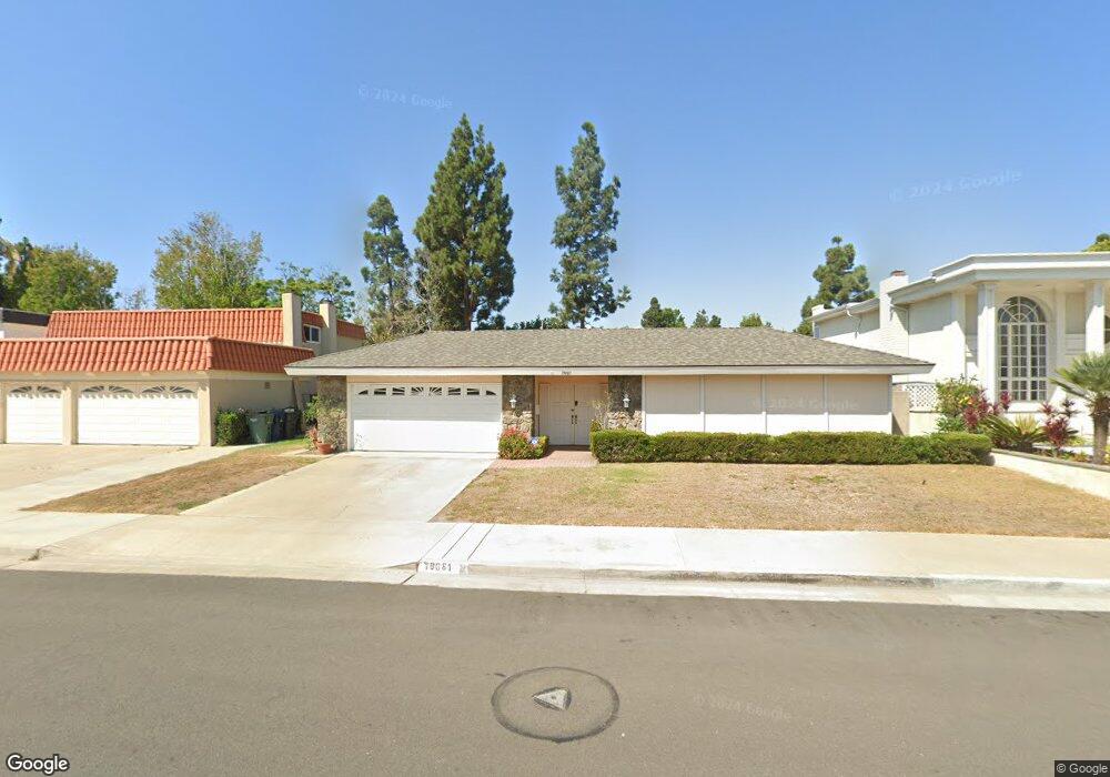
19126 Queensport Ln Unit D Huntington Beach, CA 92646
Estimated Value: $870,000 - $975,000
3
Beds
3
Baths
1,846
Sq Ft
$510/Sq Ft
Est. Value
About This Home
This home is located at 19126 Queensport Ln Unit D, Huntington Beach, CA 92646 and is currently estimated at $940,978, approximately $509 per square foot. 19126 Queensport Ln Unit D is a home located in Orange County with nearby schools including Ethel Dwyer Middle, Huntington Beach High School, and Kinetic Academy.
Ownership History
Date
Name
Owned For
Owner Type
Purchase Details
Closed on
Mar 7, 1997
Sold by
Farber Theodore C and Farber Ronna
Bought by
Andy Steven M
Current Estimated Value
Home Financials for this Owner
Home Financials are based on the most recent Mortgage that was taken out on this home.
Original Mortgage
$165,600
Outstanding Balance
$19,939
Interest Rate
7.66%
Estimated Equity
$921,039
Create a Home Valuation Report for This Property
The Home Valuation Report is an in-depth analysis detailing your home's value as well as a comparison with similar homes in the area
Home Values in the Area
Average Home Value in this Area
Purchase History
| Date | Buyer | Sale Price | Title Company |
|---|---|---|---|
| Andy Steven M | $207,000 | Fidelity National Title Ins |
Source: Public Records
Mortgage History
| Date | Status | Borrower | Loan Amount |
|---|---|---|---|
| Open | Andy Steven M | $165,600 |
Source: Public Records
Tax History Compared to Growth
Tax History
| Year | Tax Paid | Tax Assessment Tax Assessment Total Assessment is a certain percentage of the fair market value that is determined by local assessors to be the total taxable value of land and additions on the property. | Land | Improvement |
|---|---|---|---|---|
| 2025 | $3,954 | $337,127 | $130,318 | $206,809 |
| 2024 | $3,954 | $330,517 | $127,763 | $202,754 |
| 2023 | $3,862 | $324,037 | $125,258 | $198,779 |
| 2022 | $3,758 | $317,684 | $122,802 | $194,882 |
| 2021 | $3,689 | $311,455 | $120,394 | $191,061 |
| 2020 | $3,663 | $308,262 | $119,160 | $189,102 |
| 2019 | $3,621 | $302,218 | $116,823 | $185,395 |
| 2018 | $3,564 | $296,293 | $114,533 | $181,760 |
| 2017 | $3,516 | $290,484 | $112,287 | $178,197 |
| 2016 | $3,365 | $284,789 | $110,086 | $174,703 |
| 2015 | $3,330 | $280,512 | $108,433 | $172,079 |
| 2014 | $3,260 | $275,018 | $106,309 | $168,709 |
Source: Public Records
Map
Nearby Homes
- 19111 Colchester Ln
- 8120 Islandview Cir Unit C
- 18862 Carolyn Ln
- 19321 Beach Blvd
- 18815 Thornwood Cir Unit 32
- 7921 Nomad Cir
- 8291 Polk Cir
- 18785 Heavenwood Cir Unit C171
- 18911 Florida St
- 7805 Garfield Ave
- 7831 Shaffer Cir
- 18712 Demion Ln
- 18702 Demion Ln
- 18900 Delaware St Unit 220
- 18900 Delaware St Unit 48
- 18683 Applewood Cir Unit 16
- 7652 Garfield Ave Unit 19
- 7652 Garfield Ave Unit 15
- 7652 Garfield Ave Unit 87
- 7652 Garfield Ave Unit 49
- 19126 Queensport Ln Unit B
- 19126 Queensport Ln Unit A
- 19126 Queensport Ln Unit C
- 19121 Queensport Ln Unit E
- 19121 Queensport Ln Unit A
- 19121 Queensport Ln Unit B
- 19121 Queensport Ln Unit C
- 19121 Queensport Ln Unit D
- 19081 Colchester Ln
- 19116 Queensport Ln Unit D
- 19116 Queensport Ln Unit E
- 19116 Queensport Ln Unit A
- 19091 Colchester Ln
- 19061 Colchester Ln
- 8120 Baymist Dr Unit D
- 8120 Baymist Dr Unit A
- 8120 Baymist Dr Unit C
- 8120 Baymist Dr Unit E
- 8120 Baymist Dr Unit B
- 19051 Colchester Ln