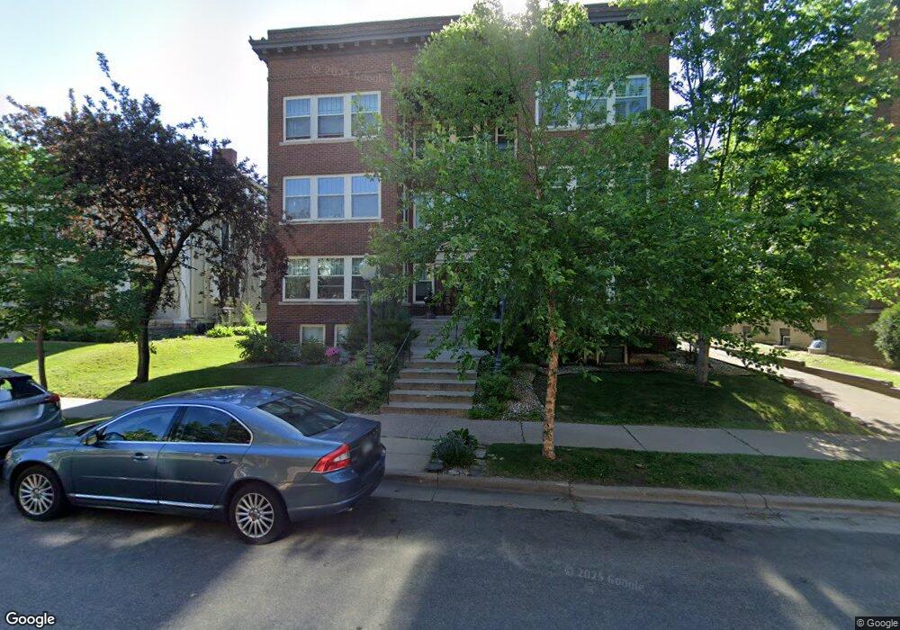
1913 Dupont Ave S Unit 2 Minneapolis, MN 55403
Lowry Hill NeighborhoodEstimated Value: $319,000 - $343,000
3
Beds
1
Bath
1,550
Sq Ft
$215/Sq Ft
Est. Value
About This Home
This home is located at 1913 Dupont Ave S Unit 2, Minneapolis, MN 55403 and is currently estimated at $333,526, approximately $215 per square foot. 1913 Dupont Ave S Unit 2 is a home located in Hennepin County with nearby schools including Kenwood Elementary School, Anwatin Middle School, and North High School.
Ownership History
Date
Name
Owned For
Owner Type
Purchase Details
Closed on
Nov 10, 2022
Sold by
Buelow Amy C
Bought by
Buelow Amy C and Amy C Buelow Revocable Intervivos Trust
Current Estimated Value
Purchase Details
Closed on
Jan 25, 2002
Sold by
Davis Laura A
Bought by
Buelow Amy C
Purchase Details
Closed on
Feb 20, 1998
Sold by
Lininger Michael R
Bought by
Davis Laura Ann
Purchase Details
Closed on
Apr 9, 1996
Sold by
Johnston Jane E
Bought by
Lininger Michael R
Create a Home Valuation Report for This Property
The Home Valuation Report is an in-depth analysis detailing your home's value as well as a comparison with similar homes in the area
Home Values in the Area
Average Home Value in this Area
Purchase History
| Date | Buyer | Sale Price | Title Company |
|---|---|---|---|
| Buelow Amy C | -- | None Listed On Document | |
| Buelow Amy C | $225,000 | -- | |
| Davis Laura Ann | $145,000 | -- | |
| Lininger Michael R | $137,000 | -- |
Source: Public Records
Tax History Compared to Growth
Tax History
| Year | Tax Paid | Tax Assessment Tax Assessment Total Assessment is a certain percentage of the fair market value that is determined by local assessors to be the total taxable value of land and additions on the property. | Land | Improvement |
|---|---|---|---|---|
| 2024 | $4,537 | $322,000 | $30,000 | $292,000 |
| 2023 | $4,352 | $340,000 | $30,000 | $310,000 |
| 2022 | $4,403 | $334,000 | $30,000 | $304,000 |
| 2021 | $3,983 | $325,000 | $33,000 | $292,000 |
| 2020 | $4,564 | $306,000 | $22,100 | $283,900 |
| 2019 | $4,453 | $322,000 | $22,100 | $299,900 |
| 2018 | $4,153 | $306,500 | $22,100 | $284,400 |
| 2017 | $3,701 | $253,000 | $22,100 | $230,900 |
| 2016 | $3,417 | $229,500 | $22,100 | $207,400 |
| 2015 | $3,585 | $229,500 | $22,100 | $207,400 |
| 2014 | -- | $219,500 | $22,100 | $197,400 |
Source: Public Records
Map
Nearby Homes
- 1940 Dupont Ave S
- 1820 Colfax Ave S
- 1932 Dupont Ave S
- 1901 Emerson Ave S Unit 402
- 1901 Emerson Ave S Unit 104
- 910 Lincoln Ave Unit B4
- 1915 Fremont Ave S
- 1785 Dupont Ave S
- 1805 Fremont Ave S
- 1770 Bryant Ave S Unit 114
- 2112 Emerson Ave S Unit 3
- 821 Douglas Ave Unit 204
- 1767 Fremont Ave S
- 904 W 22nd St
- 1212 Douglas Ave
- 2021 Girard Ave S
- 2100 Garfield Ave Unit 3
- 1721 Humboldt Ave S Unit 1
- 2316 Aldrich Ave S
- 1308 W 24th St
- 1913 Dupont Ave S Unit 7
- 1913 Dupont Ave S Unit 9
- 1913 Dupont Ave S Unit 8
- 1913 Dupont Ave S Unit 6
- 1913 Dupont Ave S Unit 5
- 1913 Dupont Ave S Unit 4
- 1913 Dupont Ave S Unit 3
- 1913 Dupont Ave S Unit 1
- 1913 Dupont Ave S Unit A
- 1913 Dupont Ave S
- 1913 Dupont Ave S Unit B
- 1913 Dupont Ave S Unit A
- 1913 1913 Dupont-Avenue-s
- 1913 1913 Dupont Ave S
- 1919 Dupont Ave S
- 1907 Dupont Ave S
- 1907 Dupont Ave S Unit Garden Apartment
- 1912 1912 Dupont-Avenue-s
- 1901 Dupont Ave S Unit 4
- 1901 Dupont Ave S Unit 5