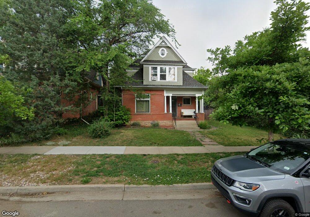
1913 Mapleton Ave Boulder, CO 80304
Whittier NeighborhoodEstimated Value: $1,244,717 - $2,103,000
4
Beds
2
Baths
1,646
Sq Ft
$996/Sq Ft
Est. Value
About This Home
This home is located at 1913 Mapleton Ave, Boulder, CO 80304 and is currently estimated at $1,639,429, approximately $996 per square foot. 1913 Mapleton Ave is a home located in Boulder County with nearby schools including Whittier Elementary School, Casey Middle School, and Boulder High School.
Ownership History
Date
Name
Owned For
Owner Type
Purchase Details
Closed on
Apr 16, 2009
Sold by
Ferris Steven C and Estate Of Charles W Ferris
Bought by
Stonich Terry
Current Estimated Value
Home Financials for this Owner
Home Financials are based on the most recent Mortgage that was taken out on this home.
Original Mortgage
$417,000
Outstanding Balance
$267,829
Interest Rate
5.24%
Mortgage Type
Purchase Money Mortgage
Estimated Equity
$1,371,600
Purchase Details
Closed on
Oct 26, 1981
Bought by
Stonich Terry and Stonich Avery
Purchase Details
Closed on
Jul 29, 1981
Bought by
Stonich Terry and Stonich Avery
Create a Home Valuation Report for This Property
The Home Valuation Report is an in-depth analysis detailing your home's value as well as a comparison with similar homes in the area
Home Values in the Area
Average Home Value in this Area
Purchase History
| Date | Buyer | Sale Price | Title Company |
|---|---|---|---|
| Stonich Terry | $545,000 | Utc Colorado | |
| Stonich Terry | -- | -- | |
| Stonich Terry | -- | -- |
Source: Public Records
Mortgage History
| Date | Status | Borrower | Loan Amount |
|---|---|---|---|
| Open | Stonich Terry | $417,000 |
Source: Public Records
Tax History
| Year | Tax Paid | Tax Assessment Tax Assessment Total Assessment is a certain percentage of the fair market value that is determined by local assessors to be the total taxable value of land and additions on the property. | Land | Improvement |
|---|---|---|---|---|
| 2025 | $8,092 | $86,206 | $68,456 | $17,750 |
| 2024 | $8,092 | $86,206 | $68,456 | $17,750 |
| 2023 | $7,949 | $91,180 | $72,092 | $22,773 |
| 2022 | $6,943 | $73,962 | $56,260 | $17,702 |
| 2021 | $6,624 | $76,090 | $57,879 | $18,211 |
| 2020 | $5,762 | $66,195 | $49,621 | $16,574 |
| 2019 | $5,674 | $66,195 | $49,621 | $16,574 |
| 2018 | $5,465 | $63,036 | $38,088 | $24,948 |
| 2017 | $5,294 | $69,689 | $42,108 | $27,581 |
| 2016 | $5,125 | $59,206 | $33,193 | $26,013 |
| 2015 | $4,853 | $47,999 | $27,860 | $20,139 |
| 2014 | $4,036 | $47,999 | $27,860 | $20,139 |
Source: Public Records
Map
Nearby Homes
- 2324 19th St
- 2230 20th St
- 1730 Bluff St
- 2236 17th St
- 1709 Pine St Unit 3
- 1938 Spruce St
- 1895 Alpine Ave Unit G22
- 1895 Alpine Ave Unit G21
- 1895 Alpine Ave Unit E18
- 1749 Alpine Ave Unit 10
- 2003 Balsam Dr
- 2240 Bluff St
- 1526 Sunset Blvd
- 1843 Walnut St Unit B
- 1837 Walnut St Unit E
- 2201 Pearl St Unit 224
- 2085 Balsam Dr
- 2870 18th St
- 1707 Walnut St Unit 203
- 1707 Walnut St Unit 307
- 2320 19th St
- 1931 Mapleton Ave
- 2324 19th St Unit B
- 2324 19th St Unit A
- 1918 Bluff St
- 2323 20th St
- 1845 Mapleton Ave
- 2315 19th St
- 2344 19th St
- 1910 Mapleton Ave
- 1920 Mapleton Ave
- 1928 Mapleton Ave
- 1837 Mapleton Ave
- 1936 Bluff St
- 2325 19th St
- 1936 Mapleton Ave
- 1844 Mapleton Ave
- 2322 20th St
- 2005 Mapleton Ave
- 1829 Mapleton Ave
Your Personal Tour Guide
Ask me questions while you tour the home.