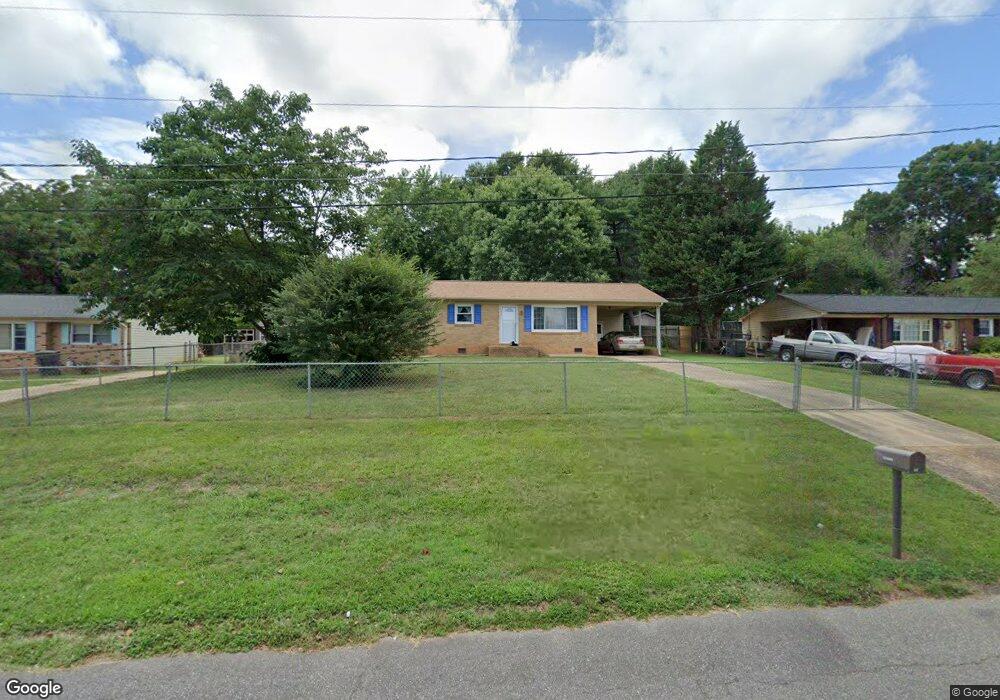
1913 Mountainbrook Dr Gastonia, NC 28052
Estimated Value: $202,000 - $242,000
3
Beds
2
Baths
1,462
Sq Ft
$151/Sq Ft
Est. Value
About This Home
This home is located at 1913 Mountainbrook Dr, Gastonia, NC 28052 and is currently estimated at $220,593, approximately $150 per square foot. 1913 Mountainbrook Dr is a home located in Gaston County with nearby schools including Pleasant Ridge Elementary School, Southwest Middle School, and Hunter Huss High School.
Ownership History
Date
Name
Owned For
Owner Type
Purchase Details
Closed on
Sep 17, 2025
Sold by
Dagenhart Ruth J
Bought by
Dagenhart Ruth J
Current Estimated Value
Home Financials for this Owner
Home Financials are based on the most recent Mortgage that was taken out on this home.
Original Mortgage
$200,000
Outstanding Balance
$197,525
Interest Rate
6.63%
Mortgage Type
Reverse Mortgage Home Equity Conversion Mortgage
Estimated Equity
$23,068
Purchase Details
Closed on
Nov 17, 2008
Sold by
Clark Mike R and Clark Paula G
Bought by
Secretary Of Housing & Urban Development
Purchase Details
Closed on
Dec 16, 2004
Sold by
Bottoms Amy Messer and Bottoms Floyd
Bought by
Clark Mike R and Clark Paula G
Home Financials for this Owner
Home Financials are based on the most recent Mortgage that was taken out on this home.
Original Mortgage
$81,025
Interest Rate
5.67%
Mortgage Type
FHA
Create a Home Valuation Report for This Property
The Home Valuation Report is an in-depth analysis detailing your home's value as well as a comparison with similar homes in the area
Home Values in the Area
Average Home Value in this Area
Purchase History
| Date | Buyer | Sale Price | Title Company |
|---|---|---|---|
| Dagenhart Ruth J | -- | None Listed On Document | |
| Secretary Of Housing & Urban Development | $83,783 | None Available | |
| Clark Mike R | $82,500 | Chicago Title Insurance Comp |
Source: Public Records
Mortgage History
| Date | Status | Borrower | Loan Amount |
|---|---|---|---|
| Open | Dagenhart Ruth J | $200,000 | |
| Closed | Dagenhart Ruth J | $200,000 | |
| Previous Owner | Clark Mike R | $81,025 |
Source: Public Records
Tax History Compared to Growth
Tax History
| Year | Tax Paid | Tax Assessment Tax Assessment Total Assessment is a certain percentage of the fair market value that is determined by local assessors to be the total taxable value of land and additions on the property. | Land | Improvement |
|---|---|---|---|---|
| 2025 | $960 | $179,670 | $17,000 | $162,670 |
| 2024 | $960 | $179,670 | $17,000 | $162,670 |
| 2023 | $970 | $179,670 | $17,000 | $162,670 |
| 2022 | $715 | $107,550 | $16,000 | $91,550 |
| 2021 | $726 | $107,550 | $16,000 | $91,550 |
| 2019 | $731 | $107,550 | $16,000 | $91,550 |
| 2018 | $516 | $81,511 | $16,000 | $65,511 |
| 2017 | $516 | $81,511 | $16,000 | $65,511 |
| 2016 | $518 | $81,511 | $0 | $0 |
| 2014 | $477 | $75,250 | $15,000 | $60,250 |
Source: Public Records
Map
Nearby Homes
- 4007 Brookstone Ct
- 1314 Shady Oak Trail
- 1234 Laurel Woods Dr
- 4201 Graceway Dr
- 949 Carson Rd
- 3402 Rollingwood Dr
- 3431 Pikes Peak Dr
- 3343 Table Rock Dr
- 3455 Table Rock Dr
- 3348 Table Rock Dr
- 618 Camp Rotary Rd
- 2829 Westmont Dr
- 2823 Westmont Dr
- 2817 Westmont Dr
- 2811 Westmont Dr
- 4131 Mount Mitchell Ave Unit 501
- 2808 Westmont Dr
- 4143 Mount Mitchell Ave Unit 504
- 4139 Mount Mitchell Ave Unit 503
- 505 Mount Mitchell Ave Unit 505
- 1907 Mountainbrook Dr
- 1919 Mountainbrook Dr
- 1928 Silverstone Dr
- 1932 Silverstone Dr
- 1901 Mountainbrook Dr
- 1925 Mountainbrook Dr
- 0 Mountainbrook Dr Unit 5064333-8873311
- 0 Mountainbrook Dr Unit 5064333-7586184
- 1924 Silverstone Dr
- 1912 Mountainbrook Dr
- 1906 Mountainbrook Dr
- 1918 Mountainbrook Dr
- 1900 Mountainbrook Dr
- 1835 Mountainbrook Dr
- 1931 Mountainbrook Dr
- 1924 Mountainbrook Dr
- 1920 Silverstone Dr
- 3914 Linwood Rd
- 1836 Mountainbrook Dr
- 1930 Mountainbrook Dr