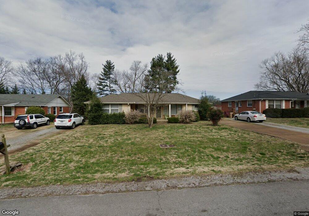
1913 Upland Dr Unit Side B Nashville, TN 37216
Inglewood NeighborhoodEstimated Value: $479,000 - $603,000
4
Beds
2
Baths
1,594
Sq Ft
$331/Sq Ft
Est. Value
About This Home
This home is located at 1913 Upland Dr Unit Side B, Nashville, TN 37216 and is currently estimated at $527,439, approximately $330 per square foot. 1913 Upland Dr Unit Side B is a home located in Davidson County with nearby schools including Inglewood Elementary School, Isaac Litton Middle, and Stratford Comprehensive High School.
Ownership History
Date
Name
Owned For
Owner Type
Purchase Details
Closed on
Mar 7, 2013
Sold by
1913 Upland Llc
Bought by
Rucker Harold B and Rucker Dianne S
Current Estimated Value
Purchase Details
Closed on
Jul 15, 2009
Sold by
Stevens Wendy H
Bought by
1913 Upland Llc
Purchase Details
Closed on
May 30, 2008
Sold by
Wilson Carolyn J and Wilson John A
Bought by
Stevens Wendy H
Home Financials for this Owner
Home Financials are based on the most recent Mortgage that was taken out on this home.
Original Mortgage
$120,000
Interest Rate
6%
Mortgage Type
Unknown
Purchase Details
Closed on
Aug 11, 2006
Sold by
Walling Carolyn J and Wilson Carolyn J
Bought by
Wilson John A
Create a Home Valuation Report for This Property
The Home Valuation Report is an in-depth analysis detailing your home's value as well as a comparison with similar homes in the area
Home Values in the Area
Average Home Value in this Area
Purchase History
| Date | Buyer | Sale Price | Title Company |
|---|---|---|---|
| Rucker Harold B | $110,000 | Residential & Commercial Tit | |
| 1913 Upland Llc | -- | None Available | |
| Stevens Wendy H | $150,000 | Multiple | |
| Wilson John A | -- | None Available |
Source: Public Records
Mortgage History
| Date | Status | Borrower | Loan Amount |
|---|---|---|---|
| Previous Owner | Stevens Wendy H | $120,000 |
Source: Public Records
Tax History Compared to Growth
Tax History
| Year | Tax Paid | Tax Assessment Tax Assessment Total Assessment is a certain percentage of the fair market value that is determined by local assessors to be the total taxable value of land and additions on the property. | Land | Improvement |
|---|---|---|---|---|
| 2024 | $3,853 | $118,400 | $40,000 | $78,400 |
| 2023 | $3,853 | $118,400 | $40,000 | $78,400 |
| 2022 | $3,853 | $118,400 | $40,000 | $78,400 |
| 2021 | $3,893 | $118,400 | $40,000 | $78,400 |
| 2020 | $3,485 | $82,560 | $44,000 | $38,560 |
| 2019 | $2,605 | $82,560 | $44,000 | $38,560 |
| 2018 | $2,605 | $82,560 | $44,000 | $38,560 |
| 2017 | $2,605 | $82,560 | $44,000 | $38,560 |
| 2016 | $1,987 | $44,000 | $12,800 | $31,200 |
| 2015 | $1,987 | $44,000 | $12,800 | $31,200 |
| 2014 | $1,987 | $44,000 | $12,800 | $31,200 |
Source: Public Records
Map
Nearby Homes
- 1904 Upland Dr
- 1952B Porter Rd
- 1943 Pinehurst Dr
- 1815 Tammany Dr
- 1721 Marsden Ave
- 1712 Litton Ave
- 1843 Willow Springs Dr
- 1711 Sherwood Ln
- 2221 Thistlewood Dr
- 1702 Litton Ave
- 1703 Litton Ave
- 1613 Tammany Dr
- 2009B Rosecliff Dr
- 1823 Willow Springs Dr
- 1513 Rosebank Ave
- 2230 Thistlewood Dr
- 2244 Stratford Ave
- 2012 Forrest Green Dr
- 2008 Riverside Dr
- 1525 Riverside Dr Unit B
- 1913 Upland Dr
- 1913 Upland Dr Unit A
- 1913 Upland Dr Unit Side A
- 1915 Upland Dr Unit B
- 1911 Upland Dr
- 1912 Pinehurst Dr
- 1910 Pinehurst Dr
- 1909 Upland # B
- 1917 Upland Dr
- 1909 Upland Dr
- 1909 Upland Dr Unit A
- 1909 Upland Dr Unit B
- 1914 Pinehurst Dr
- 1914 Upland Dr
- 1916 Upland Dr
- 1908 Pinehurst Dr
- 1912 Upland Dr
- 1918 Upland Dr
- 1916 Pinehurst Dr