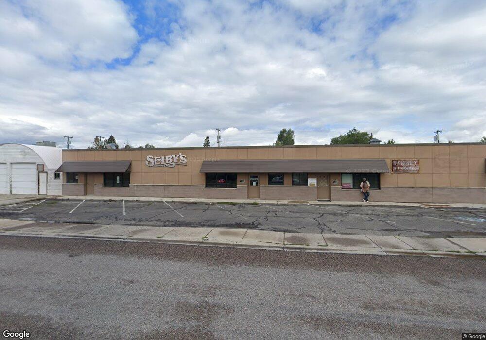
1914 North Ave W Missoula, MT 59801
Franklin to the Fort Neighborhood
--
Bed
4
Baths
3,840
Sq Ft
3,920
Sq Ft Lot
About This Home
This home is located at 1914 North Ave W, Missoula, MT 59801. 1914 North Ave W is a home located in Missoula County with nearby schools including Franklin School, Porter Middle School, and Sentinel High School.
Ownership History
Date
Name
Owned For
Owner Type
Purchase Details
Closed on
Jan 31, 2025
Sold by
Cbj Properties Mso Llc
Bought by
Unexpected Grace
Home Financials for this Owner
Home Financials are based on the most recent Mortgage that was taken out on this home.
Original Mortgage
$1,300,000
Outstanding Balance
$552,272
Interest Rate
6.72%
Mortgage Type
Construction
Purchase Details
Closed on
Jun 11, 2018
Sold by
Marshall Alice and Marshall James
Bought by
Cbj Properties Mso Llc
Create a Home Valuation Report for This Property
The Home Valuation Report is an in-depth analysis detailing your home's value as well as a comparison with similar homes in the area
Home Values in the Area
Average Home Value in this Area
Purchase History
| Date | Buyer | Sale Price | Title Company |
|---|---|---|---|
| Unexpected Grace | -- | Flying S Title And Escrow | |
| Cbj Properties Mso Llc | -- | First American Title |
Source: Public Records
Mortgage History
| Date | Status | Borrower | Loan Amount |
|---|---|---|---|
| Open | Unexpected Grace | $1,300,000 |
Source: Public Records
Tax History Compared to Growth
Tax History
| Year | Tax Paid | Tax Assessment Tax Assessment Total Assessment is a certain percentage of the fair market value that is determined by local assessors to be the total taxable value of land and additions on the property. | Land | Improvement |
|---|---|---|---|---|
| 2025 | $16,159 | $1,103,300 | $709,988 | $393,312 |
| 2024 | $15,515 | $910,700 | $480,940 | $429,760 |
| 2023 | $14,939 | $910,700 | $480,940 | $429,760 |
| 2022 | $13,058 | $690,500 | $0 | $0 |
| 2021 | $11,744 | $690,500 | $0 | $0 |
| 2020 | $10,330 | $564,500 | $0 | $0 |
| 2019 | $10,296 | $564,500 | $0 | $0 |
| 2018 | $14,359 | $743,800 | $0 | $0 |
| 2017 | $14,173 | $743,800 | $0 | $0 |
| 2016 | $12,035 | $655,900 | $0 | $0 |
| 2015 | $11,166 | $655,900 | $0 | $0 |
| 2014 | $10,261 | $473,671 | $0 | $0 |
Source: Public Records
Map
Nearby Homes
- 1755 North Ave W
- 2028 B Burlington Ave
- 2144 W Kent Ave
- 2112 & 2112 1/2 W Central Ave
- 2115 Mount Ave Unit B
- NHN S 13th St W Unit Lot 9A
- 2218 Burlington Ave
- 2225 Kensington Ave
- 2004 S 13th St W
- 2124 S 14th St W
- 2128 S 14th St W
- 1935 S 12th St W
- 1665 W Sussex Ave
- 1638 S 14th St W
- 235 S 4th St E Unit 203
- 265 S 4th St E Unit 208
- 265 S 4th St E Unit 111
- 265 S 4th St E Unit 405
- 2307 Burlington Ave
- 2345 W Kent Ave
- 1920 North Ave W
- 1925 Kensington Ave
- 1925 Kensington Ave
- 1925 1/2 Kensington Ave
- 1924 North Ave W Unit 1
- 1924 North Ave W
- 1919 North Ave W
- 1927 Kensington Ave
- 1925 Kensington Ave
- 1951 Kensington Ave Unit 1
- 1951 Kensington Ave
- 1915 Kensington Ave
- 1909 Kensington Ave
- 1909 Kensington Ave
- 1909 Kensington Ave
- 1957 Kensington Ave
- 1956 S Johnson St
- 215-235 Grant St
- 1931 Kensington Ave
- 1930 Kensington Ave