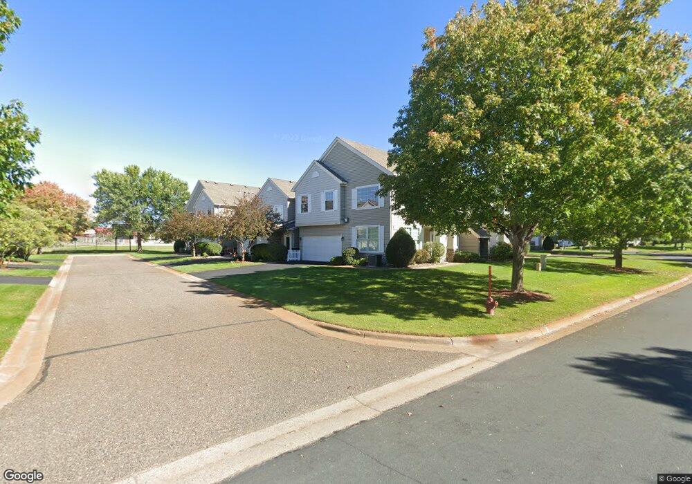
1915 Bluestem Ln Shoreview, MN 55126
Estimated Value: $240,000 - $296,000
2
Beds
2
Baths
1,572
Sq Ft
$173/Sq Ft
Est. Value
About This Home
This home is located at 1915 Bluestem Ln, Shoreview, MN 55126 and is currently estimated at $272,646, approximately $173 per square foot. 1915 Bluestem Ln is a home located in Ramsey County with nearby schools including Pinewood Elementary School, Edgewood Middle School, and Hopkinton High School.
Ownership History
Date
Name
Owned For
Owner Type
Purchase Details
Closed on
Jul 1, 2010
Sold by
Filonenko Piyanka and Filonenko Sergey
Bought by
Patel Hitesh C
Current Estimated Value
Purchase Details
Closed on
Aug 4, 2006
Sold by
Boock Tanya E and Boock Timothy
Bought by
Filonenko Piyanka and Filonenko Sergey
Purchase Details
Closed on
Jun 27, 2003
Sold by
Belisle Cara J and Belisle Mark
Bought by
Quick Tanya E
Purchase Details
Closed on
Jun 9, 2000
Sold by
The Rottlund Company Inc
Bought by
Talsoe Cara
Create a Home Valuation Report for This Property
The Home Valuation Report is an in-depth analysis detailing your home's value as well as a comparison with similar homes in the area
Home Values in the Area
Average Home Value in this Area
Purchase History
| Date | Buyer | Sale Price | Title Company |
|---|---|---|---|
| Patel Hitesh C | $120,000 | -- | |
| Filonenko Piyanka | $176,000 | -- | |
| Quick Tanya E | $155,000 | -- | |
| Talsoe Cara | $118,902 | -- |
Source: Public Records
Tax History Compared to Growth
Tax History
| Year | Tax Paid | Tax Assessment Tax Assessment Total Assessment is a certain percentage of the fair market value that is determined by local assessors to be the total taxable value of land and additions on the property. | Land | Improvement |
|---|---|---|---|---|
| 2025 | $3,436 | $267,600 | $50,000 | $217,600 |
| 2023 | $3,436 | $261,800 | $50,000 | $211,800 |
| 2022 | $2,988 | $249,500 | $50,000 | $199,500 |
| 2021 | $2,800 | $207,400 | $50,000 | $157,400 |
| 2020 | $3,006 | $198,200 | $50,000 | $148,200 |
| 2019 | $2,502 | $198,200 | $25,000 | $173,200 |
| 2018 | $2,468 | $175,600 | $25,000 | $150,600 |
| 2017 | $2,304 | $167,700 | $25,000 | $142,700 |
| 2016 | $2,414 | $0 | $0 | $0 |
| 2015 | $2,420 | $155,600 | $23,300 | $132,300 |
| 2014 | $2,260 | $0 | $0 | $0 |
Source: Public Records
Map
Nearby Homes
- 5713 Cabot Dr
- 5762 Schutta Rd
- 5601 Schutta Rd
- 1715 Hillview Rd
- 8504 Edison St NE
- 1588 Hall St
- 8798 Dunkirk Ct NE
- 5591 Albert St
- 2243 Lambert Ave
- 2956 Rice Creek Pkwy NE
- 3667 91st Dr NE
- 8718 Ghia St NE
- 8823 Fraizer St
- 2557 County Road I
- 3811 Restwood Rd
- 2560 County Road I
- 7767 Eastwood Rd
- 2550 Moundsview Dr Unit 49
- 2466 Clearview Ave
- 2639 Lake Court Cir Unit 81
- 1905 Bluestem Ln
- 1905 Bluestem Ln
- 1913 Bluestem Ln
- 1903 Bluestem Ln
- 1915 Bluestem Ln
- 1907 Bluestem Ln Unit 30
- 1909 Bluestem Ln Unit 29
- 1911 Bluestem Ln Unit 25
- 1917 Bluestem Ln Unit 28
- 1891 1891 Bluestem-Lane-
- 1869 1869 Bluestem-Lane-
- 1919 Bluestem Ln
- 1933 Bluestem Ln
- 1923 Bluestem Ln
- 1931 Bluestem Ln
- 1925 Bluestem Ln Unit 21
- 1921 Bluestem Ln Unit 23
- 1929 Bluestem Ln Unit 18
- 1919 Bluestem Ln
- 1933 1933 Bluestem Ln