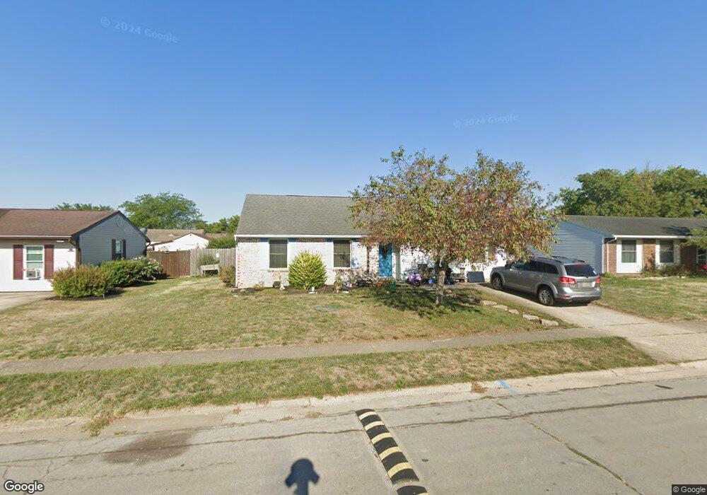
1915 Chickasaw Dr Circleville, OH 43113
Estimated Value: $238,000 - $290,000
4
Beds
1
Bath
1,675
Sq Ft
$160/Sq Ft
Est. Value
About This Home
This home is located at 1915 Chickasaw Dr, Circleville, OH 43113 and is currently estimated at $268,269, approximately $160 per square foot. 1915 Chickasaw Dr is a home located in Pickaway County with nearby schools including Logan Elm High School and Crossroads Christian Academy.
Ownership History
Date
Name
Owned For
Owner Type
Purchase Details
Closed on
Dec 18, 2015
Sold by
Mcpherson Nick R and Mcpherson Elizabeth R
Bought by
Thompson Debra K
Current Estimated Value
Home Financials for this Owner
Home Financials are based on the most recent Mortgage that was taken out on this home.
Original Mortgage
$114,880
Outstanding Balance
$91,022
Interest Rate
4.25%
Mortgage Type
FHA
Estimated Equity
$177,247
Purchase Details
Closed on
Sep 13, 2001
Sold by
Ramey Roy
Bought by
Mcpherson Nick R and Mcpherson Elizabeth R
Home Financials for this Owner
Home Financials are based on the most recent Mortgage that was taken out on this home.
Original Mortgage
$96,000
Interest Rate
7.03%
Mortgage Type
New Conventional
Purchase Details
Closed on
Jul 6, 1992
Sold by
Swank Paulette
Bought by
Rameyn Roy
Purchase Details
Closed on
Jun 30, 1992
Purchase Details
Closed on
Sep 1, 1988
Create a Home Valuation Report for This Property
The Home Valuation Report is an in-depth analysis detailing your home's value as well as a comparison with similar homes in the area
Home Values in the Area
Average Home Value in this Area
Purchase History
| Date | Buyer | Sale Price | Title Company |
|---|---|---|---|
| Thompson Debra K | $117,000 | Valmer Land Title | |
| Mcpherson Nick R | $94,900 | -- | |
| Rameyn Roy | $69,900 | -- | |
| -- | $69,900 | -- | |
| -- | $67,900 | -- |
Source: Public Records
Mortgage History
| Date | Status | Borrower | Loan Amount |
|---|---|---|---|
| Open | Thompson Debra K | $114,880 | |
| Previous Owner | Mcpherson Nick R | $96,000 |
Source: Public Records
Tax History
| Year | Tax Paid | Tax Assessment Tax Assessment Total Assessment is a certain percentage of the fair market value that is determined by local assessors to be the total taxable value of land and additions on the property. | Land | Improvement |
|---|---|---|---|---|
| 2024 | -- | $68,580 | $10,990 | $57,590 |
| 2023 | $2,289 | $68,580 | $10,990 | $57,590 |
| 2022 | $1,821 | $50,750 | $9,120 | $41,630 |
| 2021 | $1,867 | $50,750 | $9,120 | $41,630 |
| 2020 | $1,891 | $50,750 | $9,120 | $41,630 |
| 2019 | $1,402 | $40,420 | $9,120 | $31,300 |
| 2018 | $1,609 | $40,420 | $9,120 | $31,300 |
| 2017 | $1,323 | $40,420 | $9,120 | $31,300 |
| 2016 | $1,267 | $38,960 | $9,120 | $29,840 |
| 2015 | $1,271 | $38,960 | $9,120 | $29,840 |
| 2014 | $1,273 | $38,960 | $9,120 | $29,840 |
| 2013 | $1,306 | $38,960 | $9,120 | $29,840 |
Source: Public Records
Map
Nearby Homes
- 311 Tarlton Rd
- 25460 Us Highway 23 S
- 339 Walnut St
- 1028 S Court St
- 837 Clinton St
- 1002 S Court St
- 705 Clinton St
- 209 Huston St
- 575 Renick Ave
- 420 Faye Ave
- 321 S Pickaway St
- 531 E Franklin St
- 446 E Franklin St
- 551 E Main St
- 378 E Franklin St
- 225 S Court St
- 461 Watt St
- 405 Watt St
- 0 Ohio 56 Unit 226002334
- 125 N Pickaway St
- 1925 Chickasaw Dr
- 1905 Chickasaw Dr
- 1920 Cheyenne Dr
- 1930 Cheyenne Dr
- 1910 Cheyenne Dr
- 1935 Chickasaw Dr
- 1895 Chickasaw Dr
- 1930 Chickasaw Dr
- 1920 Chickasaw Dr
- 1940 Cheyenne Dr
- 1910 Chickasaw Dr
- 1900 Cheyenne Dr
- 1940 Chickasaw Dr
- 1945 Chickasaw Dr
- 1900 Chickasaw Dr
- 1950 Cheyenne Dr
- 0 Cheyenne Dr
- 1950 Chickasaw Dr
- 1890 Chickasaw Dr
- 1955 Chickasaw Dr
Your Personal Tour Guide
Ask me questions while you tour the home.