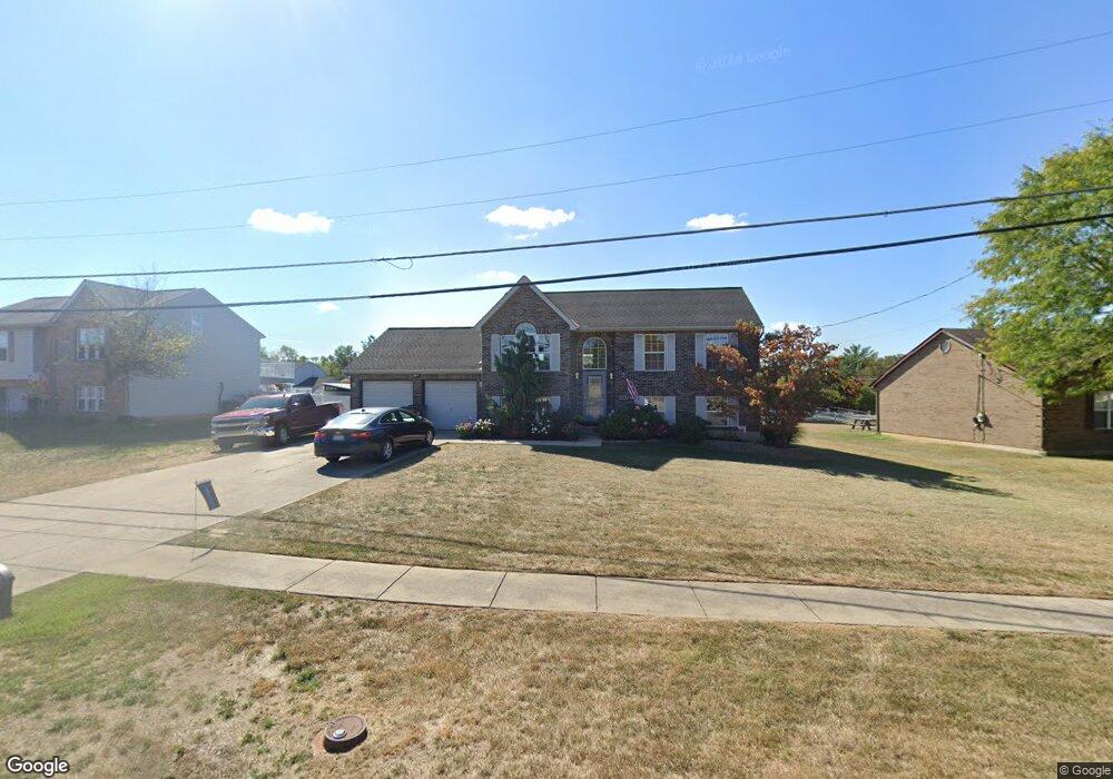
1915 Independence Rd Independence, KY 41051
Estimated Value: $231,000 - $322,000
3
Beds
2
Baths
936
Sq Ft
$278/Sq Ft
Est. Value
About This Home
This home is located at 1915 Independence Rd, Independence, KY 41051 and is currently estimated at $260,574, approximately $278 per square foot. 1915 Independence Rd is a home located in Kenton County with nearby schools including Kenton Elementary School, Twenhofel Middle School, and Simon Kenton High School.
Ownership History
Date
Name
Owned For
Owner Type
Purchase Details
Closed on
Jun 29, 2011
Sold by
Marsh James A
Bought by
Elsbernd Daniel G and Elsbernd Constance L
Current Estimated Value
Home Financials for this Owner
Home Financials are based on the most recent Mortgage that was taken out on this home.
Original Mortgage
$125,500
Outstanding Balance
$85,647
Interest Rate
4.57%
Mortgage Type
New Conventional
Estimated Equity
$174,927
Purchase Details
Closed on
Mar 28, 2007
Sold by
Marsh James Albert
Bought by
Marsh James Albert and James Albert Marsh Revocable Living Tr
Create a Home Valuation Report for This Property
The Home Valuation Report is an in-depth analysis detailing your home's value as well as a comparison with similar homes in the area
Home Values in the Area
Average Home Value in this Area
Purchase History
| Date | Buyer | Sale Price | Title Company |
|---|---|---|---|
| Elsbernd Daniel G | $132,200 | Cincinnatus Title | |
| Marsh James Albert | -- | None Available |
Source: Public Records
Mortgage History
| Date | Status | Borrower | Loan Amount |
|---|---|---|---|
| Open | Elsbernd Daniel G | $125,500 |
Source: Public Records
Tax History
| Year | Tax Paid | Tax Assessment Tax Assessment Total Assessment is a certain percentage of the fair market value that is determined by local assessors to be the total taxable value of land and additions on the property. | Land | Improvement |
|---|---|---|---|---|
| 2025 | $1,685 | $194,000 | $35,000 | $159,000 |
| 2024 | $1,335 | $155,300 | $30,000 | $125,300 |
| 2023 | $1,374 | $155,300 | $30,000 | $125,300 |
| 2022 | $1,515 | $155,300 | $30,000 | $125,300 |
| 2021 | $1,537 | $155,300 | $30,000 | $125,300 |
| 2020 | $1,284 | $132,200 | $30,000 | $102,200 |
| 2019 | $1,800 | $132,200 | $30,000 | $102,200 |
| 2018 | $1,809 | $132,200 | $30,000 | $102,200 |
| 2017 | $1,760 | $132,200 | $30,000 | $102,200 |
| 2015 | $1,706 | $132,200 | $30,000 | $102,200 |
| 2014 | $1,683 | $132,200 | $30,000 | $102,200 |
Source: Public Records
Map
Nearby Homes
- 6500 Julia Meadow
- 5261 Millcreek Cir
- 2033 Flintwood Ct
- 10434 Sharpsburg Dr
- 10737 Cypresswood Dr
- 1247 Monocacy Ct
- 2144 Hartland Blvd
- 1217 Cannonball Way
- 8382 Greenmere Cir
- 10362 Petersburg Ct
- 1197 Catletts Ct
- 64 Sherwood Dr
- 2037 Patriot Way
- 10422 Flintrock Bluff
- 10529 Greenbrook Dr
- 1436 Rosewynne Way
- 9971 Meadow Glen Dr
- 1427 Rosewynne Way
- 1365 Cairns Ct
- 10363 Canberra Dr
- 1919 Independence R
- 1919 Independence Rd
- 1911 Independence Rd
- 1923 Independence Rd
- 1907 Independence Rd
- 1888 Appeals Ct
- 1892 Appeals Ct
- 1896 Appeals Ct
- 1927 Independence Rd
- 1922 Independence Rd
- 1918 Independence Rd
- 1901 Independence Rd
- 1926 Independence Rd
- 1926 Independence Rd Unit 24
- 1900 Appeals Ct
- 1931 Independence Rd
- 1904 Independence Rd
- 1930 Independence Rd
- 1885 Appeals Ct
- 1930 Independence R
Your Personal Tour Guide
Ask me questions while you tour the home.