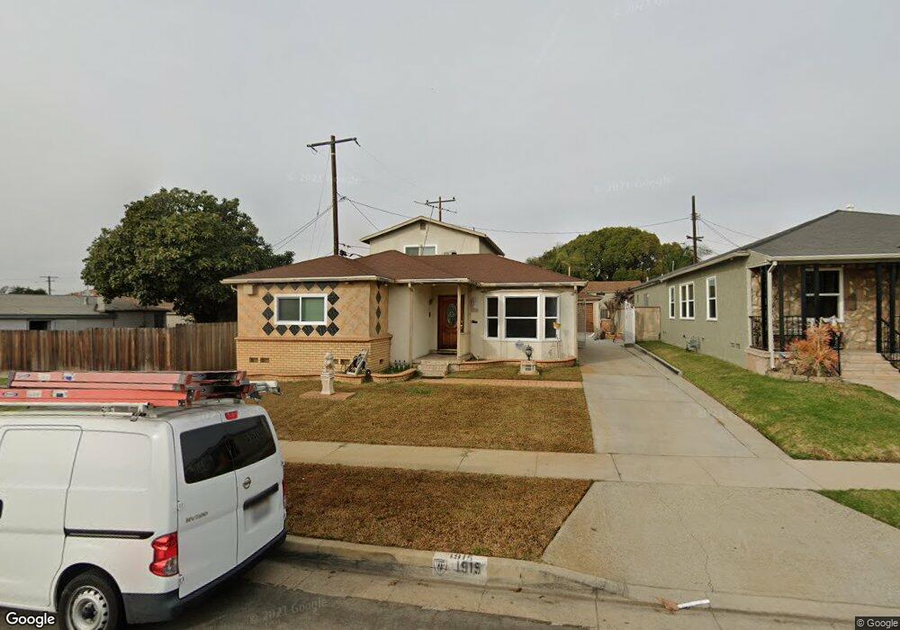
1915 W 112th St Los Angeles, CA 90047
Estimated Value: $786,000 - $888,559
4
Beds
3
Baths
2,038
Sq Ft
$411/Sq Ft
Est. Value
About This Home
This home is located at 1915 W 112th St, Los Angeles, CA 90047 and is currently estimated at $838,390, approximately $411 per square foot. 1915 W 112th St is a home located in Los Angeles County with nearby schools including Cimarron Avenue Elementary School, George Washington Preparatory High School, and Stella High Charter Academy.
Ownership History
Date
Name
Owned For
Owner Type
Purchase Details
Closed on
Nov 1, 2019
Sold by
Allen Donovan M and Allen Donovan Marquis
Bought by
Silver Dollar Liquor Corporation
Current Estimated Value
Purchase Details
Closed on
Jul 9, 2009
Sold by
Allen Phillip R
Bought by
Allen Donovan M
Purchase Details
Closed on
Sep 25, 1996
Sold by
Flowers Ruby M
Bought by
Allen Phillip Ray and Allen Wilhelmina Porch
Home Financials for this Owner
Home Financials are based on the most recent Mortgage that was taken out on this home.
Original Mortgage
$194,750
Interest Rate
7.87%
Create a Home Valuation Report for This Property
The Home Valuation Report is an in-depth analysis detailing your home's value as well as a comparison with similar homes in the area
Home Values in the Area
Average Home Value in this Area
Purchase History
| Date | Buyer | Sale Price | Title Company |
|---|---|---|---|
| Silver Dollar Liquor Corporation | -- | None Available | |
| Allen Donovan M | -- | None Available | |
| Allen Phillip Ray | $205,000 | Commonwealth Land Title Co |
Source: Public Records
Mortgage History
| Date | Status | Borrower | Loan Amount |
|---|---|---|---|
| Previous Owner | Allen Phillip Ray | $194,750 |
Source: Public Records
Tax History Compared to Growth
Tax History
| Year | Tax Paid | Tax Assessment Tax Assessment Total Assessment is a certain percentage of the fair market value that is determined by local assessors to be the total taxable value of land and additions on the property. | Land | Improvement |
|---|---|---|---|---|
| 2025 | $6,932 | $525,084 | $327,027 | $198,057 |
| 2024 | $6,932 | $514,789 | $320,615 | $194,174 |
| 2023 | $6,818 | $504,696 | $314,329 | $190,367 |
| 2022 | $6,502 | $494,801 | $308,166 | $186,635 |
| 2021 | $6,429 | $485,100 | $302,124 | $182,976 |
| 2020 | $4,886 | $345,604 | $164,350 | $181,254 |
| 2019 | $4,708 | $338,828 | $161,128 | $177,700 |
| 2018 | $4,574 | $332,185 | $157,969 | $174,216 |
| 2016 | $4,372 | $319,287 | $151,836 | $167,451 |
| 2015 | $4,305 | $314,492 | $149,556 | $164,936 |
| 2014 | $4,307 | $308,333 | $146,627 | $161,706 |
Source: Public Records
Map
Nearby Homes
- 11143 Ruthelen St
- 1945 W Imperial Hwy
- 11139 S Manhattan Place
- 1723 W 111th St
- 2165 W 115th St
- 11028 Spinning Ave
- 11119 S Denker Ave
- 1815 W 108th St
- 1559 W 113th St
- 10715 S Western Ave
- 11731 Cimarron Ave
- 1655 W 109th St
- 10600 Ruthelen St
- 2308 W 117th St
- 1519 W 111th St
- 1616 W 108th St
- 2425 W 116th St
- 1650 W 107th St
- 10527 S Wilton Place
- 10515 S Manhattan Place
- 1909 W 112th St
- 11162 Ruthelen St
- 11166 Ruthelen St
- 11179 S St Andrews Place
- 1901 W 112th St
- 11156 Ruthelen St
- 11173 S St Andrews Place
- 11150 Ruthelen St
- 1912 W 112th St
- 1918 W 112th St
- 1908 W 112th St
- 11169 S St Andrews Place
- 11146 Ruthelen St
- 1922 W 112th St
- 1900 W 112th St
- 11193 S Manhattan Place
- 1928 W 112th St
- 11140 Ruthelen St
- 11163 S St Andrews Place
- 1934 W 112th St