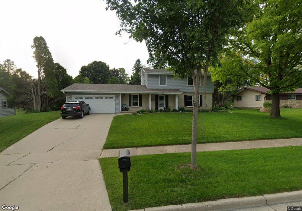
1916 Avalon Dr Waukesha, WI 53186
Estimated Value: $384,000 - $415,000
4
Beds
2
Baths
1,746
Sq Ft
$230/Sq Ft
Est. Value
About This Home
This home is located at 1916 Avalon Dr, Waukesha, WI 53186 and is currently estimated at $401,664, approximately $230 per square foot. 1916 Avalon Dr is a home located in Waukesha County with nearby schools including John F. Miller School, Banting Elementary School, and Horning Middle School.
Ownership History
Date
Name
Owned For
Owner Type
Purchase Details
Closed on
Nov 17, 2016
Sold by
Gratz Barbara J
Bought by
Secora Phillp and Secora Mary
Current Estimated Value
Home Financials for this Owner
Home Financials are based on the most recent Mortgage that was taken out on this home.
Original Mortgage
$206,150
Outstanding Balance
$165,503
Interest Rate
3.42%
Mortgage Type
New Conventional
Estimated Equity
$236,161
Purchase Details
Closed on
Nov 19, 2004
Sold by
Gratz Mark J
Bought by
Gratz Barbara J
Create a Home Valuation Report for This Property
The Home Valuation Report is an in-depth analysis detailing your home's value as well as a comparison with similar homes in the area
Home Values in the Area
Average Home Value in this Area
Purchase History
| Date | Buyer | Sale Price | Title Company |
|---|---|---|---|
| Secora Phillp | $217,000 | None Available | |
| Gratz Barbara J | -- | -- |
Source: Public Records
Mortgage History
| Date | Status | Borrower | Loan Amount |
|---|---|---|---|
| Open | Secora Phillp | $206,150 |
Source: Public Records
Tax History Compared to Growth
Tax History
| Year | Tax Paid | Tax Assessment Tax Assessment Total Assessment is a certain percentage of the fair market value that is determined by local assessors to be the total taxable value of land and additions on the property. | Land | Improvement |
|---|---|---|---|---|
| 2024 | $4,619 | $312,200 | $77,000 | $235,200 |
| 2023 | $4,488 | $312,200 | $77,000 | $235,200 |
| 2022 | $4,304 | $225,300 | $67,600 | $157,700 |
| 2021 | $4,404 | $225,300 | $67,600 | $157,700 |
| 2020 | $4,258 | $225,300 | $67,600 | $157,700 |
| 2019 | $4,124 | $225,300 | $67,600 | $157,700 |
| 2018 | $3,896 | $208,600 | $58,600 | $150,000 |
| 2017 | $3,887 | $208,600 | $58,600 | $150,000 |
| 2016 | $3,759 | $189,600 | $58,600 | $131,000 |
| 2015 | $3,738 | $189,600 | $58,600 | $131,000 |
| 2014 | $3,729 | $185,900 | $58,600 | $127,300 |
| 2013 | $3,820 | $185,900 | $58,500 | $127,400 |
Source: Public Records
Map
Nearby Homes
- 2109 Melody Ln
- 1729 Stardust Dr Unit B
- 21525 Belgren Rd
- 335 Kossow Rd
- 2423 Kossow Rd
- 1415 Niagara St Unit 109
- 1333 Niagara St
- 1308 Danny St
- 1116 Josephine St
- 1112 Gertrude St
- 1471 Cleveland Ave
- 918 Niagara St
- S17W22650 Lincoln Ave
- 937 E Moreland Blvd
- 1080 Westbrooke Pkwy
- 925 Harding Ave
- 1732 S Craftsman Dr
- 1021 Arcadian Ave
- 1021 Aurora St
- N10W23564 Robinhood Ct
- 1912 Avalon Dr
- 1911 Avalon Dr
- 1922 Avalon Dr
- 1917 Avalon Dr
- 1908 Avalon Dr
- 1905 Avalon Dr
- 1928 Avalon Dr
- 1923 Avalon Dr
- 1923 Sunnyside Dr
- 1921 Sunnyside Dr
- 1929 Sunnyside Dr
- 1915 Sunnyside Dr
- 1915 Sunnyside Dr Unit Dr
- 1934 Avalon Dr
- 1910 Stardust Dr
- 1935 Sunnyside Dr
- 1911 Sunnyside Dr
- 1929 Avalon Dr
- 1907 Sunnyside Dr
- 1880 Stardust Dr