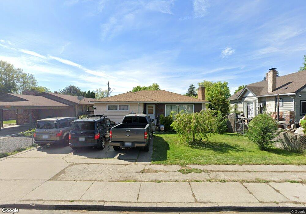
1916 E Bridgeport Ave Spokane, WA 99207
Bemiss NeighborhoodEstimated Value: $293,000 - $348,000
3
Beds
2
Baths
1,088
Sq Ft
$286/Sq Ft
Est. Value
About This Home
This home is located at 1916 E Bridgeport Ave, Spokane, WA 99207 and is currently estimated at $311,189, approximately $286 per square foot. 1916 E Bridgeport Ave is a home located in Spokane County with nearby schools including Bemiss Elementary School, Shaw Middle School, and Rogers High School.
Ownership History
Date
Name
Owned For
Owner Type
Purchase Details
Closed on
Aug 2, 2019
Sold by
Taylor Randy
Bought by
Shelden Linda and Shelden Robert
Current Estimated Value
Home Financials for this Owner
Home Financials are based on the most recent Mortgage that was taken out on this home.
Original Mortgage
$153,000
Outstanding Balance
$134,274
Interest Rate
3.8%
Mortgage Type
New Conventional
Estimated Equity
$176,915
Purchase Details
Closed on
Oct 11, 2018
Sold by
Taylor Barbara I
Bought by
Taylor Randy
Create a Home Valuation Report for This Property
The Home Valuation Report is an in-depth analysis detailing your home's value as well as a comparison with similar homes in the area
Home Values in the Area
Average Home Value in this Area
Purchase History
| Date | Buyer | Sale Price | Title Company |
|---|---|---|---|
| Shelden Linda | $170,000 | None Available | |
| Taylor Randy | -- | None Available |
Source: Public Records
Mortgage History
| Date | Status | Borrower | Loan Amount |
|---|---|---|---|
| Open | Shelden Linda | $153,000 |
Source: Public Records
Tax History Compared to Growth
Tax History
| Year | Tax Paid | Tax Assessment Tax Assessment Total Assessment is a certain percentage of the fair market value that is determined by local assessors to be the total taxable value of land and additions on the property. | Land | Improvement |
|---|---|---|---|---|
| 2025 | $2,674 | $285,900 | $75,000 | $210,900 |
| 2024 | $2,674 | $269,100 | $70,000 | $199,100 |
| 2023 | $2,607 | $264,100 | $65,000 | $199,100 |
| 2022 | $2,325 | $266,200 | $60,000 | $206,200 |
| 2021 | $1,946 | $163,200 | $22,000 | $141,200 |
| 2020 | $1,701 | $137,300 | $22,000 | $115,300 |
| 2019 | $1,456 | $121,500 | $20,000 | $101,500 |
| 2018 | $1,654 | $118,700 | $18,000 | $100,700 |
| 2017 | $1,541 | $112,600 | $18,000 | $94,600 |
| 2016 | $1,397 | $99,800 | $18,000 | $81,800 |
| 2015 | $1,322 | $92,400 | $18,000 | $74,400 |
| 2014 | -- | $89,600 | $18,000 | $71,600 |
| 2013 | -- | $0 | $0 | $0 |
Source: Public Records
Map
Nearby Homes
- 1807 E Liberty Ave
- 1743 E Dalton Ave
- 3414 N Lee St
- 1825 E Glass Ave
- 2117 E Euclid Ave Unit 2119 E Euclid Ave
- 1914 E Gordon Ave
- 1908 E Gordon Ave
- 3002 N Crestline St
- 2112 E Gordon Ave
- 1651 N Foothills Dr E
- 1703 E Providence Ave
- 2921 E Fairview Ave
- 3024 N Hogan St
- 2224 E Empire Ave
- 2317 E Providence Ave
- 2408 E Providence Ave
- 407 E Cleveland Ave
- 2923 N Hogan St
- 1418 E Dalton Ave
- 2406 E Empire Ave
- 1924 E Bridgeport Ave
- 1912 E Bridgeport Ave
- 1908 E Bridgeport Ave
- 1928 E Bridgeport Ave
- 1923 E Liberty Ave
- 1917 E Liberty Ave
- 2002 E Bridgeport Ave
- 1904 E Bridgeport Ave
- 1907 E Liberty Ave
- 1927 E Liberty Ave
- 1917 E Bridgeport Ave
- 1913 E Bridgeport Ave
- 1923 E Bridgeport Ave
- 2006 E Bridgeport Ave
- 1903 E Liberty Ave
- 1907 E Bridgeport Ave
- 1927 E Bridgeport Ave
- 1334 E Bridgeport Ave
- 3309 E Bridgeport Ave
- 2005 E Liberty Ave