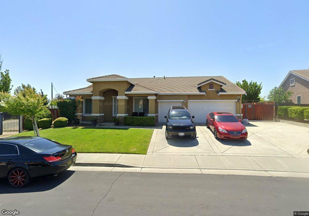
1916 Moosup Ct Fairfield, CA 94533
Estimated Value: $740,000 - $856,000
4
Beds
2
Baths
2,352
Sq Ft
$349/Sq Ft
Est. Value
About This Home
This home is located at 1916 Moosup Ct, Fairfield, CA 94533 and is currently estimated at $820,884, approximately $349 per square foot. 1916 Moosup Ct is a home located in Solano County with nearby schools including Rolling Hills Elementary School, Fairfield High School, and Fairfield Christian School.
Ownership History
Date
Name
Owned For
Owner Type
Purchase Details
Closed on
Jul 29, 2020
Sold by
Thaxton Larry L and Thaxton Eseese
Bought by
Thaxton Larry L and Thaxton Eseese
Current Estimated Value
Purchase Details
Closed on
Aug 13, 2015
Sold by
Thaxton Larry L and Thaxton Eseese
Bought by
Thaxton Larry L and Thaxton Eseese
Home Financials for this Owner
Home Financials are based on the most recent Mortgage that was taken out on this home.
Original Mortgage
$402,000
Interest Rate
3.97%
Mortgage Type
New Conventional
Purchase Details
Closed on
Aug 24, 2010
Sold by
West Coast Home Builders Inc
Bought by
Thaxton Larry and Thaxton Ese
Home Financials for this Owner
Home Financials are based on the most recent Mortgage that was taken out on this home.
Original Mortgage
$434,153
Interest Rate
4.52%
Mortgage Type
FHA
Create a Home Valuation Report for This Property
The Home Valuation Report is an in-depth analysis detailing your home's value as well as a comparison with similar homes in the area
Home Values in the Area
Average Home Value in this Area
Purchase History
| Date | Buyer | Sale Price | Title Company |
|---|---|---|---|
| Thaxton Larry L | -- | None Available | |
| Thaxton Larry L | -- | Western Resources Title Co | |
| Thaxton Larry | $545,000 | Old Republic Title Company |
Source: Public Records
Mortgage History
| Date | Status | Borrower | Loan Amount |
|---|---|---|---|
| Previous Owner | Thaxton Larry L | $402,000 | |
| Previous Owner | Thaxton Larry | $434,153 |
Source: Public Records
Tax History
| Year | Tax Paid | Tax Assessment Tax Assessment Total Assessment is a certain percentage of the fair market value that is determined by local assessors to be the total taxable value of land and additions on the property. | Land | Improvement |
|---|---|---|---|---|
| 2025 | $6,669 | $842,520 | $219,300 | $623,220 |
| 2024 | $6,669 | $725,341 | $136,748 | $588,593 |
| 2023 | $6,565 | $711,119 | $134,067 | $577,052 |
| 2022 | $6,687 | $704,399 | $132,800 | $571,599 |
| 2021 | $6,143 | $634,000 | $82,000 | $552,000 |
| 2020 | $7,865 | $634,000 | $82,000 | $552,000 |
| 2019 | $8,095 | $657,319 | $123,856 | $533,463 |
| 2018 | $8,333 | $645,000 | $96,000 | $549,000 |
| 2017 | $7,821 | $600,000 | $90,000 | $510,000 |
| 2016 | $7,346 | $551,000 | $88,000 | $463,000 |
| 2015 | $6,414 | $497,000 | $84,000 | $413,000 |
| 2014 | $6,372 | $488,000 | $83,000 | $405,000 |
Source: Public Records
Map
Nearby Homes
- 1175 Hickory Ave
- 2952 Inspiration Dr
- 3862 Clay Bank Rd
- 3045 Balance Cir
- 2856 Rebecca Dr
- 2913 Balsam Ct
- 1031 Suffolk Way
- 1401 Spur Ln
- 1417 Spur Ln
- 989 Suffolk Way
- 1504 Millennium Way
- 1571 Tommy Ln
- 1548 Nightfall Ln
- 1508 Millennium Way
- 1512 Millennium Way
- 1516 Millennium Way
- 2612 Newberry St
- 2915 Shaver St
- 2874 Shaver St
- 2972 Newberry Ct
- 1912 Moosup Ct
- 1920 Moosup Ct
- 1908 Moosup Ct
- 1922 Moosup Ct
- 1913 Moosup Ct
- 1917 Moosup Ct
- 1909 Moosup Ct
- 1928 Moosup Ct
- 1921 Moosup Ct
- 1905 Moosup Ct
- 1925 Moosup Ct
- 1932 Moosup Ct
- 3742 Clay Bank Rd
- 3746 Claybank Rd
- 3738 Clay Bank Rd
- 3738 Claybank Rd
- 3754 Clay Bank Rd
- 3742 Claybank Rd
- 1929 Moosup Ct
- 1933 Moosup Ct
Your Personal Tour Guide
Ask me questions while you tour the home.