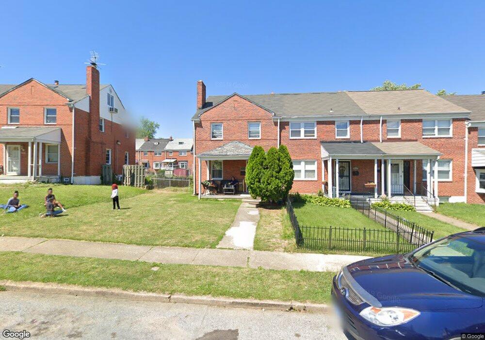
1916 Northbourne Rd Baltimore, MD 21239
Perring Loch NeighborhoodEstimated Value: $258,000
--
Bed
2
Baths
1,280
Sq Ft
$202/Sq Ft
Est. Value
About This Home
This home is located at 1916 Northbourne Rd, Baltimore, MD 21239 and is currently estimated at $258,000, approximately $201 per square foot. 1916 Northbourne Rd is a home located in Baltimore City with nearby schools including Northwood Elementary School, Booker T. Washington Middle School, and Paul Laurence Dunbar Community High School.
Ownership History
Date
Name
Owned For
Owner Type
Purchase Details
Closed on
Sep 18, 2007
Sold by
Scott Shawntiez Q
Bought by
Asli Shawntiez Q
Current Estimated Value
Home Financials for this Owner
Home Financials are based on the most recent Mortgage that was taken out on this home.
Original Mortgage
$164,000
Outstanding Balance
$106,098
Interest Rate
7%
Mortgage Type
New Conventional
Estimated Equity
$151,902
Purchase Details
Closed on
Jan 25, 2001
Sold by
Ocwen Federal Bank Fsb
Bought by
Scott Shawntiez Q
Create a Home Valuation Report for This Property
The Home Valuation Report is an in-depth analysis detailing your home's value as well as a comparison with similar homes in the area
Home Values in the Area
Average Home Value in this Area
Purchase History
| Date | Buyer | Sale Price | Title Company |
|---|---|---|---|
| Asli Shawntiez Q | -- | -- | |
| Scott Shawntiez Q | $47,250 | -- | |
| Scott Shawntiez Q | $81,000 | -- |
Source: Public Records
Mortgage History
| Date | Status | Borrower | Loan Amount |
|---|---|---|---|
| Open | Asli Shawntiez Q | $164,000 |
Source: Public Records
Tax History Compared to Growth
Tax History
| Year | Tax Paid | Tax Assessment Tax Assessment Total Assessment is a certain percentage of the fair market value that is determined by local assessors to be the total taxable value of land and additions on the property. | Land | Improvement |
|---|---|---|---|---|
| 2025 | $3,497 | $162,467 | -- | -- |
| 2024 | $3,497 | $148,900 | $36,000 | $112,900 |
| 2023 | $3,417 | $145,500 | $0 | $0 |
| 2022 | $3,354 | $142,100 | $0 | $0 |
| 2021 | $3,273 | $138,700 | $36,000 | $102,700 |
| 2020 | $3,273 | $138,700 | $36,000 | $102,700 |
| 2019 | $3,258 | $138,700 | $36,000 | $102,700 |
| 2018 | $3,512 | $148,800 | $36,000 | $112,800 |
| 2017 | $2,765 | $143,833 | $0 | $0 |
| 2016 | -- | $138,867 | $0 | $0 |
| 2015 | $2,410 | $133,900 | $0 | $0 |
| 2014 | $2,410 | $133,900 | $0 | $0 |
Source: Public Records
Map
Nearby Homes
- 1932 Hillenwood Rd
- 1907 Burnwood Rd
- 1809 Hillenwood Rd
- 1800 Burnwood Rd
- 1814 Winford Rd
- 1706 Heathfield Rd
- 1812 Ingram Rd
- 5515 Hillen Rd
- 1648 Ingram Rd
- 1613 Winford Rd
- 1717 Hartsdale Rd
- 4919 Herring Run Dr
- 5102 Hillen Rd
- 1811 Ramblewood Rd
- 5755 Maplehill Rd
- 5768 Maplehill Rd
- 1530 Burnwood Rd
- 2326 Ivy Ave
- 1513 Northbourne Rd
- 5017 Plymouth Rd
- 1918 Northbourne Rd
- 1914 Northbourne Rd
- 1920 Northbourne Rd
- 1912 Northbourne Rd
- 1922 Northbourne Rd
- 1910 Northbourne Rd
- 1924 Northbourne Rd
- 1908 Northbourne Rd
- 1926 Northbourne Rd
- 1929 Hillenwood Rd
- 1931 Hillenwood Rd
- 1927 Hillenwood Rd
- 1906 Northbourne Rd
- 1925 Hillenwood Rd
- 2001 Hillenwood Rd
- 1928 Northbourne Rd
- 1923 Hillenwood Rd
- 2003 Hillenwood Rd
- 1904 Northbourne Rd
- 1921 Hillenwood Rd