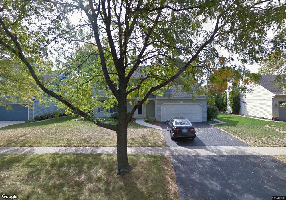
1916 Sheffield Ln Unit 2 Geneva, IL 60134
Northwest Central Geneva NeighborhoodEstimated Value: $503,000 - $527,000
4
Beds
3
Baths
2,307
Sq Ft
$223/Sq Ft
Est. Value
About This Home
This home is located at 1916 Sheffield Ln Unit 2, Geneva, IL 60134 and is currently estimated at $513,812, approximately $222 per square foot. 1916 Sheffield Ln Unit 2 is a home located in Kane County with nearby schools including Williamsburg Elementary School, Geneva Community High School, and Kensington School - Geneva.
Ownership History
Date
Name
Owned For
Owner Type
Purchase Details
Closed on
Nov 4, 2014
Sold by
Nelson Bradley C and Nelson Susanne J
Bought by
Nelson Bradley C and Bradley C Nelson Trust
Current Estimated Value
Purchase Details
Closed on
May 19, 2000
Sold by
Thomas Robert L and Thomas Michele A
Bought by
Nelson Bradley C and Nelson Susanne J
Home Financials for this Owner
Home Financials are based on the most recent Mortgage that was taken out on this home.
Original Mortgage
$102,000
Outstanding Balance
$35,213
Interest Rate
8.13%
Estimated Equity
$478,599
Create a Home Valuation Report for This Property
The Home Valuation Report is an in-depth analysis detailing your home's value as well as a comparison with similar homes in the area
Home Values in the Area
Average Home Value in this Area
Purchase History
| Date | Buyer | Sale Price | Title Company |
|---|---|---|---|
| Nelson Bradley C | -- | None Available | |
| Nelson Bradley C | $232,500 | Chicago Title Insurance Co |
Source: Public Records
Mortgage History
| Date | Status | Borrower | Loan Amount |
|---|---|---|---|
| Open | Nelson Bradley C | $102,000 |
Source: Public Records
Tax History Compared to Growth
Tax History
| Year | Tax Paid | Tax Assessment Tax Assessment Total Assessment is a certain percentage of the fair market value that is determined by local assessors to be the total taxable value of land and additions on the property. | Land | Improvement |
|---|---|---|---|---|
| 2024 | $9,384 | $138,603 | $34,159 | $104,444 |
| 2023 | $9,058 | $126,003 | $31,054 | $94,949 |
| 2022 | $8,890 | $117,081 | $28,855 | $88,226 |
| 2021 | $8,611 | $112,730 | $27,783 | $84,947 |
| 2020 | $8,502 | $111,009 | $27,359 | $83,650 |
| 2019 | $8,469 | $108,907 | $26,841 | $82,066 |
| 2018 | $8,279 | $106,859 | $26,841 | $80,018 |
| 2017 | $8,173 | $104,009 | $26,125 | $77,884 |
| 2016 | $8,116 | $101,586 | $25,772 | $75,814 |
| 2015 | -- | $96,583 | $24,503 | $72,080 |
| 2014 | -- | $96,583 | $24,503 | $72,080 |
| 2013 | -- | $96,583 | $24,503 | $72,080 |
Source: Public Records
Map
Nearby Homes
- 602 Highbury Ln
- 231 N Cambridge Dr
- 51 Burgess Rd
- 1736 Kaneville Rd
- 2749 Stone Cir
- 2753 Stone Cir
- 2747 Stone Cir
- 2751 Stone Cir
- 560 Renee Ct
- 1437 Cooper Ln
- 1211 James St
- 806 Fellows St
- 1823 Fargo Blvd
- 2692 Stone Cir Unit 203
- 629 N Lincoln Ave
- 1336-1338 S 14th St
- 2671 Stone Cir Unit 208
- 1330-1332 S 14th St
- 1108 S 12th St Unit 2
- 2731 Stone Cir
- 1912 Sheffield Ln
- 1996 Sheffield Ln
- 1921 Williamsburg Ave
- 1915 Williamsburg Ave
- 2000 Sheffield Ln Unit 2A
- 1999 Williamsburg Ave
- 1910 Sheffield Ln Unit 2
- 1919 Sheffield Ln
- 1997 Sheffield Ln Unit 2
- 2013 Williamsburg Ave
- 2002 Sheffield Ln
- 1900 Sheffield Ln
- 1909 Sheffield Ln
- 325 Colonial Cir
- 2015 Williamsburg Ave Unit 2
- 2010 Sheffield Ln
- 1896 Sheffield Ln
- 1899 Sheffield Ln
- 1918 Williamsburg Ave
- 327 Colonial Cir Unit 4