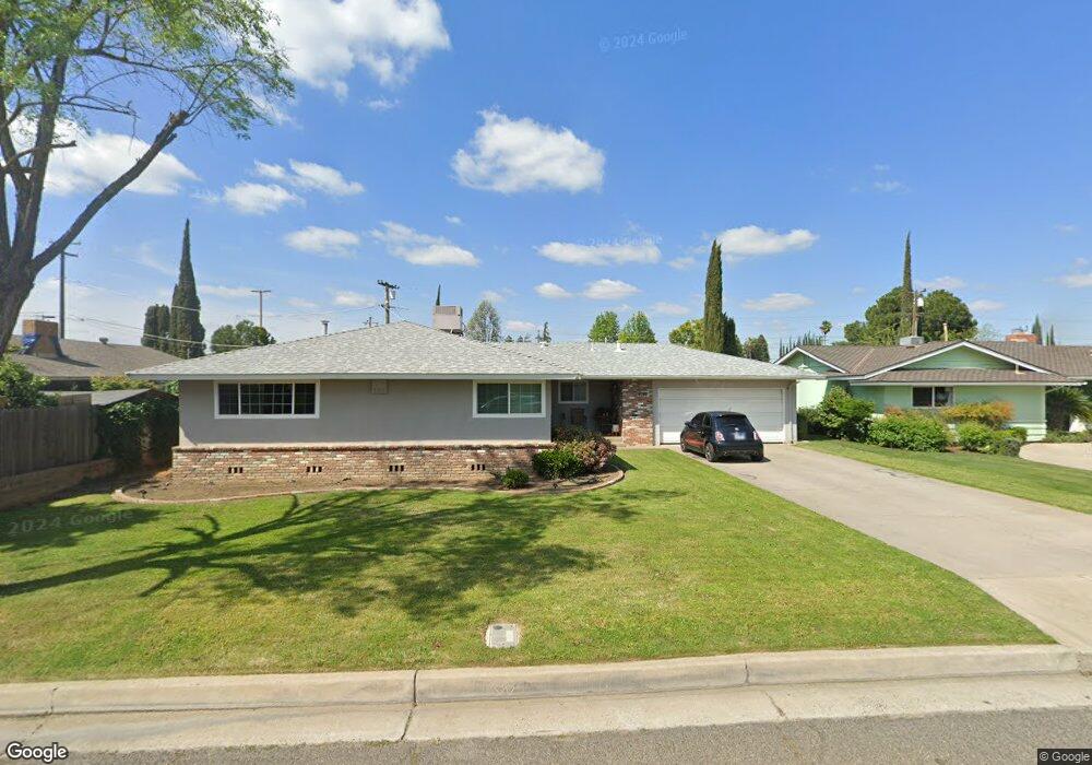
1917 Paul Ave Madera, CA 93637
West Madera NeighborhoodEstimated Value: $336,000 - $385,000
3
Beds
2
Baths
1,531
Sq Ft
$236/Sq Ft
Est. Value
About This Home
This home is located at 1917 Paul Ave, Madera, CA 93637 and is currently estimated at $361,299, approximately $235 per square foot. 1917 Paul Ave is a home located in Madera County with nearby schools including John Adams Elementary School, Thomas Jefferson Middle School, and Madera High School.
Ownership History
Date
Name
Owned For
Owner Type
Purchase Details
Closed on
Dec 3, 2014
Sold by
Johns Greg M
Bought by
Salas Daniel
Current Estimated Value
Home Financials for this Owner
Home Financials are based on the most recent Mortgage that was taken out on this home.
Original Mortgage
$157,102
Outstanding Balance
$120,516
Interest Rate
3.96%
Mortgage Type
FHA
Estimated Equity
$240,783
Purchase Details
Closed on
Dec 5, 2011
Sold by
Macgregor Donald Lee Roy and Rider Margaret Jennifer
Bought by
Johns Greg M
Home Financials for this Owner
Home Financials are based on the most recent Mortgage that was taken out on this home.
Original Mortgage
$121,831
Interest Rate
4.4%
Mortgage Type
FHA
Create a Home Valuation Report for This Property
The Home Valuation Report is an in-depth analysis detailing your home's value as well as a comparison with similar homes in the area
Home Values in the Area
Average Home Value in this Area
Purchase History
| Date | Buyer | Sale Price | Title Company |
|---|---|---|---|
| Salas Daniel | $160,000 | Old Republic Title Company | |
| Johns Greg M | $125,000 | Placer Title Company |
Source: Public Records
Mortgage History
| Date | Status | Borrower | Loan Amount |
|---|---|---|---|
| Open | Salas Daniel | $157,102 | |
| Previous Owner | Johns Greg M | $121,831 |
Source: Public Records
Tax History Compared to Growth
Tax History
| Year | Tax Paid | Tax Assessment Tax Assessment Total Assessment is a certain percentage of the fair market value that is determined by local assessors to be the total taxable value of land and additions on the property. | Land | Improvement |
|---|---|---|---|---|
| 2025 | $2,167 | $192,288 | $60,089 | $132,199 |
| 2024 | $2,167 | $188,518 | $58,911 | $129,607 |
| 2023 | $2,115 | $184,822 | $57,756 | $127,066 |
| 2022 | $1,990 | $181,199 | $56,624 | $124,575 |
| 2021 | $1,984 | $177,647 | $55,514 | $122,133 |
| 2020 | $2,019 | $175,826 | $54,945 | $120,881 |
| 2019 | $2,003 | $172,379 | $53,868 | $118,511 |
| 2018 | $1,847 | $169,000 | $52,812 | $116,188 |
| 2017 | $1,824 | $165,687 | $51,777 | $113,910 |
| 2016 | $1,777 | $162,439 | $50,762 | $111,677 |
| 2015 | $1,818 | $160,000 | $50,000 | $110,000 |
| 2014 | $1,386 | $128,077 | $30,738 | $97,339 |
Source: Public Records
Map
Nearby Homes
- 604 N Schnoor St
- 604 N Schnoor Ave
- 318 Williams Ave
- 15707 Road 22 1 2
- 1812 W 5th St
- 26 Seasons Ct
- 1688 University Ave
- 101 Mainberry Dr
- 1632 University Ave
- 22 Pointe W
- 611 Foster Ave
- 2704 Willow Dr
- 1409 Howard Rd
- 185 River Pointe
- 500 Barsotti Ave
- 2512 Driftwood Dr
- 2712 Westgate Dr
- 125 S Granada Dr Unit 52
- 227 N N St
- 1237 de Cesari Ave
- 509 N Schnoor St
- 1913 Paul Ave
- 1916 Sunset Ave
- 513 N Schnoor Ave
- 1909 Paul Ave
- 513 N Schnoor St
- 1912 Sunset Ave
- 1916 Paul Ave
- 505 N Schnoor St
- 1912 Paul Ave
- 1908 Sunset Ave
- 1905 Paul Ave
- 1908 Paul Ave
- 1904 Sunset Ave
- 1904 Paul Ave
- 1917 National Ave
- 1912 Westwood Place
- 501 N Schnoor St
- 1913 National Ave
- 601 N Schnoor St