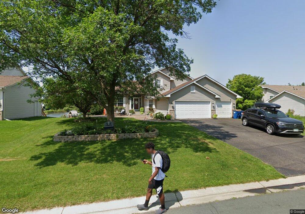
1918 Pheasant Run St Shakopee, MN 55379
Estimated Value: $483,000 - $528,000
3
Beds
3
Baths
2,196
Sq Ft
$228/Sq Ft
Est. Value
About This Home
This home is located at 1918 Pheasant Run St, Shakopee, MN 55379 and is currently estimated at $500,924, approximately $228 per square foot. 1918 Pheasant Run St is a home located in Scott County with nearby schools including Sun Path Elementary School, Shakopee West Middle School, and Shakopee Senior High School.
Ownership History
Date
Name
Owned For
Owner Type
Purchase Details
Closed on
Jun 2, 2003
Sold by
Park Michael and Park Stephanie
Bought by
Doorenbos Jeff A
Current Estimated Value
Purchase Details
Closed on
Dec 20, 2002
Sold by
Peterman Kent R and Peterman Lisa M
Bought by
Park Michael and Park Stephanie A
Purchase Details
Closed on
Sep 24, 1999
Sold by
Key-Land Homes
Bought by
Peterman Kent R and Peterman Lisa M
Purchase Details
Closed on
Mar 10, 1999
Sold by
Pheasant Run Of Shakopee L L P
Bought by
Key-Land Homes
Create a Home Valuation Report for This Property
The Home Valuation Report is an in-depth analysis detailing your home's value as well as a comparison with similar homes in the area
Home Values in the Area
Average Home Value in this Area
Purchase History
| Date | Buyer | Sale Price | Title Company |
|---|---|---|---|
| Doorenbos Jeff A | $314,900 | -- | |
| Park Michael | $295,000 | -- | |
| Peterman Kent R | $228,171 | -- | |
| Key-Land Homes | $46,400 | -- |
Source: Public Records
Mortgage History
| Date | Status | Borrower | Loan Amount |
|---|---|---|---|
| Closed | Key-Land Homes | -- |
Source: Public Records
Tax History
| Year | Tax Paid | Tax Assessment Tax Assessment Total Assessment is a certain percentage of the fair market value that is determined by local assessors to be the total taxable value of land and additions on the property. | Land | Improvement |
|---|---|---|---|---|
| 2025 | $4,808 | $455,600 | $152,800 | $302,800 |
| 2024 | $4,744 | $460,000 | $152,800 | $307,200 |
| 2023 | $5,010 | $442,700 | $147,100 | $295,600 |
| 2022 | $4,584 | $459,200 | $167,200 | $292,000 |
| 2021 | $4,108 | $363,200 | $128,100 | $235,100 |
| 2020 | $4,488 | $355,800 | $122,900 | $232,900 |
| 2019 | $4,520 | $342,100 | $109,200 | $232,900 |
| 2018 | $4,480 | $0 | $0 | $0 |
| 2016 | $4,398 | $0 | $0 | $0 |
| 2014 | -- | $0 | $0 | $0 |
Source: Public Records
Map
Nearby Homes
- 2542 Mathias Rd
- 1672 Bedford Ln
- 1646 Chadum Ln
- 1844 Mockingbird Ave Unit 1102
- 1820 Mockingbird Ave
- 1819 Mockingbird Ave
- 1596 Chartreux Ave
- 2468 Valley View Rd
- 2655 King Ave
- 2529 Green Ash Ave
- 2447 Tyrone Dr
- 2518 Green Ash Ave
- 1624 Philipp Way
- 2553 Green Ash Ave
- 2530 Green Ash Ave
- 2039 Brittany Ct
- 2027 Brittany Ct
- 1511 England Way
- 2606 Aspen Dr
- Berkley Plan at Arbor Bluff - Venture Collection
- 1930 Pheasant Run St
- 1906 Pheasant Run St
- 2198 Mathias Rd
- 1942 Pheasant Run St
- 2281 Thrush St
- 2182 Mathias Rd
- 1894 Pheasant Run St
- 1954 Pheasant Run St
- 2310 Mathias Rd
- 2166 Mathias Rd
- 2303 Thrush St
- 2286 Thrush St
- 2203 Mathias Rd
- 2299 Mathias Rd
- 1882 Pheasant Run St
- 2187 Mathias Rd
- 2150 Mathias Rd
- 2325 Thrush St
- 1966 Pheasant Run St
- 2308 Thrush St