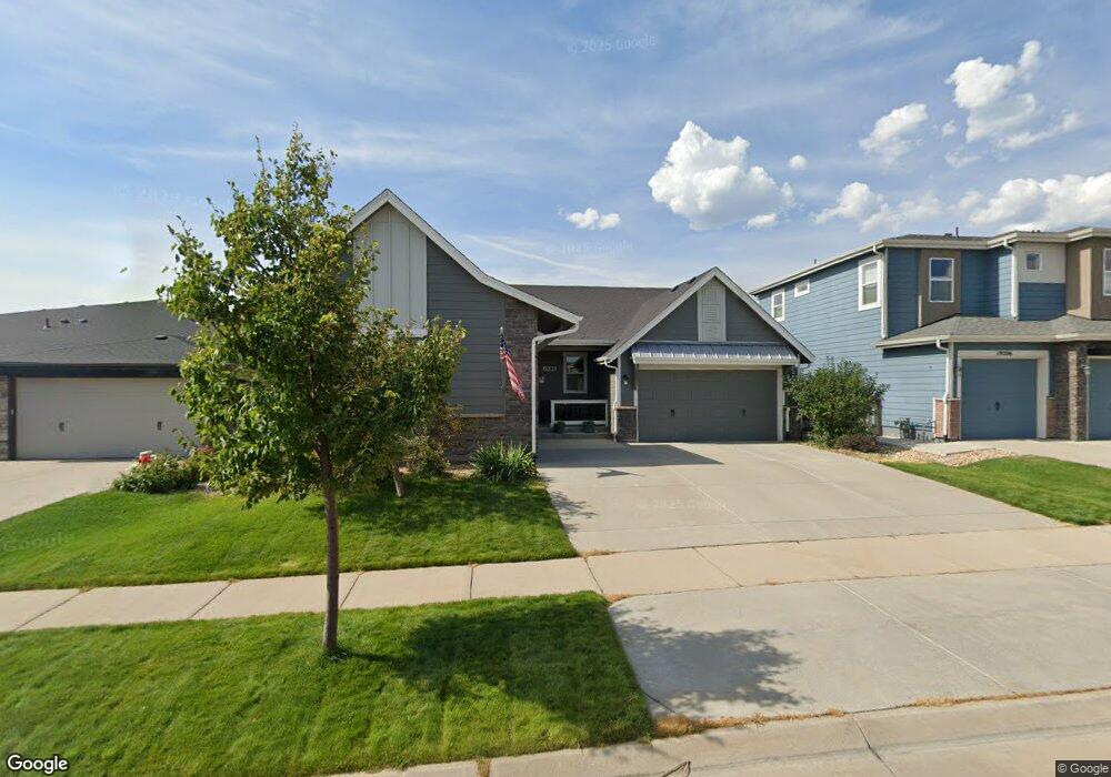
19186 W 87th Ln Arvada, CO 80007
Leyden Rock NeighborhoodEstimated Value: $784,000 - $904,000
3
Beds
2
Baths
2,133
Sq Ft
$386/Sq Ft
Est. Value
About This Home
This home is located at 19186 W 87th Ln, Arvada, CO 80007 and is currently estimated at $823,871, approximately $386 per square foot. 19186 W 87th Ln is a home with nearby schools including Millville Elementary School, Three Creeks K-8 School, and Ralston Valley Senior High School.
Ownership History
Date
Name
Owned For
Owner Type
Purchase Details
Closed on
May 18, 2017
Sold by
Remington Homes Of Colorado Inc
Bought by
Allegar Kelly and Proulx Gregory R
Current Estimated Value
Home Financials for this Owner
Home Financials are based on the most recent Mortgage that was taken out on this home.
Original Mortgage
$432,644
Outstanding Balance
$359,797
Interest Rate
4.1%
Mortgage Type
New Conventional
Estimated Equity
$464,074
Purchase Details
Closed on
Nov 17, 2016
Sold by
Leyden 6 Llc
Bought by
Remington Homes Of Colorado Inc
Create a Home Valuation Report for This Property
The Home Valuation Report is an in-depth analysis detailing your home's value as well as a comparison with similar homes in the area
Home Values in the Area
Average Home Value in this Area
Purchase History
| Date | Buyer | Sale Price | Title Company |
|---|---|---|---|
| Allegar Kelly | $540,806 | None Available | |
| Remington Homes Of Colorado Inc | -- | None Available |
Source: Public Records
Mortgage History
| Date | Status | Borrower | Loan Amount |
|---|---|---|---|
| Open | Allegar Kelly | $432,644 |
Source: Public Records
Tax History Compared to Growth
Tax History
| Year | Tax Paid | Tax Assessment Tax Assessment Total Assessment is a certain percentage of the fair market value that is determined by local assessors to be the total taxable value of land and additions on the property. | Land | Improvement |
|---|---|---|---|---|
| 2024 | $7,406 | $49,213 | $10,221 | $38,992 |
| 2023 | $7,406 | $49,213 | $10,221 | $38,992 |
| 2022 | $6,016 | $37,615 | $8,129 | $29,486 |
| 2021 | $6,144 | $38,697 | $8,363 | $30,334 |
| 2020 | $6,029 | $38,408 | $9,666 | $28,742 |
| 2019 | $5,979 | $38,408 | $9,666 | $28,742 |
| 2018 | $5,911 | $37,421 | $11,434 | $25,987 |
| 2017 | $3,267 | $21,829 | $11,434 | $10,395 |
| 2016 | $490 | $3,434 | $3,434 | $0 |
| 2015 | $247 | $3,434 | $3,434 | $0 |
Source: Public Records
Map
Nearby Homes
- 8793 Flattop St
- 8803 Flattop St
- 8852 Flattop St
- 8776 Gore St
- 8863 Flattop St
- 18941 W 84th Ave
- 18871 W 84th Ave
- 18366 W 83rd Dr
- 18830 W 92nd Dr
- 18639 W 92nd Dr
- 17897 W 87th Ave
- 19650 W 92nd Dr Unit C
- 19649 W 92nd Dr Unit C
- 9250 Garnett Way Unit A
- 19592 W 93rd Place Unit C
- 19733 W 93rd Ln Unit D
- 18541 W 93rd Place
- 20046 W 93rd Ave
- 18863 W 94th Ln
- 17674 W 84th Dr
- 19206 W 87th Ln
- 19166 W 87th Ln
- 19146 W 87th Ln
- 19226 W 87th Ln
- 8734 El Diente St
- 19126 W 87th Ln
- 19236 W 87th Ln
- 8735 El Diente St
- 8744 El Diente St
- 8733 Dunraven St
- 19106 W 87th Ln
- 19256 W 87th Ln
- 8753 Dunraven St
- 8755 El Diente St
- 8754 El Diente St
- 19276 W 87th Ln
- 8773 Dunraven St
- 19275 W 87th Ln
- 8765 El Diente St
- 8764 El Diente St