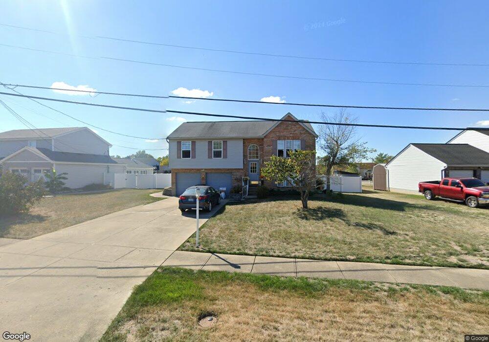
1919 Independence R Independence, KY 41051
Estimated Value: $243,000 - $280,470
3
Beds
2
Baths
1,092
Sq Ft
$238/Sq Ft
Est. Value
About This Home
This home is located at 1919 Independence R, Independence, KY 41051 and is currently estimated at $259,368, approximately $237 per square foot. 1919 Independence R is a home located in Kenton County with nearby schools including Kenton Elementary School, Twenhofel Middle School, and Simon Kenton High School.
Ownership History
Date
Name
Owned For
Owner Type
Purchase Details
Closed on
Feb 25, 1997
Sold by
Gullett Todd R
Bought by
Day Michael D and Day Theresa
Current Estimated Value
Home Financials for this Owner
Home Financials are based on the most recent Mortgage that was taken out on this home.
Original Mortgage
$105,000
Outstanding Balance
$10,847
Interest Rate
7.88%
Mortgage Type
New Conventional
Estimated Equity
$248,521
Create a Home Valuation Report for This Property
The Home Valuation Report is an in-depth analysis detailing your home's value as well as a comparison with similar homes in the area
Home Values in the Area
Average Home Value in this Area
Purchase History
| Date | Buyer | Sale Price | Title Company |
|---|---|---|---|
| Day Michael D | $105,000 | -- |
Source: Public Records
Mortgage History
| Date | Status | Borrower | Loan Amount |
|---|---|---|---|
| Open | Day Michael D | $105,000 |
Source: Public Records
Tax History Compared to Growth
Tax History
| Year | Tax Paid | Tax Assessment Tax Assessment Total Assessment is a certain percentage of the fair market value that is determined by local assessors to be the total taxable value of land and additions on the property. | Land | Improvement |
|---|---|---|---|---|
| 2025 | $1,931 | $215,100 | $35,000 | $180,100 |
| 2024 | $1,253 | $148,600 | $30,000 | $118,600 |
| 2023 | $1,290 | $148,600 | $30,000 | $118,600 |
| 2022 | $1,939 | $148,600 | $30,000 | $118,600 |
| 2021 | $1,967 | $148,600 | $30,000 | $118,600 |
| 2020 | $1,721 | $126,500 | $30,000 | $96,500 |
| 2019 | $1,725 | $126,500 | $30,000 | $96,500 |
| 2018 | $1,734 | $126,500 | $30,000 | $96,500 |
| 2017 | $1,688 | $126,500 | $30,000 | $96,500 |
| 2015 | $1,635 | $126,500 | $30,000 | $96,500 |
| 2014 | $1,613 | $126,500 | $30,000 | $96,500 |
Source: Public Records
Map
Nearby Homes
- 5267 Pioneer Dr
- 1804 Cypress Way
- 10737 Cypresswood Dr
- 5186 Christopher Dr
- 10434 Sharpsburg Dr
- 5217 Belle Dr
- 10383 Lynchburg Dr
- 89 Bradley Dr
- 10741 Lakefront Cir
- 72 Sherwood Dr
- 64 Sylvan Dr
- 5086 Woodale Ct
- 109 Sylvan Dr
- 10323 Manassas Ct
- 9947 Meadow Glen Dr
- Cumberland Plan at Greenbrook - Maple Street Collection
- Wesley Plan at Greenbrook - Maple Street Collection
- Breckenridge Plan at Greenbrook - Maple Street Collection
- Jensen Plan at Greenbrook - Maple Street Collection
- Fairfax Plan at Greenbrook - Maple Street Collection
- 1919 Independence Rd
- 1915 Independence Rd
- 1923 Independence Rd
- 1911 Independence Rd
- 1927 Independence Rd
- 1892 Appeals Ct
- 1896 Appeals Ct
- 1888 Appeals Ct
- 1922 Independence Rd
- 1907 Independence Rd
- 1900 Appeals Ct
- 1931 Independence Rd
- 1926 Independence Rd
- 1926 Independence Rd Unit 24
- 1930 Independence Rd
- 1930 Independence R
- 1918 Independence Rd
- 1904 Appeals Ct
- 1935 Independence Rd
- 1934 Independence Rd