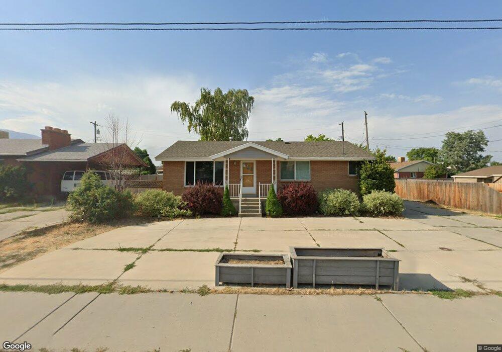
192 E Fort Union Blvd Midvale, UT 84047
Estimated Value: $460,000 - $528,000
3
Beds
3
Baths
2,184
Sq Ft
$225/Sq Ft
Est. Value
About This Home
This home is located at 192 E Fort Union Blvd, Midvale, UT 84047 and is currently estimated at $490,473, approximately $224 per square foot. 192 E Fort Union Blvd is a home located in Salt Lake County with nearby schools including Midvalley Elementary School, Hillcrest High School, and Midvale Middle School.
Ownership History
Date
Name
Owned For
Owner Type
Purchase Details
Closed on
Mar 26, 2021
Sold by
Devey Robert Brian and Devey Josefina
Bought by
Potenciano Cortez Dante
Current Estimated Value
Home Financials for this Owner
Home Financials are based on the most recent Mortgage that was taken out on this home.
Original Mortgage
$11,222
Outstanding Balance
$10,075
Interest Rate
3.18%
Mortgage Type
New Conventional
Estimated Equity
$480,398
Purchase Details
Closed on
Dec 23, 2019
Sold by
Devey Robert Brian
Bought by
Devey Robert Brian and Devey Josefina
Home Financials for this Owner
Home Financials are based on the most recent Mortgage that was taken out on this home.
Original Mortgage
$210,000
Interest Rate
3.7%
Mortgage Type
New Conventional
Purchase Details
Closed on
Dec 15, 2014
Sold by
Fannie Mae
Bought by
Devey Robert
Home Financials for this Owner
Home Financials are based on the most recent Mortgage that was taken out on this home.
Original Mortgage
$163,975
Interest Rate
3.86%
Mortgage Type
FHA
Purchase Details
Closed on
Feb 18, 2014
Sold by
Rossi Richard Tony
Bought by
Federal National Mortgage Association
Create a Home Valuation Report for This Property
The Home Valuation Report is an in-depth analysis detailing your home's value as well as a comparison with similar homes in the area
Home Values in the Area
Average Home Value in this Area
Purchase History
| Date | Buyer | Sale Price | Title Company |
|---|---|---|---|
| Potenciano Cortez Dante | -- | Sutherland Title | |
| Devey Robert Brian | -- | Accommodation | |
| Devey Robert Brian | -- | Sutherland Title | |
| Devey Robert | $167,000 | Highland Title Agency | |
| Federal National Mortgage Association | -- | Etitle Insurance Agency |
Source: Public Records
Mortgage History
| Date | Status | Borrower | Loan Amount |
|---|---|---|---|
| Open | Potenciano Cortez Dante | $11,222 | |
| Open | Potenciano Cortez Dante | $314,204 | |
| Previous Owner | Devey Robert Brian | $210,000 | |
| Previous Owner | Devey Robert | $163,975 | |
| Closed | Devey Robert | $9,838 |
Source: Public Records
Tax History
| Year | Tax Paid | Tax Assessment Tax Assessment Total Assessment is a certain percentage of the fair market value that is determined by local assessors to be the total taxable value of land and additions on the property. | Land | Improvement |
|---|---|---|---|---|
| 2025 | $2,703 | $429,200 | $130,600 | $298,600 |
| 2024 | $2,498 | $410,200 | $122,600 | $287,600 |
| 2023 | $2,346 | $381,600 | $116,500 | $265,100 |
| 2022 | $2,448 | $389,100 | $114,200 | $274,900 |
| 2021 | $2,167 | $294,500 | $107,500 | $187,000 |
| 2020 | $2,051 | $263,700 | $71,800 | $191,900 |
| 2019 | $2,020 | $253,000 | $67,700 | $185,300 |
| 2018 | $1,950 | $247,000 | $67,700 | $179,300 |
| 2017 | $1,865 | $227,100 | $67,700 | $159,400 |
| 2016 | $1,730 | $204,300 | $67,700 | $136,600 |
| 2015 | $1,497 | $173,700 | $73,900 | $99,800 |
| 2014 | $1,455 | $165,900 | $71,600 | $94,300 |
Source: Public Records
Map
Nearby Homes
- 221 E Fort Union Blvd
- 7214 S 160 E Unit 1
- 7222 S 160 E Unit 3
- 7097 S 230 E
- 195 E 7060 S
- 7218 S Viansa Ct
- 106 E 7320 S
- 7377 S Ramanee Dr
- 72 E 7320 S
- 7045 S 65 E
- 7309 S Union Village Cir
- 7045 S 300 E
- 7033 S 300 E
- 7187 S 420 E
- 6954 S 85 E
- 220 E Greenwood Ave
- 110 Greenwood Ave
- 7240 S 525 E Unit A
- 7240 S 525 E Unit B
- 7230 S 525 E Unit A
- 192 Fort Union Blvd
- 202 Fort Union Blvd
- 7211 S Ramanee Dr
- 7211 Ramanee Dr
- 193 E Nicoletti Dr
- 193 Nicoletti Dr
- 7233 Ramanee Dr
- 201 Nicoletti Dr
- 209 Nicoletti Dr Unit 211
- 189 E Fort Union Blvd
- 170 E Fort Union Blvd
- 170 Fort Union Blvd
- 177 E 7200 S
- 221 E Nicoletti Dr Unit 221
- 219 Nicoletti Dr Unit 221
- 219 E Nicoletti Dr
- 7261 Ramanee Dr
- 7261 S Ramanee Dr
- 167 E 7200 S
- 167 E Fort Union Blvd
Your Personal Tour Guide
Ask me questions while you tour the home.