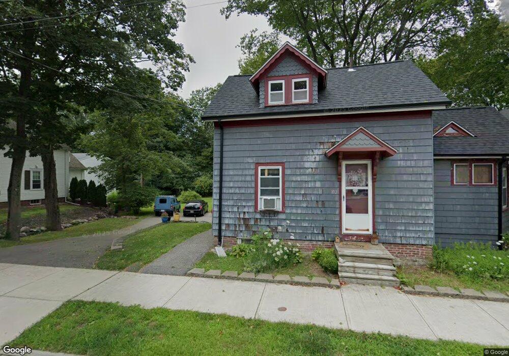
192 West St Reading, MA 01867
Estimated Value: $745,956 - $978,000
3
Beds
2
Baths
1,404
Sq Ft
$608/Sq Ft
Est. Value
About This Home
This home is located at 192 West St, Reading, MA 01867 and is currently estimated at $853,739, approximately $608 per square foot. 192 West St is a home located in Middlesex County with nearby schools including Alice M. Barrows Elementary School, Walter S. Parker Middle School, and Reading Memorial High School.
Ownership History
Date
Name
Owned For
Owner Type
Purchase Details
Closed on
Sep 14, 2004
Sold by
Corinne Rt and Mcdermott
Bought by
Shea Corinne
Current Estimated Value
Home Financials for this Owner
Home Financials are based on the most recent Mortgage that was taken out on this home.
Original Mortgage
$331,650
Outstanding Balance
$166,496
Interest Rate
6.08%
Mortgage Type
Purchase Money Mortgage
Estimated Equity
$687,243
Create a Home Valuation Report for This Property
The Home Valuation Report is an in-depth analysis detailing your home's value as well as a comparison with similar homes in the area
Home Values in the Area
Average Home Value in this Area
Purchase History
| Date | Buyer | Sale Price | Title Company |
|---|---|---|---|
| Shea Corinne | -- | -- |
Source: Public Records
Mortgage History
| Date | Status | Borrower | Loan Amount |
|---|---|---|---|
| Open | Shea Corinne | $331,650 |
Source: Public Records
Tax History
| Year | Tax Paid | Tax Assessment Tax Assessment Total Assessment is a certain percentage of the fair market value that is determined by local assessors to be the total taxable value of land and additions on the property. | Land | Improvement |
|---|---|---|---|---|
| 2025 | $7,728 | $678,500 | $423,500 | $255,000 |
| 2024 | $7,639 | $651,800 | $406,800 | $245,000 |
| 2023 | $7,399 | $587,700 | $366,800 | $220,900 |
| 2022 | $7,122 | $534,300 | $333,500 | $200,800 |
| 2021 | $5,134 | $507,100 | $315,200 | $191,900 |
| 2020 | $6,844 | $490,600 | $304,900 | $185,700 |
| 2019 | $6,628 | $465,800 | $289,500 | $176,300 |
| 2018 | $7,147 | $426,700 | $265,200 | $161,500 |
| 2017 | $5,783 | $412,200 | $256,200 | $156,000 |
| 2016 | $5,119 | $353,000 | $220,600 | $132,400 |
| 2015 | $5,091 | $346,300 | $210,100 | $136,200 |
| 2014 | $4,897 | $332,200 | $200,100 | $132,100 |
Source: Public Records
Map
Nearby Homes
- 101 King St Unit 101
- 16 Munroe Ave
- 90 Sunnyside Ave
- 1 Pennsylvania Ave
- 5 Washington St Unit D4
- 5 Washington St Unit A5
- 133 Pine Ridge Rd
- 18 Talbot Ln Unit 18
- 30 Taylor Dr Unit 3011
- 20 Pinevale Ave
- 17 Courtyard Place Unit 17
- 269 Main St Unit 4001
- 241 Main St Unit C3
- 246 Walnut St
- 75 Hopkins St
- 313 South St
- 2 Inwood Dr Unit 1005
- 75 Augustus Ct Unit 2003
- 48 Village St Unit 1001
- 1014 Gazebo Cir Unit 1014
Your Personal Tour Guide
Ask me questions while you tour the home.