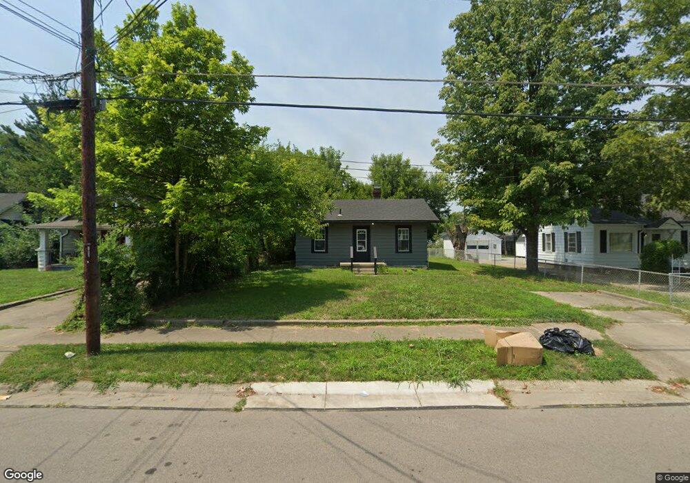
1920 Carolina St Middletown, OH 45044
Mayfield NeighborhoodEstimated Value: $73,000 - $121,000
2
Beds
1
Bath
753
Sq Ft
$124/Sq Ft
Est. Value
About This Home
This home is located at 1920 Carolina St, Middletown, OH 45044 and is currently estimated at $93,084, approximately $123 per square foot. 1920 Carolina St is a home located in Butler County with nearby schools including Mayfield Elementary School, Highview 6th Grade Center, and Middletown Middle School.
Ownership History
Date
Name
Owned For
Owner Type
Purchase Details
Closed on
Apr 18, 2024
Sold by
Gary Boehm Roth Ira and Equity Trust Co
Bought by
Foley Derrick
Current Estimated Value
Purchase Details
Closed on
Dec 22, 2021
Sold by
Sheriff Of Butler County Ohio
Bought by
Equity Trust Co
Purchase Details
Closed on
Sep 18, 1997
Sold by
Mcintosh Mary A
Bought by
Chapman David M and Chapman Mari
Home Financials for this Owner
Home Financials are based on the most recent Mortgage that was taken out on this home.
Original Mortgage
$61,750
Interest Rate
7.55%
Mortgage Type
New Conventional
Purchase Details
Closed on
Jan 14, 1997
Sold by
Mcintosh Stephen E
Bought by
Mcintosh Mary A
Create a Home Valuation Report for This Property
The Home Valuation Report is an in-depth analysis detailing your home's value as well as a comparison with similar homes in the area
Home Values in the Area
Average Home Value in this Area
Purchase History
| Date | Buyer | Sale Price | Title Company |
|---|---|---|---|
| Foley Derrick | $56,000 | None Listed On Document | |
| Foley Derrick | $56,000 | None Listed On Document | |
| Equity Trust Co | $49,000 | None Listed On Document | |
| Chapman David M | $65,000 | -- | |
| Mcintosh Mary A | $35,000 | -- |
Source: Public Records
Mortgage History
| Date | Status | Borrower | Loan Amount |
|---|---|---|---|
| Previous Owner | Chapman David M | $61,750 |
Source: Public Records
Tax History Compared to Growth
Tax History
| Year | Tax Paid | Tax Assessment Tax Assessment Total Assessment is a certain percentage of the fair market value that is determined by local assessors to be the total taxable value of land and additions on the property. | Land | Improvement |
|---|---|---|---|---|
| 2024 | $1,709 | $20,250 | $5,210 | $15,040 |
| 2023 | $1,067 | $20,250 | $5,210 | $15,040 |
| 2022 | $1,374 | $15,260 | $5,210 | $10,050 |
| 2021 | $1,153 | $15,260 | $5,210 | $10,050 |
| 2020 | $1,089 | $15,260 | $5,210 | $10,050 |
| 2019 | $904 | $12,470 | $5,250 | $7,220 |
| 2018 | $787 | $12,470 | $5,250 | $7,220 |
| 2017 | $788 | $12,470 | $5,250 | $7,220 |
| 2016 | $735 | $11,130 | $5,250 | $5,880 |
| 2015 | $724 | $11,130 | $5,250 | $5,880 |
| 2014 | $1,051 | $11,130 | $5,250 | $5,880 |
| 2013 | $1,051 | $17,590 | $5,250 | $12,340 |
Source: Public Records
Map
Nearby Homes
- 1932 Winton St
- 2216 Carolina St
- 1728 Fernwood St
- 2120 Fernwood St
- 1305 Highland St
- 3105 August Ave
- 2225 Sheffield St
- 2128 Lamberton St
- 808 The Alameda
- 800 Orchard St
- 3218 Keays Ave
- 2033 Jackson Ln
- 2308 Queen Ave
- 2409 Queen Ave
- 2121 Roosevelt Blvd
- 2010 Waynedale Ct
- 615 Highland St
- 2128 Queen Ave
- 1030 Jackson Ln
- 1012 Jackson Ln
- 1916 Carolina St
- 1924 Carolina St
- 1926 Carolina St
- 1921 Highland St
- 1931 Carolina St
- 1908 Carolina St
- 1932 Carolina St
- 1917 Highland St
- 1925 Highland St
- 1929 Highland St
- 1913 Highland St
- 1904 Carolina St
- 2000 Carolina St
- 1909 Highland St
- 1933 Highland St
- 1925 Carolina St
- 1927 Carolina St
- 1925 - 1927 Carolina St
- 1900 Carolina St
- 1905 Highland St