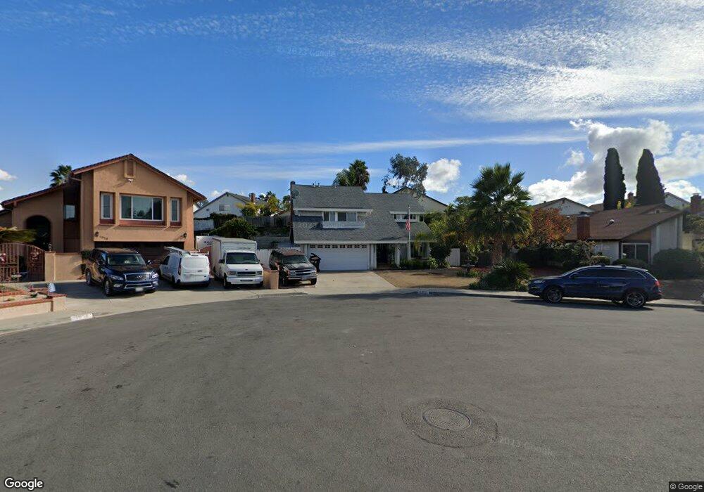
1920 Coe Place Chula Vista, CA 91913
Eastlake NeighborhoodEstimated Value: $897,000 - $1,050,000
4
Beds
3
Baths
1,838
Sq Ft
$525/Sq Ft
Est. Value
About This Home
This home is located at 1920 Coe Place, Chula Vista, CA 91913 and is currently estimated at $965,160, approximately $525 per square foot. 1920 Coe Place is a home located in San Diego County with nearby schools including Burton C. Tiffany Elementary School, Bonita Vista Middle School, and Bonita Vista Senior High School.
Ownership History
Date
Name
Owned For
Owner Type
Purchase Details
Closed on
Dec 8, 2010
Sold by
Ssft Properties Ii Llc
Bought by
Smith Rodger W and Smith Margarita
Current Estimated Value
Home Financials for this Owner
Home Financials are based on the most recent Mortgage that was taken out on this home.
Original Mortgage
$390,000
Interest Rate
4.82%
Mortgage Type
VA
Purchase Details
Closed on
Aug 26, 2010
Sold by
Maldonado Francisco and Maldonado Evelin
Bought by
Ssft Properties Ii Llc
Purchase Details
Closed on
Oct 16, 2006
Sold by
Maldonado Francisco and Maldonado Evelin
Bought by
Maldonado Francisco and Maldonado Evelin
Purchase Details
Closed on
Nov 12, 2004
Sold by
Floyd Starland Earl and Floyd Michele R
Bought by
Maldonado Francisco and Maldonado Evelin M
Home Financials for this Owner
Home Financials are based on the most recent Mortgage that was taken out on this home.
Original Mortgage
$520,000
Interest Rate
1%
Mortgage Type
New Conventional
Purchase Details
Closed on
Sep 19, 2001
Sold by
Floyd Starland Earl and Floyd Michele R
Bought by
Floyd Starland Earl and Floyd Michele R
Home Financials for this Owner
Home Financials are based on the most recent Mortgage that was taken out on this home.
Original Mortgage
$248,000
Interest Rate
6.99%
Mortgage Type
Balloon
Purchase Details
Closed on
Jul 13, 1999
Sold by
Kane Wendy Ruth and Elkind Mortimer M
Bought by
Floyd Starland Earl and Floyd Michele R
Home Financials for this Owner
Home Financials are based on the most recent Mortgage that was taken out on this home.
Original Mortgage
$220,500
Interest Rate
7.56%
Mortgage Type
Balloon
Purchase Details
Closed on
Mar 25, 1999
Sold by
Elkind Pearl
Bought by
Elkind Mortimer M and Elkind Pearl T
Purchase Details
Closed on
Oct 5, 1988
Create a Home Valuation Report for This Property
The Home Valuation Report is an in-depth analysis detailing your home's value as well as a comparison with similar homes in the area
Home Values in the Area
Average Home Value in this Area
Purchase History
| Date | Buyer | Sale Price | Title Company |
|---|---|---|---|
| Smith Rodger W | $390,000 | First American Title Company | |
| Ssft Properties Ii Llc | $306,000 | None Available | |
| Maldonado Francisco | -- | Southland Title Of San Diego | |
| Maldonado Francisco | $650,000 | New Century Title Company | |
| Floyd Starland Earl | -- | Commonwealth Land Title Co | |
| Floyd Starland Earl | $245,000 | First American Title Ins Co | |
| Elkind Mortimer M | -- | -- | |
| -- | $187,000 | -- |
Source: Public Records
Mortgage History
| Date | Status | Borrower | Loan Amount |
|---|---|---|---|
| Previous Owner | Smith Rodger W | $390,000 | |
| Previous Owner | Maldonado Francisco | $520,000 | |
| Previous Owner | Floyd Starland Earl | $248,000 | |
| Previous Owner | Floyd Starland Earl | $220,500 | |
| Closed | Maldonado Francisco | $65,000 |
Source: Public Records
Tax History Compared to Growth
Tax History
| Year | Tax Paid | Tax Assessment Tax Assessment Total Assessment is a certain percentage of the fair market value that is determined by local assessors to be the total taxable value of land and additions on the property. | Land | Improvement |
|---|---|---|---|---|
| 2025 | $5,829 | $499,645 | $230,210 | $269,435 |
| 2024 | $5,829 | $489,849 | $225,697 | $264,152 |
| 2023 | $5,840 | $480,245 | $221,272 | $258,973 |
| 2022 | $5,824 | $470,830 | $216,934 | $253,896 |
| 2021 | $5,731 | $461,599 | $212,681 | $248,918 |
| 2020 | $5,630 | $456,867 | $210,501 | $246,366 |
| 2019 | $5,549 | $447,910 | $206,374 | $241,536 |
| 2018 | $6,971 | $439,128 | $202,328 | $236,800 |
| 2017 | $6,846 | $430,518 | $198,361 | $232,157 |
| 2016 | $6,731 | $422,077 | $194,472 | $227,605 |
| 2015 | $4,689 | $415,738 | $191,551 | $224,187 |
| 2014 | $4,610 | $407,595 | $187,799 | $219,796 |
Source: Public Records
Map
Nearby Homes
- 678 Rue Avallon
- 2015 Lakeridge Cir Unit 301
- 1925 Otay Lakes Rd Unit 69
- 1925 Otay Lakes Rd Unit 43
- 1925 Otay Lakes Rd Unit 167
- 1761 Harvard St
- 725 Brookstone Rd Unit 101
- 2083 Waterbury
- 749 Brookstone Rd Unit 101
- 731 Brookstone Rd Unit 103
- 2018 Bridgeport
- 2083 Lakeridge Cir Unit 104
- 773 Brookstone Rd Unit 304
- 761 Brookstone Rd Unit 203
- 609 Rue Bayonne
- 1665 Yale St
- 1654 Yale St
- 1950 Rue Michelle
- 2100 Northshore Dr Unit A
- 845 Ridgewater Dr
- 1916 Coe Place
- 1924 Coe Place
- 1931 Gotham St
- 1939 Gotham St
- 1912 Coe Place
- 1925 Coe Place
- 1927 Gotham St
- 1943 Gotham St
- 1923 Coe Place
- 1919 Coe Place
- 1908 Coe Place
- 1923 Gotham St
- 1947 Gotham St
- 1932 Gotham St
- 1936 Gotham St
- 1915 Coe Place
- 1911 Coe Place
- 1928 Gotham St
- 1940 Gotham St
- 843 Stanford Ave