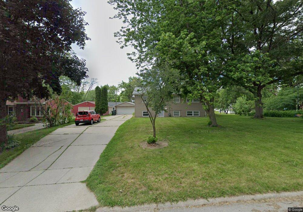
1921 Ashland Ave Unit 1923 Cedar Falls, IA 50613
Estimated Value: $256,923 - $301,000
3
Beds
2
Baths
1,040
Sq Ft
$262/Sq Ft
Est. Value
About This Home
This home is located at 1921 Ashland Ave Unit 1923, Cedar Falls, IA 50613 and is currently estimated at $272,981, approximately $262 per square foot. 1921 Ashland Ave Unit 1923 is a home located in Black Hawk County with nearby schools including Cedar Heights Elementary School, Peet Junior High School, and Cedar Falls High School.
Ownership History
Date
Name
Owned For
Owner Type
Purchase Details
Closed on
Jun 1, 2015
Sold by
Mccarty Rantals Llc
Bought by
Howard Brad M and Howard Cassie
Current Estimated Value
Home Financials for this Owner
Home Financials are based on the most recent Mortgage that was taken out on this home.
Original Mortgage
$135,000
Outstanding Balance
$103,886
Interest Rate
3.65%
Mortgage Type
New Conventional
Estimated Equity
$169,095
Create a Home Valuation Report for This Property
The Home Valuation Report is an in-depth analysis detailing your home's value as well as a comparison with similar homes in the area
Home Values in the Area
Average Home Value in this Area
Purchase History
| Date | Buyer | Sale Price | Title Company |
|---|---|---|---|
| Howard Brad M | $180,000 | None Available |
Source: Public Records
Mortgage History
| Date | Status | Borrower | Loan Amount |
|---|---|---|---|
| Open | Howard Brad M | $135,000 |
Source: Public Records
Tax History Compared to Growth
Tax History
| Year | Tax Paid | Tax Assessment Tax Assessment Total Assessment is a certain percentage of the fair market value that is determined by local assessors to be the total taxable value of land and additions on the property. | Land | Improvement |
|---|---|---|---|---|
| 2025 | $3,944 | $272,310 | $25,900 | $246,410 |
| 2024 | $3,944 | $245,060 | $25,900 | $219,160 |
| 2023 | $3,746 | $245,060 | $25,900 | $219,160 |
| 2022 | $3,792 | $202,920 | $25,900 | $177,020 |
| 2021 | $3,566 | $202,920 | $25,900 | $177,020 |
| 2020 | $3,496 | $191,530 | $22,200 | $169,330 |
| 2019 | $3,496 | $191,530 | $22,200 | $169,330 |
| 2018 | $3,540 | $191,530 | $22,200 | $169,330 |
| 2017 | $3,616 | $191,530 | $22,200 | $169,330 |
| 2016 | $3,384 | $191,530 | $22,200 | $169,330 |
| 2015 | $3,384 | $191,530 | $22,200 | $169,330 |
| 2014 | $3,286 | $183,820 | $22,200 | $161,620 |
Source: Public Records
Map
Nearby Homes
- 1927 Ashland Ave
- 1916 Ashland Ave
- 1830 Madison St
- 1316 Sunnyside Dr
- 1304 Grand Blvd
- 1221 Parker St
- 2513 Ashland Ave
- 2309 California St
- 2601 Victory Dr
- 1513 Cherry Ln
- 1117 Melrose Dr
- 1802 Waterloo Rd
- 2522 Sunset Blvd
- 2804 Neola St
- 2727 Cedar Heights Dr
- 3123 Neola St
- 2912 Tucson Dr
- 3023 Cottonwood Ln
- 1011 Grove St
- 1003 Bluff St
- 1921-1923 Ashland Ave
- 1710 Parker St
- 1922 Ashland Ave Unit 1924
- 2008 Oak Ave
- 2003 Ashland Ave
- 1704 Parker St
- 1721 Rainbow Dr
- 1622 Parker St
- 1709 Parker St
- 2006 Ashland Ave
- 1811 Rainbow Dr
- 1703 Parker St
- 1805 Rainbow Dr
- 1703 Rainbow Dr
- 2015 Ashland Ave
- 2012 Oak Ave
- 1614 Parker St
- 1825 Rainbow Dr
- 1623 Parker St
- 1617 Rainbow Dr Unit 1619