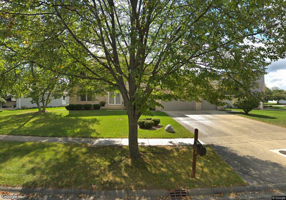
1921 Aspen Dr Algonquin, IL 60102
Estimated Value: $438,867 - $500,000
4
Beds
3
Baths
2,698
Sq Ft
$174/Sq Ft
Est. Value
About This Home
This home is located at 1921 Aspen Dr, Algonquin, IL 60102 and is currently estimated at $470,467, approximately $174 per square foot. 1921 Aspen Dr is a home located in McHenry County with nearby schools including Algonquin Lakes Elementary School, Algonquin Middle School, and Dundee-Crown High School.
Ownership History
Date
Name
Owned For
Owner Type
Purchase Details
Closed on
Sep 4, 2021
Sold by
Condas Thomas and Condas Deborah
Bought by
Condas Thomas and Condas Deborah
Current Estimated Value
Purchase Details
Closed on
Nov 25, 2003
Sold by
Selwood David and Selwood Nancy L
Bought by
Condas Thomas J and Condas Deborah L
Home Financials for this Owner
Home Financials are based on the most recent Mortgage that was taken out on this home.
Original Mortgage
$288,000
Interest Rate
6.1%
Mortgage Type
Unknown
Purchase Details
Closed on
Nov 16, 1993
Sold by
Okeson Nancy L
Bought by
Selwood David and Selwood Nancy L
Home Financials for this Owner
Home Financials are based on the most recent Mortgage that was taken out on this home.
Original Mortgage
$190,000
Interest Rate
6.92%
Create a Home Valuation Report for This Property
The Home Valuation Report is an in-depth analysis detailing your home's value as well as a comparison with similar homes in the area
Home Values in the Area
Average Home Value in this Area
Purchase History
| Date | Buyer | Sale Price | Title Company |
|---|---|---|---|
| Condas Thomas | -- | None Listed On Document | |
| Condas Thomas J | $361,000 | Chicago Title Insurance Comp | |
| Selwood David | -- | -- |
Source: Public Records
Mortgage History
| Date | Status | Borrower | Loan Amount |
|---|---|---|---|
| Previous Owner | Condas Thomas J | $288,000 | |
| Previous Owner | Selwood David | $190,000 |
Source: Public Records
Tax History Compared to Growth
Tax History
| Year | Tax Paid | Tax Assessment Tax Assessment Total Assessment is a certain percentage of the fair market value that is determined by local assessors to be the total taxable value of land and additions on the property. | Land | Improvement |
|---|---|---|---|---|
| 2024 | $10,485 | $150,028 | $27,568 | $122,460 |
| 2023 | $9,893 | $134,181 | $24,656 | $109,525 |
| 2022 | $8,570 | $110,931 | $20,766 | $90,165 |
| 2021 | $8,194 | $103,345 | $19,346 | $83,999 |
| 2020 | $7,963 | $99,686 | $18,661 | $81,025 |
| 2019 | $7,751 | $95,412 | $17,861 | $77,551 |
| 2018 | $8,994 | $105,359 | $17,438 | $87,921 |
| 2017 | $8,788 | $99,255 | $16,428 | $82,827 |
| 2016 | $8,633 | $93,092 | $15,408 | $77,684 |
| 2013 | -- | $82,752 | $14,374 | $68,378 |
Source: Public Records
Map
Nearby Homes
- 2008 Clematis Dr
- 1782 Cumberland Pkwy
- 2 Cumberland Pkwy
- 1561 Cumberland Pkwy
- 605 Claymont Ct
- 1943 Ozark Pkwy
- 1770 E Algonquin Rd
- Lot 4 b Ryan Pkwy
- 1659 E Algonquin Rd
- 2150 E Algonquin Rd
- 920 Plymouth Ct
- 1670 Yosemite Pkwy
- 911 Old Oak Cir Unit 1
- 903 Old Oak Cir
- 620 Old Oak Cir
- 14 Oxford Ct
- 1188 E Algonquin Rd
- 2003 Magenta Ln
- 2 Sunset Ln
- 925 N River Rd
- 1931 Aspen Dr
- 1911 Aspen Dr
- 1021 Prairie Dr
- 2001 Aspen Dr
- 1901 Aspen Dr
- 1031 Prairie Dr
- 1950 Aspen Dr
- 1940 Aspen Dr Unit VID
- 2000 Aspen Dr
- 1930 Aspen Dr
- 1920 Aspen Dr Unit VID
- 2011 Aspen Dr
- 1041 Prairie Dr
- 1910 Aspen Dr
- 2010 Aspen Dr
- 1900 Aspen Dr
- 2020 Aspen Dr
- 2021 Aspen Dr
- 1051 Prairie Dr
- 930 Glacier Pkwy