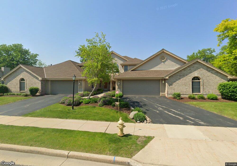
1922 Springbrook N Unit D Waukesha, WI 53186
Estimated Value: $378,997 - $400,000
2
Beds
3
Baths
1,526
Sq Ft
$255/Sq Ft
Est. Value
About This Home
This home is located at 1922 Springbrook N Unit D, Waukesha, WI 53186 and is currently estimated at $389,499, approximately $255 per square foot. 1922 Springbrook N Unit D is a home located in Waukesha County with nearby schools including Hillcrest Elementary School, Horning Middle School, and South High School.
Ownership History
Date
Name
Owned For
Owner Type
Purchase Details
Closed on
Jun 16, 2025
Sold by
Kelenic Dennis and Kelenic Bonnie
Bought by
Dennis J Kelenic And Bonnie L Kelenic Revocab
Current Estimated Value
Purchase Details
Closed on
Apr 14, 2025
Sold by
Schlipp Sharon K
Bought by
Kelenic Dennis and Kelenic Bonnie
Home Financials for this Owner
Home Financials are based on the most recent Mortgage that was taken out on this home.
Original Mortgage
$370,500
Interest Rate
6.63%
Mortgage Type
New Conventional
Purchase Details
Closed on
Dec 7, 2017
Sold by
Schlipp Reuben and Schlipp Sharon K
Bought by
Schlipp Sharon K
Purchase Details
Closed on
May 11, 2016
Sold by
Staffaroni Louis B and Staffaroni Leonita H
Bought by
Schlipp Reuben and Schlipp Sharon K
Create a Home Valuation Report for This Property
The Home Valuation Report is an in-depth analysis detailing your home's value as well as a comparison with similar homes in the area
Home Values in the Area
Average Home Value in this Area
Purchase History
| Date | Buyer | Sale Price | Title Company |
|---|---|---|---|
| Dennis J Kelenic And Bonnie L Kelenic Revocab | -- | None Listed On Document | |
| Kelenic Dennis | $390,000 | Knight Barry Title | |
| Schlipp Sharon K | -- | None Available | |
| Schlipp Reuben | $230,000 | None Available |
Source: Public Records
Mortgage History
| Date | Status | Borrower | Loan Amount |
|---|---|---|---|
| Previous Owner | Kelenic Dennis | $370,500 |
Source: Public Records
Tax History Compared to Growth
Tax History
| Year | Tax Paid | Tax Assessment Tax Assessment Total Assessment is a certain percentage of the fair market value that is determined by local assessors to be the total taxable value of land and additions on the property. | Land | Improvement |
|---|---|---|---|---|
| 2024 | $4,669 | $315,000 | $62,500 | $252,500 |
| 2023 | $4,538 | $315,000 | $62,500 | $252,500 |
| 2022 | $4,684 | $243,900 | $47,400 | $196,500 |
| 2021 | $4,795 | $243,900 | $47,400 | $196,500 |
| 2020 | $4,633 | $243,900 | $47,400 | $196,500 |
| 2019 | $4,489 | $243,900 | $47,400 | $196,500 |
| 2018 | $3,971 | $212,100 | $47,400 | $164,700 |
| 2017 | $4,436 | $212,100 | $47,400 | $164,700 |
| 2016 | $3,719 | $187,300 | $47,400 | $139,900 |
| 2015 | $3,698 | $187,300 | $47,400 | $139,900 |
| 2014 | $3,765 | $187,300 | $47,400 | $139,900 |
| 2013 | $3,850 | $187,300 | $47,400 | $139,900 |
Source: Public Records
Map
Nearby Homes
- 1929 Springbrook N Unit C
- 2029 Wildberry Ct
- 2117 E Broadway Unit B
- 310 Sheffield Rd Unit 2
- 1535 E Racine Ave
- S24W23052 Morningside Dr
- 1422 E Racine Ave
- W230S2425 Morningside Dr
- 1614 Legend Hill Ln
- 1305 Camden Way Unit D
- 1037 Windsor Dr
- 1908 Deer Path
- 621 S Greenfield Ave
- 1981 Foxcroft Ln
- 231 S Greenfield Ave
- LT1 Sunset View
- 724 Lynne Dr
- 1616 Hunter Rd
- 735 E Wabash Ave
- 403 Midland Ave
- 1922 Springbrook N Unit B
- 1922 Springbrook N Unit A
- 1922 Springbrook N Unit C
- 1922 Springbrook N
- 1922 Springbrook N Unit 1922
- 1920 Springbrook N Unit D
- 1920 Springbrook N Unit C
- 1920 Springbrook N Unit B
- 1920 Springbrook N Unit A
- 1924 Springbrook N Unit C
- 1928 Springbrook N Unit D
- 1928 Springbrook N Unit C
- 1928 Springbrook N Unit A
- 1924 Springbrook N Unit D
- 1924 Springbrook N Unit B
- 1924 Springbrook N Unit A
- 1924 Springbrook N Unit 1924
- 1910 Springbrook N Unit D
- 1910 Springbrook N Unit B
- 1910 Springbrook N Unit A