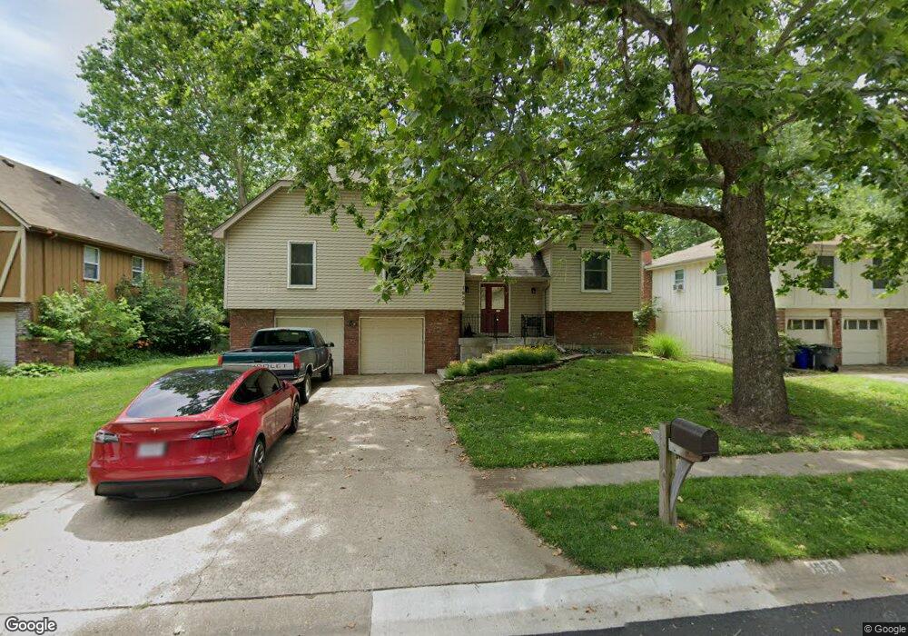
1925 E 152nd St Olathe, KS 66062
Estimated Value: $338,373 - $380,000
3
Beds
3
Baths
1,603
Sq Ft
$224/Sq Ft
Est. Value
About This Home
This home is located at 1925 E 152nd St, Olathe, KS 66062 and is currently estimated at $358,843, approximately $223 per square foot. 1925 E 152nd St is a home located in Johnson County with nearby schools including Scarborough Elementary School, Indian Trail Middle School, and Olathe South Sr High School.
Ownership History
Date
Name
Owned For
Owner Type
Purchase Details
Closed on
Mar 6, 2007
Sold by
Wells Fargo Bank Na
Bought by
Quick James E and Gillam Susan R
Current Estimated Value
Home Financials for this Owner
Home Financials are based on the most recent Mortgage that was taken out on this home.
Original Mortgage
$156,300
Outstanding Balance
$92,232
Interest Rate
6.26%
Mortgage Type
New Conventional
Estimated Equity
$266,611
Purchase Details
Closed on
Nov 15, 2006
Sold by
Doe Mary and Roe Jack
Bought by
Wells Fargo Bank Na
Purchase Details
Closed on
Sep 28, 2001
Sold by
Wilson John W and Wilson Mary Elaine
Bought by
Johnson Carolyn S
Home Financials for this Owner
Home Financials are based on the most recent Mortgage that was taken out on this home.
Original Mortgage
$118,360
Interest Rate
6.88%
Create a Home Valuation Report for This Property
The Home Valuation Report is an in-depth analysis detailing your home's value as well as a comparison with similar homes in the area
Home Values in the Area
Average Home Value in this Area
Purchase History
| Date | Buyer | Sale Price | Title Company |
|---|---|---|---|
| Quick James E | -- | Mokan Title Services Inc | |
| Wells Fargo Bank Na | $15,472 | Continental Title Co | |
| Johnson Carolyn S | -- | Columbian National Title Ins |
Source: Public Records
Mortgage History
| Date | Status | Borrower | Loan Amount |
|---|---|---|---|
| Open | Quick James E | $156,300 | |
| Previous Owner | Johnson Carolyn S | $118,360 | |
| Closed | Johnson Carolyn S | $22,192 |
Source: Public Records
Tax History
| Year | Tax Paid | Tax Assessment Tax Assessment Total Assessment is a certain percentage of the fair market value that is determined by local assessors to be the total taxable value of land and additions on the property. | Land | Improvement |
|---|---|---|---|---|
| 2025 | $3,992 | $37,076 | $7,528 | $29,548 |
| 2024 | $3,992 | $35,766 | $6,843 | $28,923 |
| 2023 | $3,694 | $32,396 | $6,223 | $26,173 |
| 2022 | $3,461 | $29,532 | $5,413 | $24,119 |
| 2021 | $3,377 | $27,381 | $5,413 | $21,968 |
| 2020 | $3,207 | $25,783 | $4,919 | $20,864 |
| 2019 | $3,087 | $24,667 | $4,916 | $19,751 |
| 2018 | $2,963 | $23,517 | $4,923 | $18,594 |
| 2017 | $2,698 | $21,218 | $4,099 | $17,119 |
| 2016 | $2,407 | $19,447 | $4,099 | $15,348 |
| 2015 | $2,150 | $17,412 | $3,416 | $13,996 |
| 2013 | -- | $14,663 | $3,416 | $11,247 |
Source: Public Records
Map
Nearby Homes
- 1836 E 153rd Cir
- 2027 E Mohawk Ct
- 0 E 151st St
- 2120 S Lindenwood Dr
- 16720 W 155th Terrace
- 15437 S Bradley Dr
- C 151st St
- 16545 W 153rd St
- 1508 S Pawnee Cir
- 15482 S Wyandotte Dr
- 2128 S Lennox Dr
- 16764 W 157th St
- 15404 S Summertree Ln
- 16021 W 153rd St
- 14747 S Homestead Dr
- 16104 W 154th St
- 1300 E 153rd St
- 2020 E Cherokee Place
- 14739 S Locust St
- 2101 E Sheridan Bridge Ln
- 1921 E 152nd St
- 2001 E 152nd St
- 1917 E 152nd St
- 2005 E 152nd St
- 1916 E 152nd Terrace
- 1830 S Arrowhead Dr
- 1912 E 152nd Terrace
- 2000 E 152nd Terrace
- 1831 S Kiowa Ct
- 1913 E 152nd St
- 2009 E 152nd St
- 2004 E 152nd Terrace
- 1908 E 152nd Terrace
- 1826 S Arrowhead Dr
- 1914 E 152nd St
- 1827 S Kiowa Ct
- 1909 E 152nd St
- 1904 E 152nd Terrace
- 1905 S Scarborough St
- 1824 S Kiowa Ct
Your Personal Tour Guide
Ask me questions while you tour the home.