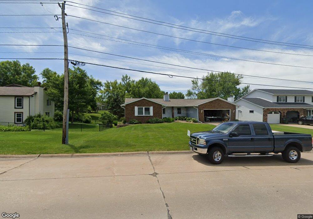
1925 E 46th St Davenport, IA 52807
North Side NeighborhoodEstimated Value: $302,000 - $332,000
4
Beds
3
Baths
1,998
Sq Ft
$161/Sq Ft
Est. Value
About This Home
This home is located at 1925 E 46th St, Davenport, IA 52807 and is currently estimated at $322,444, approximately $161 per square foot. 1925 E 46th St is a home located in Scott County with nearby schools including Jones Park Elementary School, Eisenhower Elementary School, and Casey County Middle School.
Ownership History
Date
Name
Owned For
Owner Type
Purchase Details
Closed on
Jun 9, 2011
Sold by
Dhcu Community Credit Union
Bought by
Batey Ryan R and Batey Mary E
Current Estimated Value
Home Financials for this Owner
Home Financials are based on the most recent Mortgage that was taken out on this home.
Original Mortgage
$182,875
Outstanding Balance
$126,070
Interest Rate
4.63%
Mortgage Type
New Conventional
Estimated Equity
$196,374
Purchase Details
Closed on
Mar 23, 2011
Sold by
Robinson Michael L
Bought by
Dhcu Community Credit Union
Create a Home Valuation Report for This Property
The Home Valuation Report is an in-depth analysis detailing your home's value as well as a comparison with similar homes in the area
Home Values in the Area
Average Home Value in this Area
Purchase History
| Date | Buyer | Sale Price | Title Company |
|---|---|---|---|
| Batey Ryan R | $192,500 | None Available | |
| Dhcu Community Credit Union | $194,140 | None Available |
Source: Public Records
Mortgage History
| Date | Status | Borrower | Loan Amount |
|---|---|---|---|
| Open | Batey Ryan R | $182,875 |
Source: Public Records
Tax History Compared to Growth
Tax History
| Year | Tax Paid | Tax Assessment Tax Assessment Total Assessment is a certain percentage of the fair market value that is determined by local assessors to be the total taxable value of land and additions on the property. | Land | Improvement |
|---|---|---|---|---|
| 2025 | $4,910 | $320,820 | $39,600 | $281,220 |
| 2024 | $4,788 | $284,950 | $39,600 | $245,350 |
| 2023 | $5,248 | $284,950 | $39,600 | $245,350 |
| 2022 | $5,186 | $254,580 | $39,600 | $214,980 |
| 2021 | $5,186 | $250,670 | $39,600 | $211,070 |
| 2020 | $4,914 | $235,030 | $39,600 | $195,430 |
| 2019 | $4,950 | $229,180 | $39,600 | $189,580 |
| 2018 | $4,842 | $229,180 | $39,600 | $189,580 |
| 2017 | $4,928 | $229,180 | $39,600 | $189,580 |
| 2016 | $4,742 | $225,270 | $0 | $0 |
| 2015 | $4,742 | $207,100 | $0 | $0 |
| 2014 | $4,406 | $204,990 | $0 | $0 |
| 2013 | $4,280 | $0 | $0 | $0 |
| 2012 | -- | $194,380 | $37,690 | $156,690 |
Source: Public Records
Map
Nearby Homes
- 4406 Belle Ave
- 2203 E 46th St
- 4324 Spring St
- 4600 Eastern Ave
- 2318 E 46th St
- 1960 E 50th Ct
- 2321 E 47th St
- 4230 Jersey Ridge Rd
- 2403 E 51st St Unit 102E
- 2422 E 51st St Unit E
- 4919 Lorton Ave
- 4005 Forest Rd
- 1227 E Kimberly Rd
- 2506 E 35th Street Ct
- 5810 Indigo Ave
- 3553 Kimberly Downs Rd
- 2919 E 44th Ct
- 1811 Katie Ct
- 5811 Duggleby Ave
- 2501 E 34th Street Ct
- 1919 E 46th St
- 1939 E 46th St
- 4518 Spring St
- 0 E 46th St Unit QC7023154
- 0 E 46th St Unit QC4210424
- 4510 Spring St
- 1859 Westminster Cir
- 1853 Westminster Cir
- 4502 Spring St
- 1845 Westminster Cir
- 1930 E 46th St
- 4523 Spring St
- 4604 Spring St
- 1839 Westminster Cir
- 4464 Spring St
- 4505 Spring St
- 4452 Spring St
- 1831 Westminster Cir
- 1819 E 46th St
- 1852 Westminster Cir