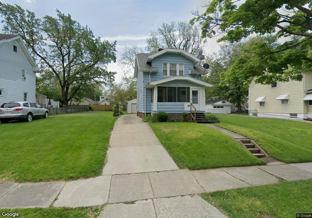
1925 Mansfield Rd Toledo, OH 43613
DeVeaux NeighborhoodEstimated Value: $93,000 - $135,000
3
Beds
1
Bath
1,130
Sq Ft
$100/Sq Ft
Est. Value
About This Home
This home is located at 1925 Mansfield Rd, Toledo, OH 43613 and is currently estimated at $113,178, approximately $100 per square foot. 1925 Mansfield Rd is a home located in Lucas County with nearby schools including McKinley Stemm Academy, Start High School, and Hope Learning Academy of Toledo.
Ownership History
Date
Name
Owned For
Owner Type
Purchase Details
Closed on
May 19, 2006
Sold by
Minnich Kevin A and Minnich Susan M
Bought by
Lange Christopher D
Current Estimated Value
Home Financials for this Owner
Home Financials are based on the most recent Mortgage that was taken out on this home.
Original Mortgage
$74,160
Outstanding Balance
$45,937
Interest Rate
7.95%
Mortgage Type
Fannie Mae Freddie Mac
Estimated Equity
$67,241
Purchase Details
Closed on
Sep 4, 1996
Sold by
Flory Braford F
Bought by
Kiff Susan M and Minnich Kevin
Home Financials for this Owner
Home Financials are based on the most recent Mortgage that was taken out on this home.
Original Mortgage
$35,600
Interest Rate
7.75%
Mortgage Type
New Conventional
Purchase Details
Closed on
Nov 5, 1993
Sold by
Flory Bradford D
Purchase Details
Closed on
Jun 21, 1989
Sold by
Murr Anita E
Create a Home Valuation Report for This Property
The Home Valuation Report is an in-depth analysis detailing your home's value as well as a comparison with similar homes in the area
Home Values in the Area
Average Home Value in this Area
Purchase History
| Date | Buyer | Sale Price | Title Company |
|---|---|---|---|
| Lange Christopher D | $92,700 | Integrity Title | |
| Kiff Susan M | $44,500 | -- | |
| -- | -- | -- | |
| -- | $33,000 | -- |
Source: Public Records
Mortgage History
| Date | Status | Borrower | Loan Amount |
|---|---|---|---|
| Open | Lange Christopher D | $74,160 | |
| Previous Owner | Kiff Susan M | $35,600 |
Source: Public Records
Tax History
| Year | Tax Paid | Tax Assessment Tax Assessment Total Assessment is a certain percentage of the fair market value that is determined by local assessors to be the total taxable value of land and additions on the property. | Land | Improvement |
|---|---|---|---|---|
| 2025 | -- | $26,495 | $7,245 | $19,250 |
| 2024 | $827 | $26,495 | $7,245 | $19,250 |
| 2023 | $1,391 | $21,140 | $5,285 | $15,855 |
| 2022 | $1,392 | $21,140 | $5,285 | $15,855 |
| 2021 | $1,426 | $21,140 | $5,285 | $15,855 |
| 2020 | $1,529 | $20,195 | $5,005 | $15,190 |
| 2019 | $1,494 | $20,195 | $5,005 | $15,190 |
| 2018 | $1,506 | $20,195 | $5,005 | $15,190 |
| 2017 | $1,534 | $19,740 | $4,900 | $14,840 |
| 2016 | $1,529 | $56,400 | $14,000 | $42,400 |
| 2015 | $1,515 | $56,400 | $14,000 | $42,400 |
| 2014 | $1,276 | $19,740 | $4,900 | $14,840 |
| 2013 | $1,276 | $19,740 | $4,900 | $14,840 |
Source: Public Records
Map
Nearby Homes
- 3433 Upton Ave
- 1929 Marlow Rd
- 3430 Upton Ave
- 1952 Fairfax Rd
- 1814 Marlow Rd
- 2005 Marlow Rd
- 1816 Loxley Rd
- 1831 Talbot St
- 1829 Talbot St
- 1822 Wychwood St
- 1953 Talbot St
- 1939 Balkan Place
- 2040 Fairfax Rd
- 3720 Kelly Ave
- 2045 Fairfax Rd
- 1832 Marne Ave
- 1820 Marne Ave
- 1717 Fairfax Rd
- 1815 Berdan Ave
- 1752 Marne Ave
- 1921 Mansfield Rd
- 1927 Mansfield Rd
- 1917 Mansfield Rd
- 1931 Mansfield Rd
- 1913 Mansfield Rd
- 1935 Mansfield Rd
- 1911 Mansfield Rd
- 1937 Mansfield Rd
- 1922 Marlow Rd
- 1930 Marlow Rd
- 1918 Marlow Rd
- 1941 Mansfield Rd
- 1934 Marlow Rd
- 1914 Marlow Rd
- 1938 Marlow Rd
- 3523 Upton Ave
- 3519 Upton Ave
- 1943 Mansfield Rd
- 3515 Upton Ave
- 3511 Upton Ave
Your Personal Tour Guide
Ask me questions while you tour the home.