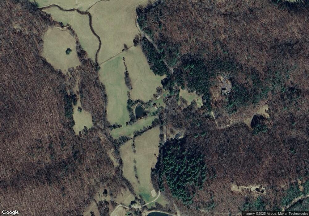
1926 Daves Rd Morganton, GA 30560
Estimated Value: $545,000 - $1,000,000
--
Bed
1
Bath
1,194
Sq Ft
$611/Sq Ft
Est. Value
About This Home
This home is located at 1926 Daves Rd, Morganton, GA 30560 and is currently estimated at $729,667, approximately $611 per square foot. 1926 Daves Rd is a home with nearby schools including Fannin County High School.
Ownership History
Date
Name
Owned For
Owner Type
Purchase Details
Closed on
Mar 17, 2010
Sold by
Thompson Lloyd W
Bought by
Thompson Connie Louise and Thompson Joey
Current Estimated Value
Purchase Details
Closed on
Sep 22, 2003
Sold by
Regions Bank
Bought by
Thompson Lloyd W
Purchase Details
Closed on
Aug 19, 1998
Sold by
Thompson Ruth Ann
Bought by
Thompson Lloyd W
Purchase Details
Closed on
Feb 20, 1992
Sold by
Skelton Ronald L
Bought by
Skelton Ronal D L
Purchase Details
Closed on
May 26, 1982
Bought by
Skelton Ronald L
Create a Home Valuation Report for This Property
The Home Valuation Report is an in-depth analysis detailing your home's value as well as a comparison with similar homes in the area
Home Values in the Area
Average Home Value in this Area
Purchase History
| Date | Buyer | Sale Price | Title Company |
|---|---|---|---|
| Thompson Connie Louise | -- | -- | |
| Thompson Lloyd W | -- | -- | |
| Thompson Lloyd W | $150,000 | -- | |
| Thompson Ruth Ann | $150,000 | -- | |
| Skelton Ronal D L | -- | -- | |
| Skelton Ronald L | $53,000 | -- |
Source: Public Records
Tax History Compared to Growth
Tax History
| Year | Tax Paid | Tax Assessment Tax Assessment Total Assessment is a certain percentage of the fair market value that is determined by local assessors to be the total taxable value of land and additions on the property. | Land | Improvement |
|---|---|---|---|---|
| 2024 | $436 | $125,164 | $100,276 | $24,888 |
| 2023 | $430 | $120,276 | $100,276 | $20,000 |
| 2022 | $425 | $120,276 | $100,276 | $20,000 |
| 2021 | $449 | $102,426 | $91,159 | $11,267 |
| 2020 | $1,460 | $102,426 | $91,159 | $11,267 |
| 2019 | $1,488 | $102,426 | $91,159 | $11,267 |
| 2018 | $330 | $99,061 | $91,159 | $7,902 |
| 2017 | $1,753 | $99,061 | $91,159 | $7,902 |
| 2016 | $305 | $96,385 | $91,159 | $5,226 |
| 2015 | $312 | $96,385 | $91,159 | $5,226 |
| 2014 | $310 | $77,784 | $72,059 | $5,725 |
| 2013 | -- | $79,510 | $72,059 | $7,451 |
Source: Public Records
Map
Nearby Homes
- Lot 37 Picklesimer Mountain Rd
- Lot 4 Picklesimer Mountain Rd
- Lot 38 Picklesimer Mountain Rd
- 366 Shepherds Way
- 180 Shepherds Ridge
- Lot 38 Shepherds Way
- 2722 Daves Rd
- 51 Last Chance Gulch
- 77 Beaver's Cove
- 455 Shepherds Walk
- 0 N Burgess Gap Rd Unit 24911808
- 0 N Burgess Gap Rd Unit 10610901
- 74 Shepherds Trail
- 1.01 AC Heards Ridge
- LOT 56 Heards Ridge
- 59 Bear Track Trail
- 145 Hoot Owl Ridge
- 195 Hoot Owl Ridge
- 93 Bear Track Trail
- 104 Honey Badger Ridge
- 1.48 Daves Rd
- 1.65 Acs Daves Rd
- 0 Daves Rd Unit 298590
- 0 Daves Rd Unit 244457
- 0 Daves Rd Unit 6749924
- 0 Daves Rd Unit 8818678
- 0 Daves Rd Unit 7529364
- 0 Daves Rd Unit 8557068
- 0 Daves Rd Unit 8605598
- 0 Daves Rd Unit 8605579
- 2001 Daves Rd
- 2084 Daves Rd
- 323 Honey Badger Ridge
- 1142 Daves Rd
- 2035 Daves Rd
- 247 Pickelsimer Rd
- 1637 Daves Rd
- 12 Picklesimer Mountain
- LT 43 Shepherds Ridge Rd
