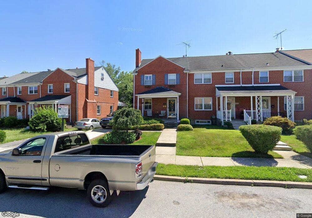
1927 Burnwood Rd Baltimore, MD 21239
Perring Loch NeighborhoodEstimated Value: $203,000 - $214,361
--
Bed
1
Bath
1,280
Sq Ft
$163/Sq Ft
Est. Value
About This Home
This home is located at 1927 Burnwood Rd, Baltimore, MD 21239 and is currently estimated at $208,681, approximately $163 per square foot. 1927 Burnwood Rd is a home located in Baltimore City with nearby schools including Northwood Elementary School, Booker T. Washington Middle School, and Paul Laurence Dunbar Community High School.
Ownership History
Date
Name
Owned For
Owner Type
Purchase Details
Closed on
Sep 1, 2005
Sold by
Signature Properties Inc
Bought by
Thompson Tracey Renee
Current Estimated Value
Purchase Details
Closed on
Oct 27, 2004
Sold by
Lilly Dayton M
Bought by
Signature Properties Inc
Purchase Details
Closed on
Sep 22, 2004
Sold by
Lilly Dayton M
Bought by
Signature Properties Inc
Create a Home Valuation Report for This Property
The Home Valuation Report is an in-depth analysis detailing your home's value as well as a comparison with similar homes in the area
Home Values in the Area
Average Home Value in this Area
Purchase History
| Date | Buyer | Sale Price | Title Company |
|---|---|---|---|
| Thompson Tracey Renee | $151,500 | -- | |
| Signature Properties Inc | $45,000 | -- | |
| Signature Properties Inc | $45,000 | -- |
Source: Public Records
Tax History Compared to Growth
Tax History
| Year | Tax Paid | Tax Assessment Tax Assessment Total Assessment is a certain percentage of the fair market value that is determined by local assessors to be the total taxable value of land and additions on the property. | Land | Improvement |
|---|---|---|---|---|
| 2025 | $2,969 | $149,800 | -- | -- |
| 2024 | $2,969 | $137,600 | $36,000 | $101,600 |
| 2023 | $2,889 | $134,533 | $0 | $0 |
| 2022 | $2,821 | $131,467 | $0 | $0 |
| 2021 | $3,030 | $128,400 | $36,000 | $92,400 |
| 2020 | $2,769 | $128,400 | $36,000 | $92,400 |
| 2019 | $2,755 | $128,400 | $36,000 | $92,400 |
| 2018 | $2,799 | $137,500 | $36,000 | $101,500 |
| 2017 | $2,715 | $133,000 | $0 | $0 |
| 2016 | $2,357 | $128,500 | $0 | $0 |
| 2015 | $2,357 | $124,000 | $0 | $0 |
| 2014 | $2,357 | $124,000 | $0 | $0 |
Source: Public Records
Map
Nearby Homes
- 1907 Burnwood Rd
- 1814 Winford Rd
- 1800 Burnwood Rd
- 1809 Hillenwood Rd
- 1706 Heathfield Rd
- 1812 Ingram Rd
- 1648 Ingram Rd
- 1613 Winford Rd
- 1717 Hartsdale Rd
- 5102 Hillen Rd
- 5515 Hillen Rd
- 4919 Herring Run Dr
- 1530 Burnwood Rd
- 1811 Ramblewood Rd
- 1513 Northbourne Rd
- 5755 Maplehill Rd
- 2326 Ivy Ave
- 2323 Ivy Ave
- 5768 Maplehill Rd
- 5017 Plymouth Rd
- 1925 Burnwood Rd
- 2001 Burnwood Rd
- 1923 Burnwood Rd
- 2003 Burnwood Rd
- 1921 Burnwood Rd
- 2005 Burnwood Rd
- 1919 Burnwood Rd
- 2007 Burnwood Rd
- 1917 Burnwood Rd
- 2009 Burnwood Rd
- 2000 Winford Rd
- 1914 Winford Rd
- 2002 Winford Rd
- 1915 Burnwood Rd
- 2004 Winford Rd
- 2011 Burnwood Rd
- 1912 Winford Rd
- 2006 Winford Rd
- 1910 Winford Rd
- 2013 Burnwood Rd