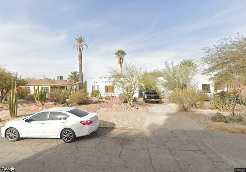
1927 E 10th St Tucson, AZ 85719
Sam Hughes NeighborhoodEstimated Value: $342,807 - $499,000
Studio
1
Bath
1,234
Sq Ft
$351/Sq Ft
Est. Value
About This Home
This home is located at 1927 E 10th St, Tucson, AZ 85719 and is currently estimated at $433,702, approximately $351 per square foot. 1927 E 10th St is a home located in Pima County with nearby schools including Sam Hughes Elementary, Mansfeld Middle School, and Tucson High Magnet School.
Ownership History
Date
Name
Owned For
Owner Type
Purchase Details
Closed on
Jan 8, 2014
Sold by
Besinger Barbara J
Bought by
Besinger Matthew
Current Estimated Value
Purchase Details
Closed on
Nov 20, 2008
Sold by
Besinger Barbara J
Bought by
Besinger Barbara J
Purchase Details
Closed on
Nov 13, 2003
Sold by
Mcneil Barbara B
Bought by
Mcneil Barbara B
Purchase Details
Closed on
Mar 5, 1999
Sold by
Johnson Norman E
Bought by
Mcneil Barbara
Create a Home Valuation Report for This Property
The Home Valuation Report is an in-depth analysis detailing your home's value as well as a comparison with similar homes in the area
Home Values in the Area
Average Home Value in this Area
Purchase History
| Date | Buyer | Sale Price | Title Company |
|---|---|---|---|
| Besinger Matthew | -- | None Available | |
| Besinger Matthew | -- | None Available | |
| Besinger Barbara J | -- | None Available | |
| Besinger Barbara J | -- | None Available | |
| Mcneil Barbara B | -- | -- | |
| Mcneil Barbara B | -- | -- | |
| Mcneil Barbara | $134,000 | -- | |
| Johnson Norman E | -- | -- |
Source: Public Records
Tax History
| Year | Tax Paid | Tax Assessment Tax Assessment Total Assessment is a certain percentage of the fair market value that is determined by local assessors to be the total taxable value of land and additions on the property. | Land | Improvement |
|---|---|---|---|---|
| 2026 | $3,658 | $29,033 | -- | -- |
| 2025 | $3,658 | $27,651 | -- | -- |
| 2024 | $3,311 | $26,334 | -- | -- |
| 2023 | $3,311 | $25,080 | $0 | $0 |
| 2022 | $3,327 | $23,886 | $0 | $0 |
| 2021 | $3,592 | $23,531 | $0 | $0 |
| 2020 | $3,483 | $23,531 | $0 | $0 |
| 2019 | $3,437 | $24,310 | $0 | $0 |
| 2018 | $3,362 | $20,741 | $0 | $0 |
| 2017 | $3,411 | $20,741 | $0 | $0 |
| 2016 | $3,517 | $21,094 | $0 | $0 |
| 2015 | $3,408 | $20,090 | $0 | $0 |
Source: Public Records
Map
Nearby Homes
- 116 N Martin Ave
- 0 No Address Unit 22515641
- 0 No Address Unit 22521060
- 0 No Address Unit 22515640
- 323 N Norris Ave
- 230 N Warren Ave
- 1827 E 13th St
- 55 N Cherry Ave Unit 206
- 55 N Cherry Ave Unit 205
- 55 N Cherry Ave Unit 105
- 55 N Cherry Ave Unit 211
- 2045 E 7th St
- 446 N Campbell Ave Unit 1304
- 446 N Campbell Ave Unit 2204
- 1515 E 12th St
- 1511 E Miles St
- 2210 E 6th St
- 2341 E 7th St
- 1333 E Broadway Blvd
- 1330 E Broadway Blvd
- 1921 E 10th St
- 1933 E 10th St
- 1915 E 10th St
- 1945 E 10th St
- 121 N Norris Ave
- 1909 E 10th St
- 127 N Norris Ave
- 120 N Campbell Ave
- 118 N Campbell Ave
- 106 N Campbell Ave
- 1932 E 10th St
- 128 N Campbell Ave
- 2001 E 10th St
- 1934 E 10th St
- 1920 E 10th St
- 1916 E 10th St
- 1948 E 10th St
- 1948 E 10th St Unit C
- 1948 E 10th St Unit A
- 1948 E 10th St Unit B
Your Personal Tour Guide
Ask me questions while you tour the home.