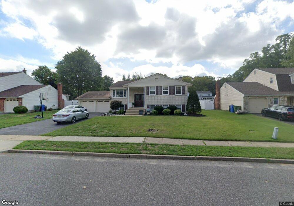
1927 Kings Point Rd Cherry Hill, NJ 08003
Estimated Value: $584,000 - $647,000
--
Bed
--
Bath
2,994
Sq Ft
$206/Sq Ft
Est. Value
About This Home
This home is located at 1927 Kings Point Rd, Cherry Hill, NJ 08003 and is currently estimated at $617,119, approximately $206 per square foot. 1927 Kings Point Rd is a home located in Camden County with nearby schools including James F. Cooper Elementary School, Henry C. Beck Middle School, and Cherry Hill High-East High School.
Ownership History
Date
Name
Owned For
Owner Type
Purchase Details
Closed on
May 18, 2001
Sold by
Li Fu
Bought by
Roberts Todd A and Roberts Diane M
Current Estimated Value
Home Financials for this Owner
Home Financials are based on the most recent Mortgage that was taken out on this home.
Original Mortgage
$150,400
Outstanding Balance
$56,409
Interest Rate
7.09%
Estimated Equity
$560,710
Purchase Details
Closed on
Apr 29, 1994
Sold by
Amonitti George
Bought by
Li Pu and Xu Hong
Home Financials for this Owner
Home Financials are based on the most recent Mortgage that was taken out on this home.
Original Mortgage
$100,000
Interest Rate
7.7%
Create a Home Valuation Report for This Property
The Home Valuation Report is an in-depth analysis detailing your home's value as well as a comparison with similar homes in the area
Home Values in the Area
Average Home Value in this Area
Purchase History
| Date | Buyer | Sale Price | Title Company |
|---|---|---|---|
| Roberts Todd A | $188,000 | -- | |
| Li Pu | $130,000 | -- |
Source: Public Records
Mortgage History
| Date | Status | Borrower | Loan Amount |
|---|---|---|---|
| Open | Roberts Todd A | $150,400 | |
| Previous Owner | Li Pu | $100,000 |
Source: Public Records
Tax History Compared to Growth
Tax History
| Year | Tax Paid | Tax Assessment Tax Assessment Total Assessment is a certain percentage of the fair market value that is determined by local assessors to be the total taxable value of land and additions on the property. | Land | Improvement |
|---|---|---|---|---|
| 2025 | $10,804 | $242,300 | $70,200 | $172,100 |
| 2024 | $10,181 | $242,300 | $70,200 | $172,100 |
| 2023 | $10,181 | $242,300 | $70,200 | $172,100 |
| 2022 | $9,900 | $242,300 | $70,200 | $172,100 |
| 2021 | $9,932 | $242,300 | $70,200 | $172,100 |
| 2020 | $9,811 | $242,300 | $70,200 | $172,100 |
| 2019 | $9,806 | $242,300 | $70,200 | $172,100 |
| 2018 | $9,779 | $242,300 | $70,200 | $172,100 |
| 2017 | $9,646 | $242,300 | $70,200 | $172,100 |
| 2016 | $9,518 | $242,300 | $70,200 | $172,100 |
| 2015 | $9,117 | $242,300 | $70,200 | $172,100 |
| 2014 | $9,013 | $242,300 | $70,200 | $172,100 |
Source: Public Records
Map
Nearby Homes
- 1976 Greentree Rd
- 24 Westbury Dr
- 1986 Greentree Rd
- 110 Partree Rd
- 307 Society Hill Blvd
- 102 Partree Rd
- 1037 Society Hill Blvd
- 317 Brandywine Dr
- 1003 Society Hill Blvd
- 725 Society Hill Blvd
- 8 Yorktown Ct
- 2 Collage Ct
- 100 Old Colony Ln
- 1701 Woodhollow Dr
- 1704 Woodhollow Dr Unit 1704
- 1404 Woodhollow Dr Unit 1404
- 1506 Woodhollow Dr Unit 1506
- 309 Highgate Ln
- 7 Cameo Ct
- 607 Woodhollow Dr
- 1929 Kings Point Rd
- 1925 Kings Point Rd
- 1923 Kings Point Rd
- 1931 Kings Point Rd
- 1922 Kings Point Rd
- 1 Lisa Ln
- 4 Strathmore Dr
- 1940 Greentree Rd
- 1936 Greentree Rd
- 1921 Kings Point Rd
- 1924 Kings Point Rd
- 1942 Greentree Rd
- 10 Strathmore Dr
- 1919 Kings Point Rd
- 2 Lisa Ln
- 5 Lisa Ln
- 3 Strathmore Dr
- 12 Strathmore Dr
- 4 Lisa Ln
- 7 Strathmore Dr