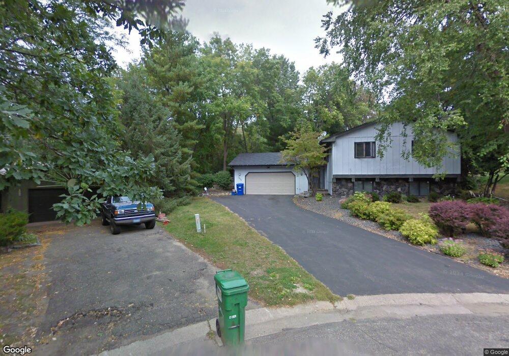
1929 Foxridge Rd Saint Paul, MN 55119
Battle Creek NeighborhoodEstimated Value: $343,000 - $350,000
3
Beds
2
Baths
1,152
Sq Ft
$300/Sq Ft
Est. Value
About This Home
This home is located at 1929 Foxridge Rd, Saint Paul, MN 55119 and is currently estimated at $345,865, approximately $300 per square foot. 1929 Foxridge Rd is a home located in Ramsey County with nearby schools including Battle Creek Elementary School, Battle Creek Middle School, and Harding Senior High School.
Ownership History
Date
Name
Owned For
Owner Type
Purchase Details
Closed on
Sep 4, 2019
Sold by
Miller Cliffton and Miller Rachel
Bought by
Bjornson Jacob M and Bjornson Amanda M
Current Estimated Value
Home Financials for this Owner
Home Financials are based on the most recent Mortgage that was taken out on this home.
Original Mortgage
$245,373
Interest Rate
3.73%
Mortgage Type
FHA
Purchase Details
Closed on
Feb 1, 2017
Sold by
Cooper Jacquelyn
Bought by
Real Estate Result Inc
Purchase Details
Closed on
Jun 13, 2012
Sold by
Cooper Jacquelyn
Bought by
Walker Terrence P and Walker Kimberly
Home Financials for this Owner
Home Financials are based on the most recent Mortgage that was taken out on this home.
Original Mortgage
$2,750
Interest Rate
4%
Mortgage Type
Seller Take Back
Purchase Details
Closed on
Aug 31, 1998
Sold by
Zenz Michael D and Zenz Kathleen M
Bought by
Cooper Jacqueline C
Create a Home Valuation Report for This Property
The Home Valuation Report is an in-depth analysis detailing your home's value as well as a comparison with similar homes in the area
Home Values in the Area
Average Home Value in this Area
Purchase History
| Date | Buyer | Sale Price | Title Company |
|---|---|---|---|
| Bjornson Jacob M | $249,900 | Land Title Inc | |
| Real Estate Result Inc | $142,196 | None Available | |
| Walker Terrence P | $190,000 | None Available | |
| Cooper Jacqueline C | $132,000 | -- |
Source: Public Records
Mortgage History
| Date | Status | Borrower | Loan Amount |
|---|---|---|---|
| Previous Owner | Bjornson Jacob M | $245,373 | |
| Previous Owner | Walker Terrence P | $2,750 |
Source: Public Records
Tax History Compared to Growth
Tax History
| Year | Tax Paid | Tax Assessment Tax Assessment Total Assessment is a certain percentage of the fair market value that is determined by local assessors to be the total taxable value of land and additions on the property. | Land | Improvement |
|---|---|---|---|---|
| 2025 | $5,434 | $358,800 | $62,500 | $296,300 |
| 2023 | $5,434 | $347,200 | $62,500 | $284,700 |
| 2022 | $3,832 | $328,300 | $62,500 | $265,800 |
| 2021 | $4,232 | $247,500 | $62,500 | $185,000 |
| 2020 | $3,874 | $269,000 | $62,500 | $206,500 |
| 2019 | $3,834 | $228,100 | $62,500 | $165,600 |
| 2018 | $3,506 | $222,200 | $62,500 | $159,700 |
| 2017 | $3,780 | $208,300 | $55,000 | $153,300 |
| 2016 | $3,618 | $0 | $0 | $0 |
| 2015 | $4,234 | $187,700 | $55,000 | $132,700 |
| 2014 | $4,124 | $0 | $0 | $0 |
Source: Public Records
Map
Nearby Homes
- 1935 Warbler Ln
- 1989 N Park Dr
- 125 Battle Creek Place
- 138 Ruth St N Unit 9
- 2059 Parkside Dr Unit 29
- 136 White Bear Ave N
- 2063 N Park Dr Unit 6
- 2069 Parkside Dr Unit G2
- 49 Battle Creek Place
- 1821 Wilson Ave
- 125 Mcknight Rd N Unit K
- 465 Ruth St N
- 237 Sigurd St
- 267 Hazelwood St
- 2169 Glenridge Ave
- 1600 Old Hudson Rd
- 1935 Fremont Ave E
- 2138 3rd St E
- 2243 Edgebrook Ave
- 1964 4th St E
- 1928 Warbler Ln
- 1923 Foxridge Rd
- 1935 Foxridge Rd
- 1934 Warbler Ln
- 1922 Foxridge Rd
- 1939 Foxridge Rd
- 1942 Warbler Ln
- 1928 Foxridge Rd
- 1934 Foxridge Rd
- 1923 Warbler Ln
- 1947 Foxridge Rd
- 182 Hazel St N
- 176 Hazel St N
- 186 Hazel St N
- 1948 Warbler Ln
- 1948 1948 Warbler-Lane-
- 1940 Foxridge Rd
- 170 Hazel St N
- 192 Hazel St N
- 1929 Warbler Ln