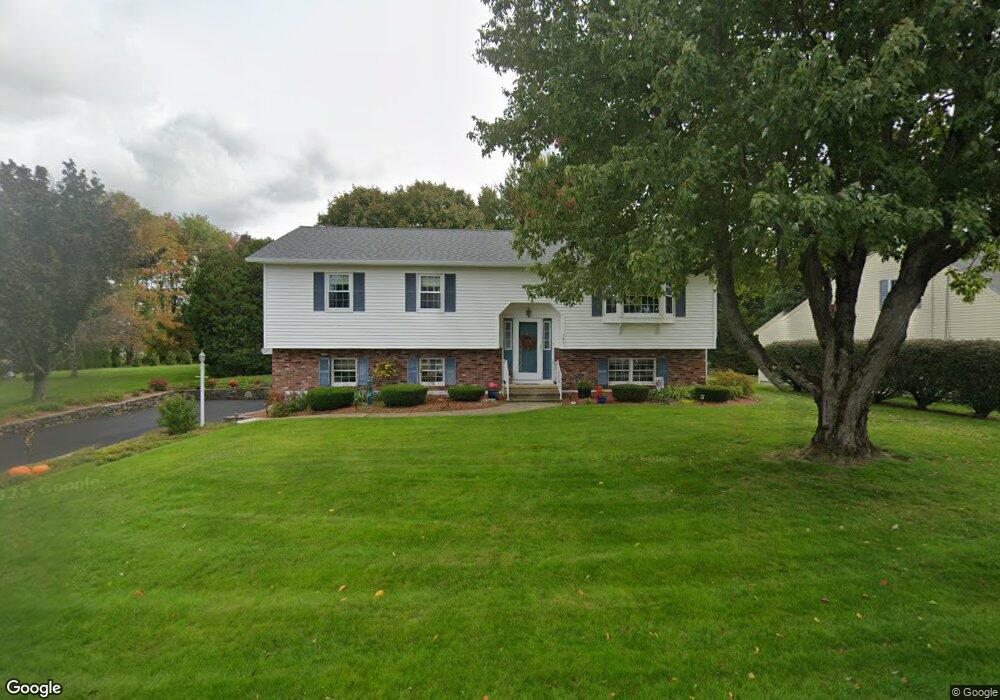
193 Leo Dr Gardner, MA 01440
Estimated Value: $493,000 - $550,000
3
Beds
3
Baths
1,426
Sq Ft
$357/Sq Ft
Est. Value
About This Home
This home is located at 193 Leo Dr, Gardner, MA 01440 and is currently estimated at $509,603, approximately $357 per square foot. 193 Leo Dr is a home located in Worcester County with nearby schools including Gardner High School and Holy Family Academy.
Ownership History
Date
Name
Owned For
Owner Type
Purchase Details
Closed on
May 16, 2023
Sold by
Gikis George M and Gikis Colleen F
Bought by
Gikis Michael J and Gikis George M
Current Estimated Value
Purchase Details
Closed on
Nov 30, 2001
Sold by
Rousseau Leona D and Bacon Lorraine
Bought by
Gikis George M and Gikis Colleen F
Home Financials for this Owner
Home Financials are based on the most recent Mortgage that was taken out on this home.
Original Mortgage
$150,000
Interest Rate
6.66%
Mortgage Type
Purchase Money Mortgage
Purchase Details
Closed on
Jan 16, 1987
Sold by
Mattos Michael J
Bought by
Rousseau L D
Create a Home Valuation Report for This Property
The Home Valuation Report is an in-depth analysis detailing your home's value as well as a comparison with similar homes in the area
Home Values in the Area
Average Home Value in this Area
Purchase History
| Date | Buyer | Sale Price | Title Company |
|---|---|---|---|
| Gikis Michael J | -- | None Available | |
| Gikis George M | $239,900 | -- | |
| Rousseau L D | $175,000 | -- |
Source: Public Records
Mortgage History
| Date | Status | Borrower | Loan Amount |
|---|---|---|---|
| Previous Owner | Rousseau L D | $153,000 | |
| Previous Owner | Rousseau L D | $150,000 |
Source: Public Records
Tax History
| Year | Tax Paid | Tax Assessment Tax Assessment Total Assessment is a certain percentage of the fair market value that is determined by local assessors to be the total taxable value of land and additions on the property. | Land | Improvement |
|---|---|---|---|---|
| 2025 | $63 | $437,400 | $82,100 | $355,300 |
| 2024 | $6,092 | $406,400 | $74,600 | $331,800 |
| 2023 | $5,923 | $367,200 | $73,500 | $293,700 |
| 2022 | $5,902 | $317,500 | $55,700 | $261,800 |
| 2021 | $5,719 | $285,400 | $48,400 | $237,000 |
| 2020 | $5,144 | $260,600 | $48,400 | $212,200 |
| 2019 | $5,248 | $260,600 | $48,400 | $212,200 |
| 2018 | $4,962 | $244,800 | $48,400 | $196,400 |
| 2017 | $4,876 | $238,100 | $48,400 | $189,700 |
| 2016 | $4,684 | $228,800 | $48,400 | $180,400 |
| 2015 | $4,388 | $219,600 | $48,400 | $171,200 |
| 2014 | $4,202 | $222,700 | $56,100 | $166,600 |
Source: Public Records
Map
Nearby Homes
Your Personal Tour Guide
Ask me questions while you tour the home.