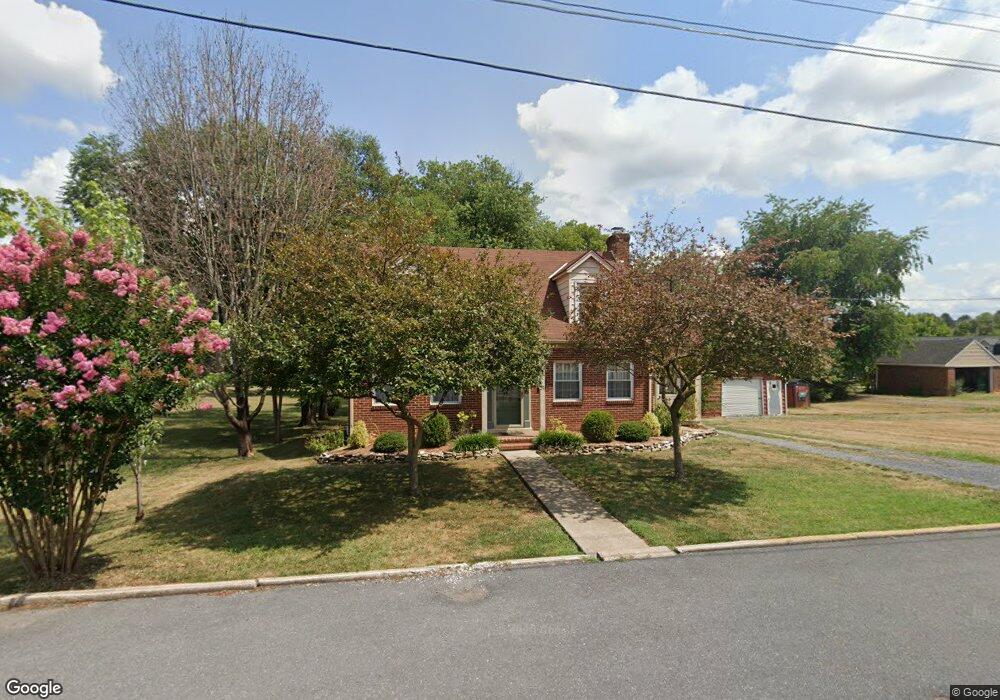
193 Mason St Broadway, VA 22815
Estimated Value: $258,000 - $307,000
3
Beds
2
Baths
1,322
Sq Ft
$210/Sq Ft
Est. Value
About This Home
This home is located at 193 Mason St, Broadway, VA 22815 and is currently estimated at $277,120, approximately $209 per square foot. 193 Mason St is a home located in Rockingham County with nearby schools including John C. Myers Elementary School, J. Frank Hillyard Middle School, and Broadway High School.
Ownership History
Date
Name
Owned For
Owner Type
Purchase Details
Closed on
Mar 9, 2006
Sold by
Fulk Elma G
Bought by
Fulk Steven Wesley
Current Estimated Value
Purchase Details
Closed on
Aug 15, 2005
Sold by
Bacon Clifford L and Bacon Carol A
Bought by
Fletcher Adam L and Fletcher Nora Sams
Home Financials for this Owner
Home Financials are based on the most recent Mortgage that was taken out on this home.
Original Mortgage
$33,950
Interest Rate
5.66%
Mortgage Type
Stand Alone Second
Create a Home Valuation Report for This Property
The Home Valuation Report is an in-depth analysis detailing your home's value as well as a comparison with similar homes in the area
Home Values in the Area
Average Home Value in this Area
Purchase History
| Date | Buyer | Sale Price | Title Company |
|---|---|---|---|
| Fulk Steven Wesley | -- | None Available | |
| Fletcher Adam L | $170,000 | None Available |
Source: Public Records
Mortgage History
| Date | Status | Borrower | Loan Amount |
|---|---|---|---|
| Previous Owner | Fletcher Adam L | $33,950 |
Source: Public Records
Tax History Compared to Growth
Tax History
| Year | Tax Paid | Tax Assessment Tax Assessment Total Assessment is a certain percentage of the fair market value that is determined by local assessors to be the total taxable value of land and additions on the property. | Land | Improvement |
|---|---|---|---|---|
| 2025 | $1,253 | $184,200 | $27,000 | $157,200 |
| 2024 | $1,253 | $184,200 | $27,000 | $157,200 |
| 2023 | $1,253 | $184,200 | $27,000 | $157,200 |
| 2022 | $1,253 | $184,200 | $27,000 | $157,200 |
| 2021 | $997 | $134,700 | $27,000 | $107,700 |
| 2020 | $997 | $134,700 | $27,000 | $107,700 |
| 2019 | $997 | $134,700 | $27,000 | $107,700 |
| 2018 | $997 | $134,700 | $27,000 | $107,700 |
| 2017 | $975 | $131,800 | $27,000 | $104,800 |
| 2016 | $923 | $131,800 | $27,000 | $104,800 |
| 2015 | $883 | $131,800 | $27,000 | $104,800 |
| 2014 | $844 | $131,800 | $27,000 | $104,800 |
Source: Public Records
Map
Nearby Homes
- 182 Church St
- 285 Park Ave
- 111 Church St
- 184 Walnut Dr
- 218 Broadway Ave
- 294 Ridgewood Ave
- 121 S Central St
- TBD Broadway Ave
- 164 Alger Ln
- 168 Alger Ln
- 174 Griffin Ln
- TBD Timber Way
- 0 Timber Way Unit 669532
- 0 Holsinger Rd Unit VARO2000782
- TBD Holsinger Rd
- 573 Denali Dr
- 170 Morningside Dr
- 261 Turner Ave
- 198 Acres Runions Creek Rd
- Tbd Brunk Spring Ln