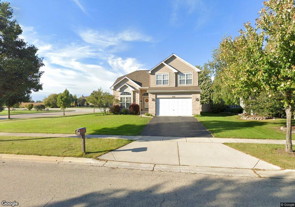
1930 Broadsmore Dr Algonquin, IL 60102
Estimated Value: $449,973 - $512,000
3
Beds
--
Bath
2,377
Sq Ft
$203/Sq Ft
Est. Value
About This Home
This home is located at 1930 Broadsmore Dr, Algonquin, IL 60102 and is currently estimated at $482,993, approximately $203 per square foot. 1930 Broadsmore Dr is a home located in Kane County with nearby schools including Westfield Community School and Harry D Jacobs High School.
Ownership History
Date
Name
Owned For
Owner Type
Purchase Details
Closed on
May 24, 2001
Sold by
Willoughby Farms Ltd Partnership
Bought by
Shannon Peter L
Current Estimated Value
Home Financials for this Owner
Home Financials are based on the most recent Mortgage that was taken out on this home.
Original Mortgage
$249,000
Outstanding Balance
$93,871
Interest Rate
7.16%
Estimated Equity
$389,122
Create a Home Valuation Report for This Property
The Home Valuation Report is an in-depth analysis detailing your home's value as well as a comparison with similar homes in the area
Home Values in the Area
Average Home Value in this Area
Purchase History
| Date | Buyer | Sale Price | Title Company |
|---|---|---|---|
| Shannon Peter L | $248,500 | Stewart Title Company |
Source: Public Records
Mortgage History
| Date | Status | Borrower | Loan Amount |
|---|---|---|---|
| Open | Shannon Peter L | $249,000 |
Source: Public Records
Tax History Compared to Growth
Tax History
| Year | Tax Paid | Tax Assessment Tax Assessment Total Assessment is a certain percentage of the fair market value that is determined by local assessors to be the total taxable value of land and additions on the property. | Land | Improvement |
|---|---|---|---|---|
| 2024 | $10,333 | $136,434 | $24,205 | $112,229 |
| 2023 | $9,234 | $122,759 | $21,779 | $100,980 |
| 2022 | $8,427 | $108,299 | $21,779 | $86,520 |
| 2021 | $8,169 | $102,256 | $20,564 | $81,692 |
| 2020 | $8,004 | $99,957 | $20,102 | $79,855 |
| 2019 | $7,755 | $94,890 | $19,083 | $75,807 |
| 2018 | $7,806 | $93,011 | $18,705 | $74,306 |
| 2017 | $7,477 | $87,008 | $17,498 | $69,510 |
| 2016 | $7,436 | $81,962 | $16,942 | $65,020 |
| 2015 | -- | $76,235 | $17,040 | $59,195 |
| 2014 | -- | $70,795 | $16,569 | $54,226 |
| 2013 | -- | $72,962 | $17,076 | $55,886 |
Source: Public Records
Map
Nearby Homes
- 1141 Waterford St
- 1111 Waterford St
- 2219 Barrett Dr
- 110 Newburgh Ln
- 1261 Glenmont St
- 1051 Waterford St
- 1101 Waterford St
- 1081 Waterford St
- 1263 Glenmont St
- 1269 Glenmont St
- 1110 Waterford St
- 130 Newburgh Ln
- 1161 Waterford St
- 2070 Cosman Way
- 2040 Cosman Way
- 2262 Stonegate Rd
- 1260 Glenmont St
- 1121 Waterford St
- 1071 Waterford St
- 2258 Stonegate Rd
- 1920 Broadsmore Dr
- 1910 Broadsmore Dr Unit 2
- 1921 Broadsmore Dr
- 1911 Broadsmore Dr
- 1900 Broadsmore Dr Unit 2
- 1931 Broadsmore Dr Unit 3
- 1901 Broadsmore Dr
- 2273 Moser Ln Unit 1
- 2309 Barrett Dr
- 2269 Moser Ln
- 1890 Broadsmore Dr
- 1891 Broadsmore Dr
- 1941 Broadsmore Dr
- 2265 Moser Ln
- 2254 Barrett Dr
- 2308 Barrett Dr
- 2261 Moser Ln
- 2313 Barrett Dr
- 10 Greyshire Ct
- 1880 Broadsmore Dr