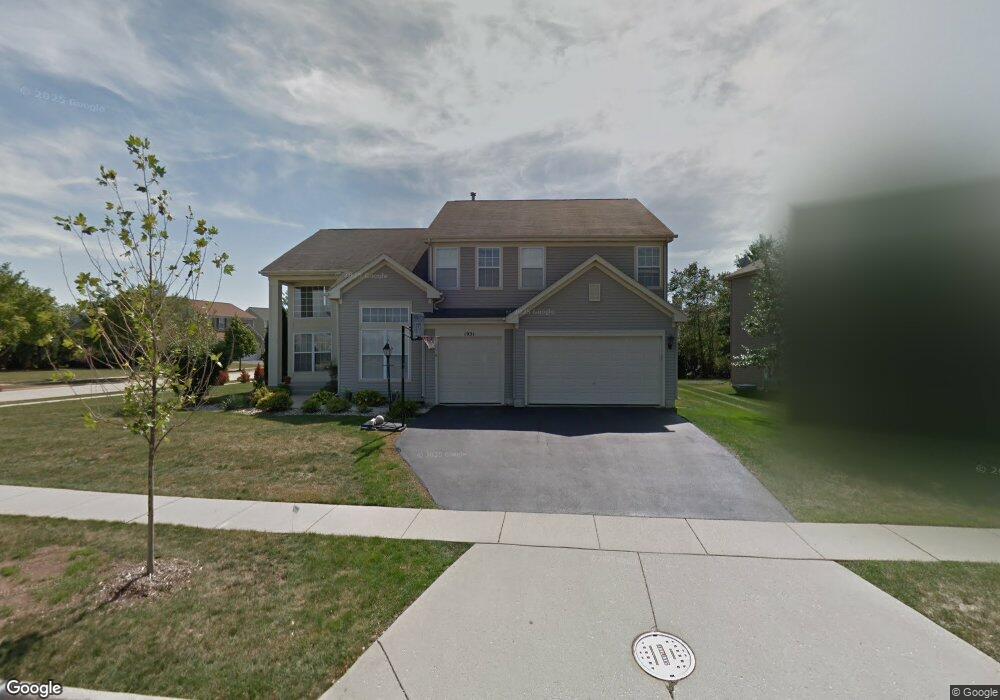
1931 Broadsmore Dr Unit 3 Algonquin, IL 60102
Estimated Value: $518,916 - $549,000
4
Beds
--
Bath
2,994
Sq Ft
$179/Sq Ft
Est. Value
About This Home
This home is located at 1931 Broadsmore Dr Unit 3, Algonquin, IL 60102 and is currently estimated at $536,229, approximately $179 per square foot. 1931 Broadsmore Dr Unit 3 is a home located in Kane County with nearby schools including Westfield Community School and Harry D Jacobs High School.
Ownership History
Date
Name
Owned For
Owner Type
Purchase Details
Closed on
Sep 18, 2002
Sold by
Czeropski Steve and Alfaro Marivel R
Bought by
Karidas Spiro and Karidas Sandy
Current Estimated Value
Home Financials for this Owner
Home Financials are based on the most recent Mortgage that was taken out on this home.
Original Mortgage
$200,000
Interest Rate
6.18%
Purchase Details
Closed on
Feb 27, 2001
Sold by
Willoughby Farms Ltd Partnership
Bought by
Czeropski Steven and Alfaro Marivel
Home Financials for this Owner
Home Financials are based on the most recent Mortgage that was taken out on this home.
Original Mortgage
$235,000
Interest Rate
7.18%
Create a Home Valuation Report for This Property
The Home Valuation Report is an in-depth analysis detailing your home's value as well as a comparison with similar homes in the area
Home Values in the Area
Average Home Value in this Area
Purchase History
| Date | Buyer | Sale Price | Title Company |
|---|---|---|---|
| Karidas Spiro | $310,000 | Stewart Title Company | |
| Czeropski Steven | $273,000 | -- |
Source: Public Records
Mortgage History
| Date | Status | Borrower | Loan Amount |
|---|---|---|---|
| Previous Owner | Karidas Spiro | $200,000 | |
| Previous Owner | Czeropski Steven | $235,000 |
Source: Public Records
Tax History Compared to Growth
Tax History
| Year | Tax Paid | Tax Assessment Tax Assessment Total Assessment is a certain percentage of the fair market value that is determined by local assessors to be the total taxable value of land and additions on the property. | Land | Improvement |
|---|---|---|---|---|
| 2024 | $10,922 | $152,216 | $25,730 | $126,486 |
| 2023 | $10,377 | $136,959 | $23,151 | $113,808 |
| 2022 | $10,373 | $131,925 | $23,151 | $108,774 |
| 2021 | $10,063 | $124,563 | $21,859 | $102,704 |
| 2020 | $9,861 | $121,763 | $21,368 | $100,395 |
| 2019 | $9,561 | $115,591 | $20,285 | $95,306 |
| 2018 | $9,626 | $113,302 | $19,883 | $93,419 |
| 2017 | $9,229 | $105,989 | $18,600 | $87,389 |
| 2016 | $8,884 | $96,758 | $18,009 | $78,749 |
| 2015 | -- | $88,514 | $17,040 | $71,474 |
| 2014 | -- | $82,392 | $16,569 | $65,823 |
| 2013 | -- | $84,914 | $17,076 | $67,838 |
Source: Public Records
Map
Nearby Homes
- 1141 Waterford St
- 1111 Waterford St
- 110 Newburgh Ln
- 2219 Barrett Dr
- 1261 Glenmont St
- 1051 Waterford St
- 1101 Waterford St
- 1081 Waterford St
- 1263 Glenmont St
- 1269 Glenmont St
- 1110 Waterford St
- 130 Newburgh Ln
- 1161 Waterford St
- 2070 Cosman Way
- 2040 Cosman Way
- 2262 Stonegate Rd
- 1260 Glenmont St
- 1121 Waterford St
- 1071 Waterford St
- 2258 Stonegate Rd
- 1941 Broadsmore Dr
- 2308 Barrett Dr
- 1921 Broadsmore Dr
- 2312 Barrett Dr
- 2309 Barrett Dr
- 1961 Broadsmore Dr
- 1911 Broadsmore Dr
- 2313 Barrett Dr
- 1930 Broadsmore Dr
- 2316 Barrett Dr
- 1950 Broadsmore Dr
- 2317 Barrett Dr
- 1971 Broadsmore Dr
- 1920 Broadsmore Dr
- 1960 Broadsmore Dr
- 1901 Broadsmore Dr
- 1880 Highmeadow Ln
- 8 Greyshire Ct
- 1970 Broadsmore Dr
- 1981 Broadsmore Dr