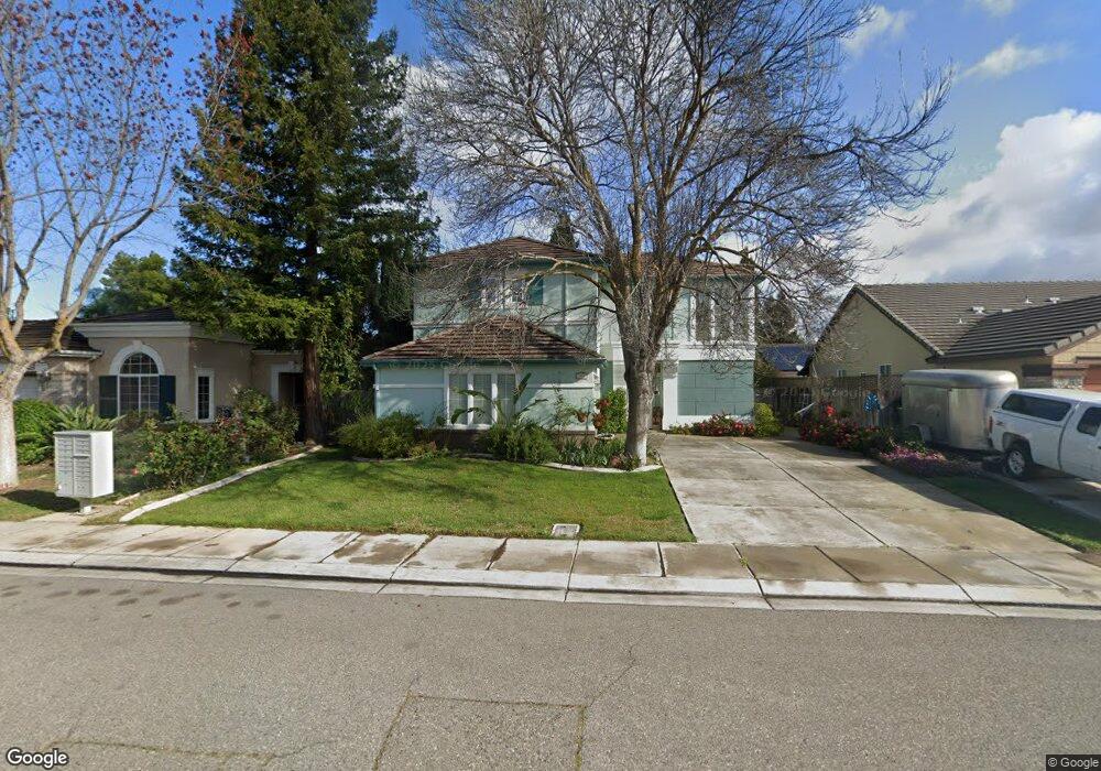
1931 Fall Brook Ct Merced, CA 95340
North Merced NeighborhoodEstimated Value: $462,000 - $509,000
4
Beds
3
Baths
2,100
Sq Ft
$229/Sq Ft
Est. Value
About This Home
This home is located at 1931 Fall Brook Ct, Merced, CA 95340 and is currently estimated at $481,296, approximately $229 per square foot. 1931 Fall Brook Ct is a home located in Merced County with nearby schools including Donn B. Chenoweth Elementary School, Herbert H. Cruickshank Middle School, and Golden Valley High School.
Ownership History
Date
Name
Owned For
Owner Type
Purchase Details
Closed on
Nov 29, 2023
Sold by
Williams Georgine S
Bought by
Georgine S Williams 2023 Trust and Williams
Current Estimated Value
Purchase Details
Closed on
Jun 29, 1999
Sold by
Heritage Homes Llc
Bought by
Williams Georgine S
Home Financials for this Owner
Home Financials are based on the most recent Mortgage that was taken out on this home.
Original Mortgage
$93,000
Interest Rate
7.82%
Mortgage Type
Purchase Money Mortgage
Create a Home Valuation Report for This Property
The Home Valuation Report is an in-depth analysis detailing your home's value as well as a comparison with similar homes in the area
Home Values in the Area
Average Home Value in this Area
Purchase History
| Date | Buyer | Sale Price | Title Company |
|---|---|---|---|
| Georgine S Williams 2023 Trust | -- | None Listed On Document | |
| Williams Georgine S | $159,500 | Transcounty Title Company |
Source: Public Records
Mortgage History
| Date | Status | Borrower | Loan Amount |
|---|---|---|---|
| Previous Owner | Williams Georgine S | $93,000 |
Source: Public Records
Tax History
| Year | Tax Paid | Tax Assessment Tax Assessment Total Assessment is a certain percentage of the fair market value that is determined by local assessors to be the total taxable value of land and additions on the property. | Land | Improvement |
|---|---|---|---|---|
| 2025 | $2,828 | $258,237 | $53,781 | $204,456 |
| 2024 | $2,828 | $253,175 | $52,727 | $200,448 |
| 2023 | $2,783 | $248,212 | $51,694 | $196,518 |
| 2022 | $2,735 | $243,346 | $50,681 | $192,665 |
| 2021 | $2,714 | $238,576 | $49,688 | $188,888 |
| 2020 | $2,700 | $236,131 | $49,179 | $186,952 |
| 2019 | $2,668 | $231,502 | $48,215 | $183,287 |
| 2018 | $2,432 | $226,964 | $47,270 | $179,694 |
| 2017 | $2,501 | $222,515 | $46,344 | $176,171 |
| 2016 | $2,460 | $218,153 | $45,436 | $172,717 |
| 2015 | $2,407 | $214,877 | $44,754 | $170,123 |
| 2014 | $2,368 | $210,669 | $43,878 | $166,791 |
Source: Public Records
Map
Nearby Homes
- 3437 Cypress Point Dr
- 2067 Robin Hood Ln
- 3314 Robin Hood Ln
- 1833 La Quinta Ct
- 1787 Edgewood Ct
- 3342 Banbury Ln
- 3351 Banbury Ln
- 3320 Banbury Ln
- 2144 King Arthur Ct
- 3507 Creekview Ct
- 2149 Brookdale Dr
- 1276 Panorama Point Ct
- 3279 Laura Ave
- 3332 Shamrock Place
- 3317 Shamrock Ave
- 2377 Mariner Way
- 3205 N Parsons Ave
- 1143 Brownie Ct
- 1965 Kimberly Ave
- 2367 Explorador Dr
- 1947 Fall Brook Ct
- 1938 Silverado Ave
- 1924 Silverado Ave
- 1955 Fall Brook Ct
- 1940 Silverado Ave
- 1903 Fall Brook Ct
- 1934 Fall Brook Ct
- 1906 Silverado Ave
- 1956 Silverado Ave
- 1908 Fall Brook Ct
- 1963 Fall Brook Ct
- 1962 Silverado Ave
- 1895 La Quinta Ct
- 1937 Pinehurst Dr
- 1964 Fall Brook Ct
- 1923 Pinehurst Dr
- 1927 Silverado Ave
- 1945 Pinehurst Dr
- 3502 St Andrews Dr
Your Personal Tour Guide
Ask me questions while you tour the home.