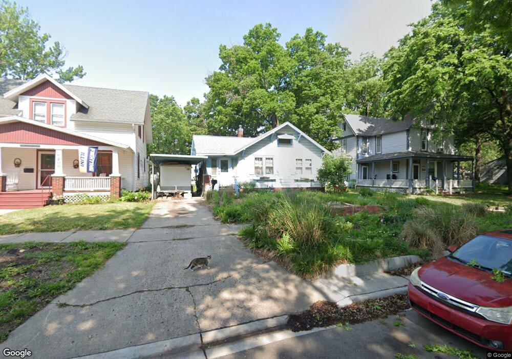
1931 SW Lane St Topeka, KS 66604
Chesney Park NeighborhoodEstimated Value: $73,170 - $109,000
2
Beds
1
Bath
1,148
Sq Ft
$76/Sq Ft
Est. Value
About This Home
This home is located at 1931 SW Lane St, Topeka, KS 66604 and is currently estimated at $87,543, approximately $76 per square foot. 1931 SW Lane St is a home located in Shawnee County with nearby schools including Buckeye Elementary School, Rosenwald Elementary School, and Martin Park Elementary School.
Ownership History
Date
Name
Owned For
Owner Type
Purchase Details
Closed on
Jan 3, 2005
Sold by
Karlin Michael J and Karlin Victoria L
Bought by
Gilmore Alan M
Current Estimated Value
Home Financials for this Owner
Home Financials are based on the most recent Mortgage that was taken out on this home.
Original Mortgage
$48,985
Outstanding Balance
$24,748
Interest Rate
5.76%
Mortgage Type
New Conventional
Estimated Equity
$62,795
Create a Home Valuation Report for This Property
The Home Valuation Report is an in-depth analysis detailing your home's value as well as a comparison with similar homes in the area
Home Values in the Area
Average Home Value in this Area
Purchase History
| Date | Buyer | Sale Price | Title Company |
|---|---|---|---|
| Gilmore Alan M | -- | Heartland Title Services Inc |
Source: Public Records
Mortgage History
| Date | Status | Borrower | Loan Amount |
|---|---|---|---|
| Open | Gilmore Alan M | $48,985 |
Source: Public Records
Tax History Compared to Growth
Tax History
| Year | Tax Paid | Tax Assessment Tax Assessment Total Assessment is a certain percentage of the fair market value that is determined by local assessors to be the total taxable value of land and additions on the property. | Land | Improvement |
|---|---|---|---|---|
| 2025 | $1,906 | $7,984 | -- | -- |
| 2023 | $1,906 | $7,174 | $0 | $0 |
| 2022 | $945 | $6,705 | $0 | $0 |
| 2021 | $930 | $6,095 | $0 | $0 |
| 2020 | $656 | $4,434 | $0 | $0 |
| 2019 | $646 | $4,347 | $0 | $0 |
| 2018 | $627 | $4,221 | $0 | $0 |
| 2017 | $628 | $4,221 | $0 | $0 |
| 2014 | $635 | $4,221 | $0 | $0 |
Source: Public Records
Map
Nearby Homes
- 1907 SW Buchanan St
- 1912 SW Buchanan St
- 2058 SW Buchanan St
- 1501-1599 SW 17th St
- 1647 SW 21st St
- 2129 SW Buchanan St
- 1700 SW Buchanan St
- 1630 SW Buchanan St
- 1556 SW 23rd St
- 1620 SW Clay St
- 918 SW 17th St
- 1527 SW Mulvane St
- 1637 SW Fillmore St
- 1531 SW 15th St
- 1500 SW Mulvane St
- 1610 SW Central Park Ave
- 1717 SW 15th St
- 1015 SW 16th St
- 0 SW Buchanan St
- 1610 SW Plass Ave
- 1933 SW Lane St
- 1929 SW Lane St
- 2003 SW Lane St
- 1932 SW Washburn Ave
- 1934 SW Washburn Ave
- 1921 SW Lane St
- 1926 SW Washburn Ave
- 1932 SW Lane St
- 1928 SW Lane St
- 1917 SW Lane St
- 1936 SW Lane St
- 2007 SW Lane St
- 2002 SW Washburn Ave
- 1926 SW Lane St
- 2000 SW Lane St
- 1915 SW Lane St
- 1924 SW Lane St
- 1920 SW Lane St
- 1313 SW 20th St
- 2008 SW Washburn Ave