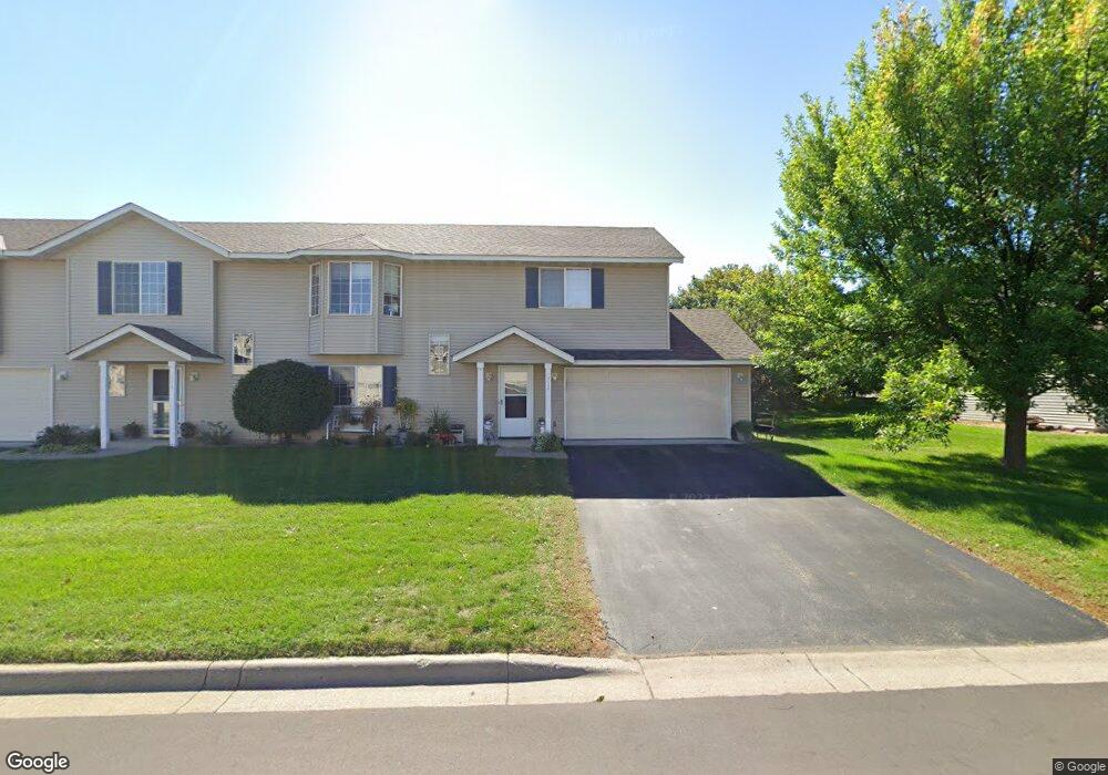
1932 Downing Ave Shakopee, MN 55379
Estimated Value: $256,494 - $272,000
3
Beds
2
Baths
1,428
Sq Ft
$184/Sq Ft
Est. Value
About This Home
This home is located at 1932 Downing Ave, Shakopee, MN 55379 and is currently estimated at $262,374, approximately $183 per square foot. 1932 Downing Ave is a home located in Scott County with nearby schools including Sun Path Elementary School, Shakopee West Middle School, and Shakopee Senior High School.
Ownership History
Date
Name
Owned For
Owner Type
Purchase Details
Closed on
Dec 14, 2018
Sold by
Hutter Jacob
Bought by
Thurairajalingam Arulraj and Thurairajalingam Sivasutha
Current Estimated Value
Home Financials for this Owner
Home Financials are based on the most recent Mortgage that was taken out on this home.
Original Mortgage
$141,750
Outstanding Balance
$125,134
Interest Rate
4.9%
Mortgage Type
New Conventional
Estimated Equity
$137,240
Purchase Details
Closed on
Dec 4, 2003
Sold by
Rudd Kristina
Bought by
Hutter Jacob
Purchase Details
Closed on
Aug 30, 2000
Sold by
Mw Johnson Construction
Bought by
Rudd Kristina R
Create a Home Valuation Report for This Property
The Home Valuation Report is an in-depth analysis detailing your home's value as well as a comparison with similar homes in the area
Home Values in the Area
Average Home Value in this Area
Purchase History
| Date | Buyer | Sale Price | Title Company |
|---|---|---|---|
| Thurairajalingam Arulraj | $189,000 | Watermark Title Agency | |
| Hutter Jacob | $166,000 | -- | |
| Rudd Kristina R | $124,430 | -- |
Source: Public Records
Mortgage History
| Date | Status | Borrower | Loan Amount |
|---|---|---|---|
| Open | Thurairajalingam Arulraj | $141,750 |
Source: Public Records
Tax History
| Year | Tax Paid | Tax Assessment Tax Assessment Total Assessment is a certain percentage of the fair market value that is determined by local assessors to be the total taxable value of land and additions on the property. | Land | Improvement |
|---|---|---|---|---|
| 2025 | $2,546 | $252,100 | $83,800 | $168,300 |
| 2024 | $2,544 | $240,700 | $79,800 | $160,900 |
| 2023 | $2,604 | $237,000 | $78,300 | $158,700 |
| 2022 | $2,564 | $238,800 | $80,100 | $158,700 |
| 2021 | $2,268 | $201,400 | $62,700 | $138,700 |
| 2020 | $2,392 | $194,600 | $55,100 | $139,500 |
| 2019 | $1,962 | $180,300 | $47,200 | $133,100 |
| 2018 | $2,056 | $0 | $0 | $0 |
| 2016 | $1,856 | $0 | $0 | $0 |
| 2014 | -- | $0 | $0 | $0 |
Source: Public Records
Map
Nearby Homes
- 2066 Mockingbird Ave
- 1928 Vierling Dr E
- 1596 Chartreux Ave
- 2350 Downing Ave
- 2423 Tyrone Dr
- 2399 Tyrone Dr
- 2351 Tyrone Dr
- 1227 Elmwood Ave Unit 85
- 2574 Vierling Dr E
- 2006 Tyrone Dr
- 2655 King Ave
- 2795 Downing Ave
- 1667 Countryside Dr
- 2817 Downing Ave
- 1624 Philipp Way
- 1542 Philipp Way
- 1777 Countryside Dr
- 1035 Providence Dr
- 2542 Mathias Rd
- 2868 Trinity Dr
- 1948 Downing Ave
- 1916 Downing Ave
- 1964 Downing Ave
- 1900 Downing Ave
- 1929 Downing Ave
- 1897 Pintail Ave Unit 1805
- 1945 Downing Ave
- 1881 Pintail Ave
- 1930 Pintail Ave
- 1961 Downing Ave
- 1884 Downing Ave
- 1893 Pintail Ave
- 1934 Pintail Ave
- 1934 1934 Pintail Ave
- 1877 Pintail Ave
- 1897 Downing Ave
- 1977 Downing Ave
- 1933 Mockingbird Ave Unit 1708
- 1938 Pintail Ave
- 1937 Mockingbird Ave
Your Personal Tour Guide
Ask me questions while you tour the home.