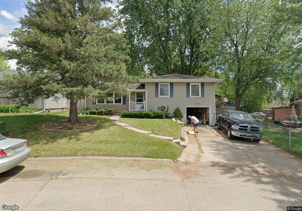
1932 Elmwood Ave Cedar Falls, IA 50613
Estimated Value: $194,820 - $213,000
3
Beds
2
Baths
1,108
Sq Ft
$185/Sq Ft
Est. Value
About This Home
This home is located at 1932 Elmwood Ave, Cedar Falls, IA 50613 and is currently estimated at $204,955, approximately $184 per square foot. 1932 Elmwood Ave is a home located in Black Hawk County with nearby schools including Cedar Heights Elementary School, Peet Junior High School, and Cedar Falls High School.
Ownership History
Date
Name
Owned For
Owner Type
Purchase Details
Closed on
May 22, 2008
Sold by
Lindaman Allan D and Lindaman Susan K
Bought by
Forsblom Chad E
Current Estimated Value
Home Financials for this Owner
Home Financials are based on the most recent Mortgage that was taken out on this home.
Original Mortgage
$122,400
Outstanding Balance
$77,475
Interest Rate
5.87%
Mortgage Type
VA
Estimated Equity
$127,480
Create a Home Valuation Report for This Property
The Home Valuation Report is an in-depth analysis detailing your home's value as well as a comparison with similar homes in the area
Home Values in the Area
Average Home Value in this Area
Purchase History
| Date | Buyer | Sale Price | Title Company |
|---|---|---|---|
| Forsblom Chad E | $123,000 | None Available |
Source: Public Records
Mortgage History
| Date | Status | Borrower | Loan Amount |
|---|---|---|---|
| Open | Forsblom Chad E | $122,400 |
Source: Public Records
Tax History Compared to Growth
Tax History
| Year | Tax Paid | Tax Assessment Tax Assessment Total Assessment is a certain percentage of the fair market value that is determined by local assessors to be the total taxable value of land and additions on the property. | Land | Improvement |
|---|---|---|---|---|
| 2025 | $2,478 | $200,750 | $16,660 | $184,090 |
| 2024 | $2,478 | $181,030 | $16,660 | $164,370 |
| 2023 | $2,522 | $181,030 | $16,660 | $164,370 |
| 2022 | $2,550 | $152,240 | $16,660 | $135,580 |
| 2021 | $2,398 | $152,240 | $16,660 | $135,580 |
| 2020 | $2,344 | $143,960 | $14,280 | $129,680 |
| 2019 | $2,344 | $143,960 | $14,280 | $129,680 |
| 2018 | $2,376 | $143,960 | $14,280 | $129,680 |
| 2017 | $2,376 | $143,960 | $14,280 | $129,680 |
| 2016 | $2,272 | $143,960 | $14,280 | $129,680 |
| 2015 | $2,272 | $143,960 | $14,280 | $129,680 |
| 2014 | $2,194 | $138,070 | $14,280 | $123,790 |
Source: Public Records
Map
Nearby Homes
- 1221 Parker St
- 1802 Waterloo Rd
- 1117 Melrose Dr
- 1316 Sunnyside Dr
- 1304 Grand Blvd
- 1609 Rainbow Dr
- 1623 Grand Blvd
- 1916 Ashland Ave
- 2601 Victory Dr
- 1830 Madison St
- 2513 Ashland Ave
- 2912 Tucson Dr
- 1011 Grove St
- 1103 State St
- 1003 Bluff St
- 2309 California St
- 2316 Franklin St
- 1513 Cherry Ln
- 1804 Tremont St
- 1316 Franklin St
- 1928 Elmwood Ave
- 1938 Elmwood Ave
- 2008 Waterloo Rd
- 1922 Elmwood Ave
- 2012 Waterloo Rd
- 1925 Belle Ave
- 1931 Belle Ave
- 1930 Waterloo Rd
- 2018 Waterloo Rd
- 1011 Rainbow Dr
- 1935 Belle Ave
- 1913 Belle Ave
- 2024 Waterloo Rd
- 1939 Belle Ave
- 1909 Elmwood Ave
- 1019 Rainbow Dr
- 1023 Rainbow Dr
- 2011 Waterloo Rd
- 1920 Waterloo Rd Unit 1922
- 1015 Rainbow Dr